Villejésus
| Villejésus | |
|---|---|
|
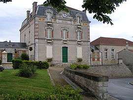
Town hall | |
 Villejésus | |
|
Location within Nouvelle-Aquitaine region  Villejésus | |
| Coordinates: 45°53′46″N 0°01′49″E / 45.8961°N 0.0303°ECoordinates: 45°53′46″N 0°01′49″E / 45.8961°N 0.0303°E | |
| Country | France |
| Region | Nouvelle-Aquitaine |
| Department | Charente |
| Arrondissement | Confolens |
| Canton | Aigre |
| Intercommunality | Pays d'Aigre |
| Government | |
| • Mayor (2008–2014) | Nadia Caillaud |
| Area1 | 17.23 km2 (6.65 sq mi) |
| Population (2008)2 | 555 |
| • Density | 32/km2 (83/sq mi) |
| Time zone | CET (UTC+1) |
| • Summer (DST) | CEST (UTC+2) |
| INSEE/Postal code | 16411 / 16140 |
| Elevation | 60–151 m (197–495 ft) |
|
1 French Land Register data, which excludes lakes, ponds, glaciers > 1 km² (0.386 sq mi or 247 acres) and river estuaries. 2 Population without double counting: residents of multiple communes (e.g., students and military personnel) only counted once. | |
Villejésus is a commune in the Charente department in southwestern France.
Population
| Historical population | ||
|---|---|---|
| Year | Pop. | ±% |
| 1793 | 1,012 | — |
| 1800 | 1,101 | +8.8% |
| 1806 | 1,156 | +5.0% |
| 1821 | 1,268 | +9.7% |
| 1831 | 1,289 | +1.7% |
| 1841 | 1,292 | +0.2% |
| 1846 | 1,256 | −2.8% |
| 1851 | 1,243 | −1.0% |
| 1856 | 1,160 | −6.7% |
| 1861 | 1,183 | +2.0% |
| 1866 | 1,113 | −5.9% |
| 1872 | 1,134 | +1.9% |
| 1876 | 1,089 | −4.0% |
| 1881 | 975 | −10.5% |
| 1886 | 848 | −13.0% |
| 1891 | 865 | +2.0% |
| 1896 | 770 | −11.0% |
| 1901 | 769 | −0.1% |
| 1906 | 764 | −0.7% |
| 1911 | 783 | +2.5% |
| 1921 | 697 | −11.0% |
| 1926 | 722 | +3.6% |
| 1931 | 625 | −13.4% |
| 1936 | 592 | −5.3% |
| 1946 | 548 | −7.4% |
| 1954 | 585 | +6.8% |
| 1962 | 542 | −7.4% |
| 1968 | 531 | −2.0% |
| 1975 | 511 | −3.8% |
| 1982 | 491 | −3.9% |
| 1990 | 550 | +12.0% |
| 1999 | 544 | −1.1% |
| 2008 | 555 | +2.0% |
See also
References
| Wikimedia Commons has media related to Villejésus. |
This article is issued from Wikipedia - version of the 2/28/2013. The text is available under the Creative Commons Attribution/Share Alike but additional terms may apply for the media files.