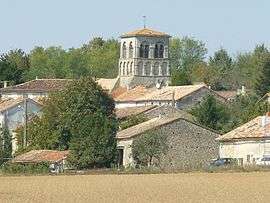
Saint-Germain-de-Montbron
| Saint-Germain-de-Montbron | |
|---|---|
 | |
 Saint-Germain-de-Montbron | |
|
Location within Nouvelle-Aquitaine region  Saint-Germain-de-Montbron | |
| Coordinates: 45°37′26″N 0°25′14″E / 45.6239°N 0.4206°ECoordinates: 45°37′26″N 0°25′14″E / 45.6239°N 0.4206°E | |
| Country | France |
| Region | Nouvelle-Aquitaine |
| Department | Charente |
| Arrondissement | Angoulême |
| Canton | Montbron |
| Intercommunality | Seuil Charente-Périgord |
| Government | |
| • Mayor (2008–2014) | Monique Frodeau |
| Area1 | 14.91 km2 (5.76 sq mi) |
| Population (2008)2 | 473 |
| • Density | 32/km2 (82/sq mi) |
| Time zone | CET (UTC+1) |
| • Summer (DST) | CEST (UTC+2) |
| INSEE/Postal code | 16323 / 16380 |
| Elevation |
93–182 m (305–597 ft) (avg. 110 m or 360 ft) |
|
1 French Land Register data, which excludes lakes, ponds, glaciers > 1 km² (0.386 sq mi or 247 acres) and river estuaries. 2 Population without double counting: residents of multiple communes (e.g., students and military personnel) only counted once. | |
Saint-Germain-de-Montbron is a commune in the Charente department in southwestern France.
Population
| Historical population | ||
|---|---|---|
| Year | Pop. | ±% |
| 1793 | 665 | — |
| 1800 | 718 | +8.0% |
| 1806 | 686 | −4.5% |
| 1821 | 648 | −5.5% |
| 1831 | 720 | +11.1% |
| 1841 | 678 | −5.8% |
| 1846 | 714 | +5.3% |
| 1851 | 724 | +1.4% |
| 1856 | 725 | +0.1% |
| 1861 | 658 | −9.2% |
| 1866 | 662 | +0.6% |
| 1872 | 580 | −12.4% |
| 1876 | 619 | +6.7% |
| 1881 | 608 | −1.8% |
| 1886 | 637 | +4.8% |
| 1891 | 603 | −5.3% |
| 1896 | 552 | −8.5% |
| 1901 | 522 | −5.4% |
| 1906 | 521 | −0.2% |
| 1911 | 509 | −2.3% |
| 1921 | 524 | +2.9% |
| 1926 | 521 | −0.6% |
| 1931 | 530 | +1.7% |
| 1936 | 530 | +0.0% |
| 1946 | 527 | −0.6% |
| 1954 | 487 | −7.6% |
| 1962 | 458 | −6.0% |
| 1968 | 445 | −2.8% |
| 1975 | 456 | +2.5% |
| 1982 | 458 | +0.4% |
| 1990 | 436 | −4.8% |
| 1999 | 434 | −0.5% |
| 2008 | 473 | +9.0% |
See also
References
| Wikimedia Commons has media related to Saint-Germain-de-Montbron. |
This article is issued from Wikipedia - version of the 2/22/2013. The text is available under the Creative Commons Attribution/Share Alike but additional terms may apply for the media files.