Rivières, Charente
| Rivières | |
|---|---|
 | |
 Rivières | |
|
Location within Nouvelle-Aquitaine region  Rivières | |
| Coordinates: 45°45′13″N 0°21′46″E / 45.7536°N 0.3628°ECoordinates: 45°45′13″N 0°21′46″E / 45.7536°N 0.3628°E | |
| Country | France |
| Region | Nouvelle-Aquitaine |
| Department | Charente |
| Arrondissement | Angoulême |
| Canton | La Rochefoucauld |
| Intercommunality | Bandiat-Tardoire |
| Government | |
| • Mayor (2008–2014) | Michel Cuny |
| Area1 | 21.54 km2 (8.32 sq mi) |
| Population (2008)2 | 1,865 |
| • Density | 87/km2 (220/sq mi) |
| Time zone | CET (UTC+1) |
| • Summer (DST) | CEST (UTC+2) |
| INSEE/Postal code | 16280 / 16110 |
| Elevation |
65–156 m (213–512 ft) (avg. 108 m or 354 ft) |
|
1 French Land Register data, which excludes lakes, ponds, glaciers > 1 km² (0.386 sq mi or 247 acres) and river estuaries. 2 Population without double counting: residents of multiple communes (e.g., students and military personnel) only counted once. | |
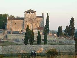
Rivières is a commune in the Charente department in southwestern France.
Population
| Historical population | ||
|---|---|---|
| Year | Pop. | ±% |
| 1793 | 1,049 | — |
| 1800 | 1,206 | +15.0% |
| 1806 | 1,206 | +0.0% |
| 1821 | 1,282 | +6.3% |
| 1831 | 1,325 | +3.4% |
| 1841 | 1,298 | −2.0% |
| 1846 | 1,275 | −1.8% |
| 1851 | 1,240 | −2.7% |
| 1856 | 1,212 | −2.3% |
| 1861 | 1,135 | −6.4% |
| 1866 | 1,129 | −0.5% |
| 1872 | 1,049 | −7.1% |
| 1876 | 1,086 | +3.5% |
| 1881 | 1,072 | −1.3% |
| 1886 | 1,095 | +2.1% |
| 1891 | 1,074 | −1.9% |
| 1896 | 913 | −15.0% |
| 1901 | 843 | −7.7% |
| 1906 | 859 | +1.9% |
| 1911 | 858 | −0.1% |
| 1921 | 852 | −0.7% |
| 1926 | 837 | −1.8% |
| 1931 | 887 | +6.0% |
| 1936 | 907 | +2.3% |
| 1946 | 827 | −8.8% |
| 1954 | 911 | +10.2% |
| 1962 | 1,050 | +15.3% |
| 1968 | 1,106 | +5.3% |
| 1975 | 1,212 | +9.6% |
| 1982 | 1,484 | +22.4% |
| 1990 | 1,587 | +6.9% |
| 1999 | 1,737 | +9.5% |
| 2008 | 1,865 | +7.4% |
See also
References
| Wikimedia Commons has media related to Rivières (Charente). |
This article is issued from Wikipedia - version of the 2/23/2013. The text is available under the Creative Commons Attribution/Share Alike but additional terms may apply for the media files.