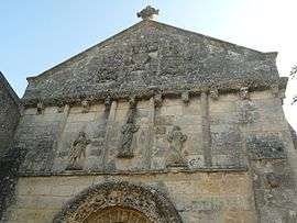
Trois-Palis
| Trois-Palis | |
|---|---|
 | |
 Trois-Palis | |
|
Location within Nouvelle-Aquitaine region  Trois-Palis | |
| Coordinates: 45°38′28″N 0°03′23″E / 45.6411°N 0.0564°ECoordinates: 45°38′28″N 0°03′23″E / 45.6411°N 0.0564°E | |
| Country | France |
| Region | Nouvelle-Aquitaine |
| Department | Charente |
| Arrondissement | Angoulême |
| Canton | Hiersac |
| Intercommunality | Charente-Boëme-Charraud |
| Government | |
| • Mayor (2008–2014) | Denis Durocher |
| Area1 | 4.22 km2 (1.63 sq mi) |
| Population (2008)2 | 786 |
| • Density | 190/km2 (480/sq mi) |
| Time zone | CET (UTC+1) |
| • Summer (DST) | CEST (UTC+2) |
| INSEE/Postal code | 16388 / 16730 |
| Elevation |
22–92 m (72–302 ft) (avg. 40 m or 130 ft) |
|
1 French Land Register data, which excludes lakes, ponds, glaciers > 1 km² (0.386 sq mi or 247 acres) and river estuaries. 2 Population without double counting: residents of multiple communes (e.g., students and military personnel) only counted once. | |
Trois-Palis is a commune in the Charente department of southwestern France.
Population
| Historical population | ||
|---|---|---|
| Year | Pop. | ±% |
| 1793 | 293 | — |
| 1800 | 326 | +11.3% |
| 1806 | 268 | −17.8% |
| 1821 | 271 | +1.1% |
| 1831 | 295 | +8.9% |
| 1841 | 268 | −9.2% |
| 1846 | 258 | −3.7% |
| 1851 | 266 | +3.1% |
| 1856 | 311 | +16.9% |
| 1861 | 288 | −7.4% |
| 1866 | 263 | −8.7% |
| 1872 | 321 | +22.1% |
| 1876 | 319 | −0.6% |
| 1881 | 361 | +13.2% |
| 1886 | 322 | −10.8% |
| 1891 | 355 | +10.2% |
| 1896 | 341 | −3.9% |
| 1901 | 351 | +2.9% |
| 1906 | 343 | −2.3% |
| 1911 | 363 | +5.8% |
| 1921 | 293 | −19.3% |
| 1926 | 313 | +6.8% |
| 1931 | 272 | −13.1% |
| 1936 | 260 | −4.4% |
| 1946 | 253 | −2.7% |
| 1954 | 301 | +19.0% |
| 1962 | 318 | +5.6% |
| 1968 | 324 | +1.9% |
| 1975 | 352 | +8.6% |
| 1982 | 504 | +43.2% |
| 1990 | 555 | +10.1% |
| 1999 | 671 | +20.9% |
| 2008 | 786 | +17.1% |
See also
References
| Wikimedia Commons has media related to Trois-Palis. |
This article is issued from Wikipedia - version of the 2/11/2016. The text is available under the Creative Commons Attribution/Share Alike but additional terms may apply for the media files.