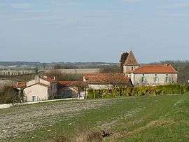
Orival, Charente
| Orival | |
|---|---|
 | |
 Orival | |
|
Location within Nouvelle-Aquitaine region  Orival | |
| Coordinates: 45°16′40″N 0°04′21″E / 45.2778°N .0725°ECoordinates: 45°16′40″N 0°04′21″E / 45.2778°N .0725°E | |
| Country | France |
| Region | Nouvelle-Aquitaine |
| Department | Charente |
| Arrondissement | Angoulême |
| Canton | Chalais |
| Intercommunality | Pays de Chalais |
| Government | |
| • Mayor (2008–2014) | Christine Duval |
| Area1 | 5.43 km2 (2.10 sq mi) |
| Population (2008)2 | 155 |
| • Density | 29/km2 (74/sq mi) |
| Time zone | CET (UTC+1) |
| • Summer (DST) | CEST (UTC+2) |
| INSEE/Postal code | 16252 / 16210 |
| Elevation |
45–154 m (148–505 ft) (avg. 90 m or 300 ft) |
|
1 French Land Register data, which excludes lakes, ponds, glaciers > 1 km² (0.386 sq mi or 247 acres) and river estuaries. 2 Population without double counting: residents of multiple communes (e.g., students and military personnel) only counted once. | |
Orival is a commune in the Charente department in southwestern France.
Population
| Historical population | ||
|---|---|---|
| Year | Pop. | ±% |
| 1793 | 389 | — |
| 1800 | 341 | −12.3% |
| 1806 | 335 | −1.8% |
| 1821 | 350 | +4.5% |
| 1831 | 350 | +0.0% |
| 1841 | 358 | +2.3% |
| 1846 | 353 | −1.4% |
| 1851 | 353 | +0.0% |
| 1856 | 371 | +5.1% |
| 1861 | 345 | −7.0% |
| 1866 | 319 | −7.5% |
| 1872 | 322 | +0.9% |
| 1876 | 301 | −6.5% |
| 1881 | 293 | −2.7% |
| 1886 | 290 | −1.0% |
| 1891 | 269 | −7.2% |
| 1896 | 258 | −4.1% |
| 1901 | 238 | −7.8% |
| 1906 | 251 | +5.5% |
| 1911 | 232 | −7.6% |
| 1921 | 215 | −7.3% |
| 1926 | 214 | −0.5% |
| 1931 | 222 | +3.7% |
| 1936 | 204 | −8.1% |
| 1946 | 183 | −10.3% |
| 1954 | 174 | −4.9% |
| 1962 | 129 | −25.9% |
| 1968 | 123 | −4.7% |
| 1975 | 143 | +16.3% |
| 1982 | 173 | +21.0% |
| 1990 | 177 | +2.3% |
| 1999 | 155 | −12.4% |
| 2008 | 155 | +0.0% |
See also
References
| Wikimedia Commons has media related to Orival (Charente). |
This article is issued from Wikipedia - version of the 7/2/2016. The text is available under the Creative Commons Attribution/Share Alike but additional terms may apply for the media files.