Cellefrouin
| Cellefrouin | |
|---|---|
|
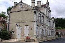
Town hall | |
 Cellefrouin | |
|
Location within Nouvelle-Aquitaine region  Cellefrouin | |
| Coordinates: 45°53′28″N 0°23′29″E / 45.8910°N 0.3914°ECoordinates: 45°53′28″N 0°23′29″E / 45.8910°N 0.3914°E | |
| Country | France |
| Region | Nouvelle-Aquitaine |
| Department | Charente |
| Arrondissement | Confolens |
| Canton | Mansle |
| Intercommunality | Haute-Charente |
| Government | |
| • Mayor (2008–2014) | Jean Damerose |
| Area1 | 40.09 km2 (15.48 sq mi) |
| Population (2008)2 | 532 |
| • Density | 13/km2 (34/sq mi) |
| Time zone | CET (UTC+1) |
| • Summer (DST) | CEST (UTC+2) |
| INSEE/Postal code | 16068 / 16260 |
| Elevation |
81–189 m (266–620 ft) (avg. 142 m or 466 ft) |
|
1 French Land Register data, which excludes lakes, ponds, glaciers > 1 km² (0.386 sq mi or 247 acres) and river estuaries. 2 Population without double counting: residents of multiple communes (e.g., students and military personnel) only counted once. | |
Cellefrouin is a commune in the Charente department in southwestern France.
Population
| Historical population | ||
|---|---|---|
| Year | Pop. | ±% |
| 1793 | 1,628 | — |
| 1800 | 1,819 | +11.7% |
| 1806 | 1,934 | +6.3% |
| 1821 | 2,018 | +4.3% |
| 1831 | 2,043 | +1.2% |
| 1841 | 2,069 | +1.3% |
| 1846 | 2,117 | +2.3% |
| 1851 | 2,091 | −1.2% |
| 1856 | 2,008 | −4.0% |
| 1861 | 2,047 | +1.9% |
| 1866 | 1,821 | −11.0% |
| 1872 | 1,750 | −3.9% |
| 1876 | 1,805 | +3.1% |
| 1881 | 1,777 | −1.6% |
| 1886 | 1,720 | −3.2% |
| 1891 | 1,674 | −2.7% |
| 1896 | 1,616 | −3.5% |
| 1901 | 1,586 | −1.9% |
| 1906 | 1,544 | −2.6% |
| 1911 | 1,559 | +1.0% |
| 1921 | 1,199 | −23.1% |
| 1926 | 1,140 | −4.9% |
| 1931 | 1,125 | −1.3% |
| 1936 | 1,098 | −2.4% |
| 1946 | 958 | −12.8% |
| 1954 | 907 | −5.3% |
| 1962 | 840 | −7.4% |
| 1968 | 730 | −13.1% |
| 1975 | 593 | −18.8% |
| 1982 | 580 | −2.2% |
| 1990 | 563 | −2.9% |
| 1999 | 510 | −9.4% |
| 2008 | 532 | +4.3% |
See also
References
| Wikimedia Commons has media related to Cellefrouin. |
This article is issued from Wikipedia - version of the 7/13/2016. The text is available under the Creative Commons Attribution/Share Alike but additional terms may apply for the media files.