Vouharte
| Vouharte | |
|---|---|
|
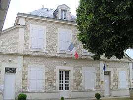
Town hall | |
 Vouharte | |
|
Location within Nouvelle-Aquitaine region  Vouharte | |
| Coordinates: 45°48′59″N 0°04′31″E / 45.8164°N 0.0753°ECoordinates: 45°48′59″N 0°04′31″E / 45.8164°N 0.0753°E | |
| Country | France |
| Region | Nouvelle-Aquitaine |
| Department | Charente |
| Arrondissement | Angoulême |
| Canton | Saint-Amant-de-Boixe |
| Intercommunality | Boixe |
| Government | |
| • Mayor (2008–2014) | Jean Renier |
| Area1 | 10.64 km2 (4.11 sq mi) |
| Population (2008)2 | 328 |
| • Density | 31/km2 (80/sq mi) |
| Time zone | CET (UTC+1) |
| • Summer (DST) | CEST (UTC+2) |
| INSEE/Postal code | 16419 / 16330 |
| Elevation |
42–137 m (138–449 ft) (avg. 45 m or 148 ft) |
|
1 French Land Register data, which excludes lakes, ponds, glaciers > 1 km² (0.386 sq mi or 247 acres) and river estuaries. 2 Population without double counting: residents of multiple communes (e.g., students and military personnel) only counted once. | |
Vouharte is a commune in the Charente department in southwestern France.
Population
| Historical population | ||
|---|---|---|
| Year | Pop. | ±% |
| 1793 | 455 | — |
| 1800 | 471 | +3.5% |
| 1806 | 498 | +5.7% |
| 1821 | 627 | +25.9% |
| 1831 | 611 | −2.6% |
| 1841 | 597 | −2.3% |
| 1846 | 636 | +6.5% |
| 1851 | 663 | +4.2% |
| 1856 | 652 | −1.7% |
| 1861 | 681 | +4.4% |
| 1866 | 666 | −2.2% |
| 1872 | 631 | −5.3% |
| 1876 | 621 | −1.6% |
| 1881 | 522 | −15.9% |
| 1886 | 508 | −2.7% |
| 1891 | 491 | −3.3% |
| 1896 | 436 | −11.2% |
| 1901 | 425 | −2.5% |
| 1906 | 426 | +0.2% |
| 1911 | 423 | −0.7% |
| 1921 | 346 | −18.2% |
| 1926 | 366 | +5.8% |
| 1931 | 328 | −10.4% |
| 1936 | 308 | −6.1% |
| 1946 | 267 | −13.3% |
| 1954 | 253 | −5.2% |
| 1962 | 259 | +2.4% |
| 1968 | 280 | +8.1% |
| 1975 | 313 | +11.8% |
| 1982 | 340 | +8.6% |
| 1990 | 339 | −0.3% |
| 1999 | 330 | −2.7% |
| 2008 | 328 | −0.6% |
See also
References
| Wikimedia Commons has media related to Vouharte. |
This article is issued from Wikipedia - version of the 9/10/2016. The text is available under the Creative Commons Attribution/Share Alike but additional terms may apply for the media files.