Puymoyen
| Puymoyen | |
|---|---|
|
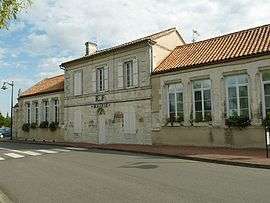
Town hall | |
 Puymoyen | |
|
Location within Nouvelle-Aquitaine region  Puymoyen | |
| Coordinates: 45°36′52″N 0°10′55″E / 45.6144°N 0.1819°ECoordinates: 45°36′52″N 0°10′55″E / 45.6144°N 0.1819°E | |
| Country | France |
| Region | Nouvelle-Aquitaine |
| Department | Charente |
| Arrondissement | Angoulême |
| Canton | La Couronne |
| Intercommunality | Grand Angoulême |
| Government | |
| • Mayor (2008–2014) | Jean-Pierre Grand |
| Area1 | 7.26 km2 (2.80 sq mi) |
| Population (2008)2 | 2,405 |
| • Density | 330/km2 (860/sq mi) |
| Time zone | CET (UTC+1) |
| • Summer (DST) | CEST (UTC+2) |
| INSEE/Postal code | 16271 / 16400 |
| Elevation | 51–149 m (167–489 ft) |
|
1 French Land Register data, which excludes lakes, ponds, glaciers > 1 km² (0.386 sq mi or 247 acres) and river estuaries. 2 Population without double counting: residents of multiple communes (e.g., students and military personnel) only counted once. | |
Puymoyen is a commune in the Charente department in southwestern France.
Population
| Historical population | ||
|---|---|---|
| Year | Pop. | ±% |
| 1793 | 316 | — |
| 1800 | 315 | −0.3% |
| 1806 | 302 | −4.1% |
| 1821 | 337 | +11.6% |
| 1831 | 421 | +24.9% |
| 1841 | 407 | −3.3% |
| 1846 | 483 | +18.7% |
| 1851 | 496 | +2.7% |
| 1856 | 511 | +3.0% |
| 1861 | 526 | +2.9% |
| 1866 | 532 | +1.1% |
| 1872 | 519 | −2.4% |
| 1876 | 560 | +7.9% |
| 1881 | 519 | −7.3% |
| 1886 | 679 | +30.8% |
| 1891 | 705 | +3.8% |
| 1896 | 705 | +0.0% |
| 1901 | 685 | −2.8% |
| 1906 | 658 | −3.9% |
| 1911 | 687 | +4.4% |
| 1921 | 753 | +9.6% |
| 1926 | 750 | −0.4% |
| 1931 | 743 | −0.9% |
| 1936 | 799 | +7.5% |
| 1946 | 272 | −66.0% |
| 1954 | 316 | +16.2% |
| 1962 | 314 | −0.6% |
| 1968 | 436 | +38.9% |
| 1975 | 841 | +92.9% |
| 1982 | 1,573 | +87.0% |
| 1990 | 2,258 | +43.5% |
| 1999 | 2,309 | +2.3% |
| 2008 | 2,405 | +4.2% |
See also
References
External links
| Wikimedia Commons has media related to Puymoyen. |
This article is issued from Wikipedia - version of the 11/13/2014. The text is available under the Creative Commons Attribution/Share Alike but additional terms may apply for the media files.