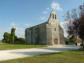
Saint-Médard, Charente
| Saint-Médard | |
|---|---|
 | |
 Saint-Médard | |
|
Location within Nouvelle-Aquitaine region  Saint-Médard | |
| Coordinates: 45°30′42″N 0°08′10″W / 45.5117°N 0.1361°WCoordinates: 45°30′42″N 0°08′10″W / 45.5117°N 0.1361°W | |
| Country | France |
| Region | Nouvelle-Aquitaine |
| Department | Charente |
| Arrondissement | Cognac |
| Canton | Barbezieux-Saint-Hilaire |
| Intercommunality | Sud-Charente |
| Government | |
| • Mayor (2008–2014) | Danièle Boisseau |
| Area1 | 8.24 km2 (3.18 sq mi) |
| Population (2008)2 | 261 |
| • Density | 32/km2 (82/sq mi) |
| Time zone | CET (UTC+1) |
| • Summer (DST) | CEST (UTC+2) |
| INSEE/Postal code | 16338 / 16300 |
| Elevation |
36–83 m (118–272 ft) (avg. 55 m or 180 ft) |
|
1 French Land Register data, which excludes lakes, ponds, glaciers > 1 km² (0.386 sq mi or 247 acres) and river estuaries. 2 Population without double counting: residents of multiple communes (e.g., students and military personnel) only counted once. | |
Saint-Médard is a commune in the Charente department in southwestern France.
Population
| Historical population | ||
|---|---|---|
| Year | Pop. | ±% |
| 1793 | 438 | — |
| 1800 | 440 | +0.5% |
| 1806 | 439 | −0.2% |
| 1821 | 464 | +5.7% |
| 1831 | 541 | +16.6% |
| 1841 | 490 | −9.4% |
| 1846 | 468 | −4.5% |
| 1851 | 447 | −4.5% |
| 1856 | 452 | +1.1% |
| 1861 | 449 | −0.7% |
| 1866 | 454 | +1.1% |
| 1872 | 427 | −5.9% |
| 1876 | 399 | −6.6% |
| 1881 | 375 | −6.0% |
| 1886 | 359 | −4.3% |
| 1891 | 324 | −9.7% |
| 1896 | 294 | −9.3% |
| 1901 | 288 | −2.0% |
| 1906 | 293 | +1.7% |
| 1911 | 324 | +10.6% |
| 1921 | 284 | −12.3% |
| 1926 | 270 | −4.9% |
| 1931 | 310 | +14.8% |
| 1936 | 263 | −15.2% |
| 1946 | 269 | +2.3% |
| 1954 | 280 | +4.1% |
| 1962 | 286 | +2.1% |
| 1968 | 264 | −7.7% |
| 1975 | 237 | −10.2% |
| 1982 | 257 | +8.4% |
| 1990 | 257 | +0.0% |
| 1999 | 271 | +5.4% |
| 2008 | 261 | −3.7% |
See also
References
| Wikimedia Commons has media related to Saint-Médard (Charente). |
This article is issued from Wikipedia - version of the 2/22/2013. The text is available under the Creative Commons Attribution/Share Alike but additional terms may apply for the media files.