Courgeac
| Courgeac | |
|---|---|
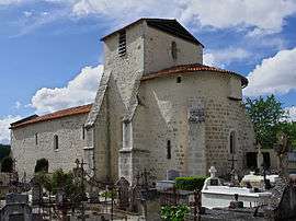 | |
 Courgeac | |
|
Location within Nouvelle-Aquitaine region  Courgeac | |
| Coordinates: 45°23′42″N 0°05′08″E / 45.395°N 0.0856°ECoordinates: 45°23′42″N 0°05′08″E / 45.395°N 0.0856°E | |
| Country | France |
| Region | Nouvelle-Aquitaine |
| Department | Charente |
| Arrondissement | Angoulême |
| Canton | Montmoreau-Saint-Cybard |
| Intercommunality | Montmorélien |
| Government | |
| • Mayor (2008–2014) | Michel Touzeau |
| Area1 | 18.42 km2 (7.11 sq mi) |
| Population (2008)2 | 199 |
| • Density | 11/km2 (28/sq mi) |
| Time zone | CET (UTC+1) |
| • Summer (DST) | CEST (UTC+2) |
| INSEE/Postal code | 16111 / 16190 |
| Elevation |
72–177 m (236–581 ft) (avg. 110 m or 360 ft) |
|
1 French Land Register data, which excludes lakes, ponds, glaciers > 1 km² (0.386 sq mi or 247 acres) and river estuaries. 2 Population without double counting: residents of multiple communes (e.g., students and military personnel) only counted once. | |
Courgeac is a commune in the Charente department in southwestern France.
Population
| Historical population | ||
|---|---|---|
| Year | Pop. | ±% |
| 1793 | 725 | — |
| 1800 | 637 | −12.1% |
| 1806 | 677 | +6.3% |
| 1821 | 636 | −6.1% |
| 1831 | 696 | +9.4% |
| 1841 | 681 | −2.2% |
| 1846 | 685 | +0.6% |
| 1851 | 625 | −8.8% |
| 1856 | 615 | −1.6% |
| 1861 | 602 | −2.1% |
| 1866 | 565 | −6.1% |
| 1872 | 555 | −1.8% |
| 1876 | 530 | −4.5% |
| 1881 | 538 | +1.5% |
| 1886 | 494 | −8.2% |
| 1891 | 419 | −15.2% |
| 1896 | 420 | +0.2% |
| 1901 | 423 | +0.7% |
| 1906 | 413 | −2.4% |
| 1911 | 392 | −5.1% |
| 1921 | 349 | −11.0% |
| 1926 | 346 | −0.9% |
| 1931 | 316 | −8.7% |
| 1936 | 328 | +3.8% |
| 1946 | 319 | −2.7% |
| 1954 | 318 | −0.3% |
| 1962 | 302 | −5.0% |
| 1968 | 249 | −17.5% |
| 1975 | 219 | −12.0% |
| 1982 | 205 | −6.4% |
| 1990 | 174 | −15.1% |
| 1999 | 175 | +0.6% |
| 2008 | 199 | +13.7% |
See also
References
| Wikimedia Commons has media related to Courgeac. |
This article is issued from Wikipedia - version of the 6/10/2013. The text is available under the Creative Commons Attribution/Share Alike but additional terms may apply for the media files.