Tuzie
| Tuzie | |
|---|---|
|
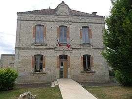
Town hall | |
 Tuzie | |
|
Location within Nouvelle-Aquitaine region  Tuzie | |
| Coordinates: 45°58′35″N 0°09′29″E / 45.9764°N 0.1581°ECoordinates: 45°58′35″N 0°09′29″E / 45.9764°N 0.1581°E | |
| Country | France |
| Region | Nouvelle-Aquitaine |
| Department | Charente |
| Arrondissement | Confolens |
| Canton | Villefagnan |
| Intercommunality | Pays de Villefagnan |
| Government | |
| • Mayor (2008–2014) | Jean-Paul Terrassier |
| Area1 | 2.43 km2 (0.94 sq mi) |
| Population (2008)2 | 146 |
| • Density | 60/km2 (160/sq mi) |
| Time zone | CET (UTC+1) |
| • Summer (DST) | CEST (UTC+2) |
| INSEE/Postal code | 16391 / 16700 |
| Elevation |
76–136 m (249–446 ft) (avg. 130 m or 430 ft) |
|
1 French Land Register data, which excludes lakes, ponds, glaciers > 1 km² (0.386 sq mi or 247 acres) and river estuaries. 2 Population without double counting: residents of multiple communes (e.g., students and military personnel) only counted once. | |
Tuzie is a commune in the Charente department in southwestern France.
Population
| Historical population | ||
|---|---|---|
| Year | Pop. | ±% |
| 1793 | 299 | — |
| 1800 | 325 | +8.7% |
| 1806 | 293 | −9.8% |
| 1821 | 393 | +34.1% |
| 1831 | 348 | −11.5% |
| 1841 | 301 | −13.5% |
| 1846 | 321 | +6.6% |
| 1851 | 288 | −10.3% |
| 1856 | 293 | +1.7% |
| 1861 | 284 | −3.1% |
| 1866 | 249 | −12.3% |
| 1872 | 224 | −10.0% |
| 1876 | 244 | +8.9% |
| 1881 | 239 | −2.0% |
| 1886 | 199 | −16.7% |
| 1891 | 218 | +9.5% |
| 1896 | 198 | −9.2% |
| 1901 | 162 | −18.2% |
| 1906 | 174 | +7.4% |
| 1911 | 173 | −0.6% |
| 1921 | 163 | −5.8% |
| 1926 | 153 | −6.1% |
| 1931 | 158 | +3.3% |
| 1936 | 158 | +0.0% |
| 1946 | 151 | −4.4% |
| 1954 | 136 | −9.9% |
| 1962 | 127 | −6.6% |
| 1968 | 118 | −7.1% |
| 1975 | 110 | −6.8% |
| 1982 | 107 | −2.7% |
| 1990 | 113 | +5.6% |
| 1999 | 120 | +6.2% |
| 2008 | 146 | +21.7% |
See also
References
| Wikimedia Commons has media related to Tuzie. |
This article is issued from Wikipedia - version of the 2/12/2016. The text is available under the Creative Commons Attribution/Share Alike but additional terms may apply for the media files.