Mouton, Charente
| Mouton | |
|---|---|
 | |
 Mouton | |
|
Location within Nouvelle-Aquitaine region  Mouton | |
| Coordinates: 45°53′32″N 0°14′38″E / 45.8922°N .2439°ECoordinates: 45°53′32″N 0°14′38″E / 45.8922°N .2439°E | |
| Country | France |
| Region | Nouvelle-Aquitaine |
| Department | Charente |
| Arrondissement | Confolens |
| Canton | Mansle |
| Intercommunality | Pays Manslois |
| Government | |
| • Mayor (2008–2014) | Hervé Saulnier |
| Area1 | 9.08 km2 (3.51 sq mi) |
| Population (2008)2 | 227 |
| • Density | 25/km2 (65/sq mi) |
| Time zone | CET (UTC+1) |
| • Summer (DST) | CEST (UTC+2) |
| INSEE/Postal code | 16237 / 16460 |
| Elevation |
57–109 m (187–358 ft) (avg. 64 m or 210 ft) |
|
1 French Land Register data, which excludes lakes, ponds, glaciers > 1 km² (0.386 sq mi or 247 acres) and river estuaries. 2 Population without double counting: residents of multiple communes (e.g., students and military personnel) only counted once. | |
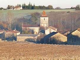
Mouton is a commune in the Charente department in southwestern France.
Population
| Historical population | ||
|---|---|---|
| Year | Pop. | ±% |
| 1793 | 556 | — |
| 1800 | 587 | +5.6% |
| 1806 | 512 | −12.8% |
| 1821 | 676 | +32.0% |
| 1831 | 654 | −3.3% |
| 1841 | 648 | −0.9% |
| 1846 | 628 | −3.1% |
| 1851 | 637 | +1.4% |
| 1856 | 618 | −3.0% |
| 1861 | 569 | −7.9% |
| 1866 | 562 | −1.2% |
| 1872 | 528 | −6.0% |
| 1876 | 486 | −8.0% |
| 1881 | 488 | +0.4% |
| 1886 | 472 | −3.3% |
| 1891 | 429 | −9.1% |
| 1896 | 397 | −7.5% |
| 1901 | 362 | −8.8% |
| 1906 | 359 | −0.8% |
| 1911 | 341 | −5.0% |
| 1921 | 314 | −7.9% |
| 1926 | 312 | −0.6% |
| 1931 | 347 | +11.2% |
| 1936 | 340 | −2.0% |
| 1946 | 325 | −4.4% |
| 1954 | 280 | −13.8% |
| 1962 | 283 | +1.1% |
| 1968 | 259 | −8.5% |
| 1975 | 235 | −9.3% |
| 1982 | 212 | −9.8% |
| 1990 | 194 | −8.5% |
| 1999 | 223 | +14.9% |
| 2008 | 227 | +1.8% |
See also
References
| Wikimedia Commons has media related to Mouton (Charente). |
This article is issued from Wikipedia - version of the 2/22/2013. The text is available under the Creative Commons Attribution/Share Alike but additional terms may apply for the media files.