Puyréaux
| Puyréaux | |
|---|---|
|
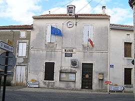
Town hall | |
 Puyréaux | |
|
Location within Nouvelle-Aquitaine region  Puyréaux | |
| Coordinates: 45°51′44″N 0°12′46″E / 45.8622°N 0.2128°ECoordinates: 45°51′44″N 0°12′46″E / 45.8622°N 0.2128°E | |
| Country | France |
| Region | Nouvelle-Aquitaine |
| Department | Charente |
| Arrondissement | Confolens |
| Canton | Mansle |
| Intercommunality | Pays Manslois |
| Government | |
| • Mayor (2008–2014) | Robert Barbot |
| Area1 | 8.11 km2 (3.13 sq mi) |
| Population (2008)2 | 463 |
| • Density | 57/km2 (150/sq mi) |
| Time zone | CET (UTC+1) |
| • Summer (DST) | CEST (UTC+2) |
| INSEE/Postal code | 16272 / 16230 |
| Elevation |
57–116 m (187–381 ft) (avg. 100 m or 330 ft) |
|
1 French Land Register data, which excludes lakes, ponds, glaciers > 1 km² (0.386 sq mi or 247 acres) and river estuaries. 2 Population without double counting: residents of multiple communes (e.g., students and military personnel) only counted once. | |
Puyréaux is a commune in the Charente department in southwestern France.
Population
| Historical population | ||
|---|---|---|
| Year | Pop. | ±% |
| 1793 | 441 | — |
| 1800 | 461 | +4.5% |
| 1806 | 450 | −2.4% |
| 1821 | 510 | +13.3% |
| 1831 | 488 | −4.3% |
| 1841 | 537 | +10.0% |
| 1846 | 514 | −4.3% |
| 1851 | 534 | +3.9% |
| 1856 | 510 | −4.5% |
| 1861 | 525 | +2.9% |
| 1866 | 521 | −0.8% |
| 1872 | 516 | −1.0% |
| 1876 | 549 | +6.4% |
| 1881 | 515 | −6.2% |
| 1886 | 503 | −2.3% |
| 1891 | 519 | +3.2% |
| 1896 | 522 | +0.6% |
| 1901 | 508 | −2.7% |
| 1906 | 507 | −0.2% |
| 1911 | 500 | −1.4% |
| 1921 | 414 | −17.2% |
| 1926 | 360 | −13.0% |
| 1931 | 354 | −1.7% |
| 1936 | 370 | +4.5% |
| 1946 | 338 | −8.6% |
| 1954 | 326 | −3.6% |
| 1962 | 343 | +5.2% |
| 1968 | 334 | −2.6% |
| 1975 | 321 | −3.9% |
| 1982 | 361 | +12.5% |
| 1990 | 403 | +11.6% |
| 1999 | 396 | −1.7% |
| 2008 | 463 | +16.9% |
See also
References
| Wikimedia Commons has media related to Puyréaux. |
This article is issued from Wikipedia - version of the 3/15/2016. The text is available under the Creative Commons Attribution/Share Alike but additional terms may apply for the media files.