Triac-Lautrait
| Triac-Lautrait | |
|---|---|
|
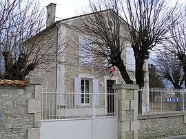
Town hall | |
 Triac-Lautrait | |
|
Location within Nouvelle-Aquitaine region  Triac-Lautrait | |
| Coordinates: 45°41′26″N 0°07′31″W / 45.6906°N 0.1253°WCoordinates: 45°41′26″N 0°07′31″W / 45.6906°N 0.1253°W | |
| Country | France |
| Region | Nouvelle-Aquitaine |
| Department | Charente |
| Arrondissement | Cognac |
| Canton | Jarnac |
| Government | |
| • Mayor (2008–2014) | Michel Gambier |
| Area1 | 6.4 km2 (2.5 sq mi) |
| Population (1999)2 | 454 |
| • Density | 71/km2 (180/sq mi) |
| Time zone | CET (UTC+1) |
| • Summer (DST) | CEST (UTC+2) |
| INSEE/Postal code | 16387 / 16200 |
| Elevation |
12–49 m (39–161 ft) (avg. 12 m or 39 ft) |
|
1 French Land Register data, which excludes lakes, ponds, glaciers > 1 km² (0.386 sq mi or 247 acres) and river estuaries. 2 Population without double counting: residents of multiple communes (e.g., students and military personnel) only counted once. | |
Triac-Lautrait is a commune in the Charente department in southwestern France.
Population
| Historical population | ||
|---|---|---|
| Year | Pop. | ±% |
| 1793 | 447 | — |
| 1800 | 510 | +14.1% |
| 1806 | 481 | −5.7% |
| 1821 | 488 | +1.5% |
| 1831 | 518 | +6.1% |
| 1841 | 464 | −10.4% |
| 1846 | 504 | +8.6% |
| 1851 | 501 | −0.6% |
| 1856 | 494 | −1.4% |
| 1861 | 508 | +2.8% |
| 1866 | 473 | −6.9% |
| 1872 | 457 | −3.4% |
| 1876 | 457 | +0.0% |
| 1881 | 419 | −8.3% |
| 1886 | 420 | +0.2% |
| 1891 | 410 | −2.4% |
| 1896 | 420 | +2.4% |
| 1901 | 391 | −6.9% |
| 1906 | 406 | +3.8% |
| 1911 | 379 | −6.7% |
| 1921 | 335 | −11.6% |
| 1926 | 329 | −1.8% |
| 1931 | 291 | −11.6% |
| 1936 | 294 | +1.0% |
| 1946 | 334 | +13.6% |
| 1954 | 314 | −6.0% |
| 1962 | 342 | +8.9% |
| 1968 | 344 | +0.6% |
| 1975 | 339 | −1.5% |
| 1982 | 342 | +0.9% |
| 1990 | 401 | +17.3% |
| 1999 | 398 | −0.7% |
| 2008 | 454 | +14.1% |
See also
References
| Wikimedia Commons has media related to Triac-Lautrait. |
This article is issued from Wikipedia - version of the 2/11/2016. The text is available under the Creative Commons Attribution/Share Alike but additional terms may apply for the media files.