Juignac
| Juignac | |
|---|---|
|
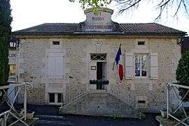
Town hall | |
 Juignac | |
|
Location within Nouvelle-Aquitaine region  Juignac | |
| Coordinates: 45°22′44″N 0°09′52″E / 45.3789°N 0.1644°ECoordinates: 45°22′44″N 0°09′52″E / 45.3789°N 0.1644°E | |
| Country | France |
| Region | Nouvelle-Aquitaine |
| Department | Charente |
| Arrondissement | Angoulême |
| Canton | Montmoreau-Saint-Cybard |
| Intercommunality | Montmorélien |
| Government | |
| • Mayor (2008–2014) | Alain Delaunay |
| Area1 | 24.18 km2 (9.34 sq mi) |
| Population (2008)2 | 412 |
| • Density | 17/km2 (44/sq mi) |
| Time zone | CET (UTC+1) |
| • Summer (DST) | CEST (UTC+2) |
| INSEE/Postal code | 16170 / 16190 |
| Elevation |
61–191 m (200–627 ft) (avg. 126 m or 413 ft) |
|
1 French Land Register data, which excludes lakes, ponds, glaciers > 1 km² (0.386 sq mi or 247 acres) and river estuaries. 2 Population without double counting: residents of multiple communes (e.g., students and military personnel) only counted once. | |
Juignac is a commune in the Charente department in southwestern France.
Population
| Historical population | ||
|---|---|---|
| Year | Pop. | ±% |
| 1793 | 1,281 | — |
| 1800 | 1,100 | −14.1% |
| 1806 | 1,344 | +22.2% |
| 1821 | 1,316 | −2.1% |
| 1831 | 1,369 | +4.0% |
| 1841 | 1,268 | −7.4% |
| 1846 | 1,232 | −2.8% |
| 1851 | 1,177 | −4.5% |
| 1856 | 1,192 | +1.3% |
| 1861 | 1,160 | −2.7% |
| 1866 | 1,116 | −3.8% |
| 1872 | 1,051 | −5.8% |
| 1876 | 1,003 | −4.6% |
| 1881 | 960 | −4.3% |
| 1886 | 853 | −11.1% |
| 1891 | 802 | −6.0% |
| 1896 | 806 | +0.5% |
| 1901 | 801 | −0.6% |
| 1906 | 810 | +1.1% |
| 1911 | 809 | −0.1% |
| 1921 | 704 | −13.0% |
| 1926 | 632 | −10.2% |
| 1931 | 632 | +0.0% |
| 1936 | 622 | −1.6% |
| 1946 | 608 | −2.3% |
| 1954 | 569 | −6.4% |
| 1962 | 615 | +8.1% |
| 1968 | 613 | −0.3% |
| 1975 | 560 | −8.6% |
| 1982 | 517 | −7.7% |
| 1990 | 466 | −9.9% |
| 1999 | 439 | −5.8% |
| 2008 | 412 | −6.2% |
See also
References
| Wikimedia Commons has media related to Juignac. |
This article is issued from Wikipedia - version of the 2/11/2016. The text is available under the Creative Commons Attribution/Share Alike but additional terms may apply for the media files.