Pérignac, Charente
| Pérignac | |
|---|---|
 | |
 Pérignac | |
|
Location within Nouvelle-Aquitaine region  Pérignac | |
| Coordinates: 45°27′55″N 0°04′42″E / 45.4653°N 0.0783°ECoordinates: 45°27′55″N 0°04′42″E / 45.4653°N 0.0783°E | |
| Country | France |
| Region | Nouvelle-Aquitaine |
| Department | Charente |
| Arrondissement | Angoulême |
| Canton | Blanzac-Porcheresse |
| Intercommunality | Blanzacais |
| Government | |
| • Mayor (2008–2014) | Christian Matrat |
| Area1 | 25.52 km2 (9.85 sq mi) |
| Population (2008)2 | 530 |
| • Density | 21/km2 (54/sq mi) |
| Time zone | CET (UTC+1) |
| • Summer (DST) | CEST (UTC+2) |
| INSEE/Postal code | 16258 / 16250 |
| Elevation |
77–189 m (253–620 ft) (avg. 182 m or 597 ft) |
|
1 French Land Register data, which excludes lakes, ponds, glaciers > 1 km² (0.386 sq mi or 247 acres) and river estuaries. 2 Population without double counting: residents of multiple communes (e.g., students and military personnel) only counted once. | |
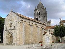
Pérignac is a commune in the Charente department in southwestern France.
Population
| Historical population | ||
|---|---|---|
| Year | Pop. | ±% |
| 1793 | 1,100 | — |
| 1800 | 889 | −19.2% |
| 1806 | 1,833 | +106.2% |
| 1821 | 1,011 | −44.8% |
| 1831 | 1,013 | +0.2% |
| 1841 | 1,044 | +3.1% |
| 1846 | 1,005 | −3.7% |
| 1851 | 1,002 | −0.3% |
| 1856 | 961 | −4.1% |
| 1861 | 1,004 | +4.5% |
| 1866 | 949 | −5.5% |
| 1872 | 874 | −7.9% |
| 1876 | 887 | +1.5% |
| 1881 | 845 | −4.7% |
| 1886 | 812 | −3.9% |
| 1891 | 715 | −11.9% |
| 1896 | 782 | +9.4% |
| 1901 | 718 | −8.2% |
| 1906 | 700 | −2.5% |
| 1911 | 800 | +14.3% |
| 1921 | 640 | −20.0% |
| 1926 | 647 | +1.1% |
| 1931 | 638 | −1.4% |
| 1936 | 628 | −1.6% |
| 1946 | 582 | −7.3% |
| 1954 | 545 | −6.4% |
| 1962 | 528 | −3.1% |
| 1968 | 501 | −5.1% |
| 1975 | 467 | −6.8% |
| 1982 | 430 | −7.9% |
| 1990 | 475 | +10.5% |
| 1999 | 485 | +2.1% |
| 2008 | 530 | +9.3% |
The residents are called Pérignacais.
See also
References
External links
| Wikimedia Commons has media related to Pérignac (Charente). |
This article is issued from Wikipedia - version of the 3/15/2016. The text is available under the Creative Commons Attribution/Share Alike but additional terms may apply for the media files.