Oradour-Fanais
| Oradour-Fanais | |
|---|---|
 | |
 Oradour-Fanais | |
|
Location within Nouvelle-Aquitaine region  Oradour-Fanais | |
| Coordinates: 46°07′18″N 0°47′04″E / 46.1217°N 0.7844°ECoordinates: 46°07′18″N 0°47′04″E / 46.1217°N 0.7844°E | |
| Country | France |
| Region | Nouvelle-Aquitaine |
| Department | Charente |
| Arrondissement | Confolens |
| Canton | Confolens-Sud |
| Intercommunality | Confolentais |
| Government | |
| • Mayor (2008–2014) | Roland Telmar |
| Area1 | 26.41 km2 (10.20 sq mi) |
| Population (2008)2 | 371 |
| • Density | 14/km2 (36/sq mi) |
| Time zone | CET (UTC+1) |
| • Summer (DST) | CEST (UTC+2) |
| INSEE/Postal code | 16249 / 16500 |
| Elevation |
178–239 m (584–784 ft) (avg. 210 m or 690 ft) |
|
1 French Land Register data, which excludes lakes, ponds, glaciers > 1 km² (0.386 sq mi or 247 acres) and river estuaries. 2 Population without double counting: residents of multiple communes (e.g., students and military personnel) only counted once. | |
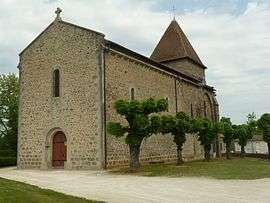
Oradour-Fanais is a commune in the Charente department in southwestern France.
Population
| Historical population | ||
|---|---|---|
| Year | Pop. | ±% |
| 1793 | 970 | — |
| 1800 | 922 | −4.9% |
| 1806 | 952 | +3.3% |
| 1821 | 926 | −2.7% |
| 1831 | 887 | −4.2% |
| 1841 | 910 | +2.6% |
| 1846 | 914 | +0.4% |
| 1851 | 878 | −3.9% |
| 1856 | 894 | +1.8% |
| 1861 | 862 | −3.6% |
| 1866 | 856 | −0.7% |
| 1872 | 833 | −2.7% |
| 1876 | 885 | +6.2% |
| 1881 | 904 | +2.1% |
| 1886 | 911 | +0.8% |
| 1891 | 849 | −6.8% |
| 1896 | 871 | +2.6% |
| 1901 | 848 | −2.6% |
| 1906 | 850 | +0.2% |
| 1911 | 850 | +0.0% |
| 1921 | 761 | −10.5% |
| 1926 | 749 | −1.6% |
| 1931 | 712 | −4.9% |
| 1936 | 704 | −1.1% |
| 1946 | 595 | −15.5% |
| 1954 | 599 | +0.7% |
| 1962 | 554 | −7.5% |
| 1968 | 475 | −14.3% |
| 1975 | 407 | −14.3% |
| 1982 | 375 | −7.9% |
| 1990 | 340 | −9.3% |
| 1999 | 342 | +0.6% |
| 2008 | 371 | +8.5% |
See also
References
| Wikimedia Commons has media related to Oradour-Fanais. |
This article is issued from Wikipedia - version of the 2/23/2013. The text is available under the Creative Commons Attribution/Share Alike but additional terms may apply for the media files.