Suaux
| Suaux | |
|---|---|
|
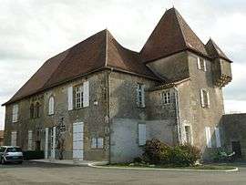
Chateau used as the town hall | |
 Suaux | |
|
Location within Nouvelle-Aquitaine region  Suaux | |
| Coordinates: 45°51′09″N 0°30′25″E / 45.8525°N 0.5069°ECoordinates: 45°51′09″N 0°30′25″E / 45.8525°N 0.5069°E | |
| Country | France |
| Region | Nouvelle-Aquitaine |
| Department | Charente |
| Arrondissement | Confolens |
| Canton | Saint-Claud |
| Intercommunality | Haute-Charente |
| Government | |
| • Mayor (2008–2014) | Olivier Périnet |
| Area1 | 11.93 km2 (4.61 sq mi) |
| Population (2008)2 | 377 |
| • Density | 32/km2 (82/sq mi) |
| Time zone | CET (UTC+1) |
| • Summer (DST) | CEST (UTC+2) |
| INSEE/Postal code | 16375 / 16260 |
| Elevation |
120–212 m (394–696 ft) (avg. 184 m or 604 ft) |
|
1 French Land Register data, which excludes lakes, ponds, glaciers > 1 km² (0.386 sq mi or 247 acres) and river estuaries. 2 Population without double counting: residents of multiple communes (e.g., students and military personnel) only counted once. | |
Suaux is a commune in the Charente department in southwestern France.
Population
| Historical population | ||
|---|---|---|
| Year | Pop. | ±% |
| 1793 | 891 | — |
| 1800 | 771 | −13.5% |
| 1806 | 783 | +1.6% |
| 1821 | 884 | +12.9% |
| 1831 | 900 | +1.8% |
| 1841 | 845 | −6.1% |
| 1846 | 905 | +7.1% |
| 1851 | 968 | +7.0% |
| 1856 | 870 | −10.1% |
| 1861 | 869 | −0.1% |
| 1866 | 872 | +0.3% |
| 1872 | 850 | −2.5% |
| 1876 | 882 | +3.8% |
| 1881 | 850 | −3.6% |
| 1886 | 840 | −1.2% |
| 1891 | 807 | −3.9% |
| 1896 | 772 | −4.3% |
| 1901 | 769 | −0.4% |
| 1906 | 733 | −4.7% |
| 1911 | 714 | −2.6% |
| 1921 | 609 | −14.7% |
| 1926 | 564 | −7.4% |
| 1931 | 540 | −4.3% |
| 1936 | 519 | −3.9% |
| 1946 | 522 | +0.6% |
| 1954 | 512 | −1.9% |
| 1962 | 509 | −0.6% |
| 1968 | 484 | −4.9% |
| 1975 | 460 | −5.0% |
| 1982 | 373 | −18.9% |
| 1990 | 367 | −1.6% |
| 1999 | 356 | −3.0% |
| 2008 | 377 | +5.9% |
See also
References
| Wikimedia Commons has media related to Suaux. |
This article is issued from Wikipedia - version of the 2/27/2013. The text is available under the Creative Commons Attribution/Share Alike but additional terms may apply for the media files.