Châtignac
| Châtignac | |
|---|---|
|
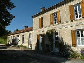
Town hall | |
 Châtignac | |
|
Location within Nouvelle-Aquitaine region  Châtignac | |
| Coordinates: 45°20′52″N 0°00′26″W / 45.3478°N 0.0072°WCoordinates: 45°20′52″N 0°00′26″W / 45.3478°N 0.0072°W | |
| Country | France |
| Region | Nouvelle-Aquitaine |
| Department | Charente |
| Arrondissement | Cognac |
| Canton | Brossac |
| Intercommunality | 3B - Sud-Charente |
| Government | |
| • Mayor (2008–2014) | Jean-Yves Ambaud |
| Area1 | 9.75 km2 (3.76 sq mi) |
| Population (2008)2 | 207 |
| • Density | 21/km2 (55/sq mi) |
| Time zone | CET (UTC+1) |
| • Summer (DST) | CEST (UTC+2) |
| INSEE/Postal code | 16091 / 16480 |
| Elevation |
71–190 m (233–623 ft) (avg. 179 m or 587 ft) |
|
1 French Land Register data, which excludes lakes, ponds, glaciers > 1 km² (0.386 sq mi or 247 acres) and river estuaries. 2 Population without double counting: residents of multiple communes (e.g., students and military personnel) only counted once. | |
Châtignac is a commune in the Charente department in southwestern France.
Population
| Historical population | ||
|---|---|---|
| Year | Pop. | ±% |
| 1793 | 484 | — |
| 1800 | 434 | −10.3% |
| 1806 | 392 | −9.7% |
| 1821 | 421 | +7.4% |
| 1831 | 498 | +18.3% |
| 1841 | 526 | +5.6% |
| 1846 | 578 | +9.9% |
| 1851 | 511 | −11.6% |
| 1856 | 490 | −4.1% |
| 1861 | 458 | −6.5% |
| 1866 | 451 | −1.5% |
| 1872 | 426 | −5.5% |
| 1876 | 400 | −6.1% |
| 1881 | 422 | +5.5% |
| 1886 | 422 | +0.0% |
| 1891 | 379 | −10.2% |
| 1896 | 361 | −4.7% |
| 1901 | 360 | −0.3% |
| 1906 | 328 | −8.9% |
| 1911 | 302 | −7.9% |
| 1921 | 263 | −12.9% |
| 1926 | 279 | +6.1% |
| 1931 | 230 | −17.6% |
| 1936 | 237 | +3.0% |
| 1946 | 205 | −13.5% |
| 1954 | 222 | +8.3% |
| 1962 | 210 | −5.4% |
| 1968 | 191 | −9.0% |
| 1975 | 181 | −5.2% |
| 1982 | 158 | −12.7% |
| 1990 | 143 | −9.5% |
| 1999 | 185 | +29.4% |
| 2008 | 207 | +11.9% |
See also
References
| Wikimedia Commons has media related to Châtignac. |
This article is issued from Wikipedia - version of the 2/22/2013. The text is available under the Creative Commons Attribution/Share Alike but additional terms may apply for the media files.