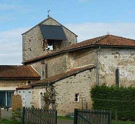
Mazières
| Mazières | |
|---|---|
 | |
 Mazières | |
|
Location within Nouvelle-Aquitaine region  Mazières | |
| Coordinates: 45°50′13″N 0°34′17″E / 45.8369°N 0.5714°ECoordinates: 45°50′13″N 0°34′17″E / 45.8369°N 0.5714°E | |
| Country | France |
| Region | Nouvelle-Aquitaine |
| Department | Charente |
| Arrondissement | Confolens |
| Canton | Saint-Claud |
| Intercommunality | Haute-Charente |
| Government | |
| • Mayor (2008–2014) | Robert Denis |
| Area1 | 5.87 km2 (2.27 sq mi) |
| Population (2008)2 | 101 |
| • Density | 17/km2 (45/sq mi) |
| Time zone | CET (UTC+1) |
| • Summer (DST) | CEST (UTC+2) |
| INSEE/Postal code | 16214 / 16270 |
| Elevation |
145–236 m (476–774 ft) (avg. 200 m or 660 ft) |
|
1 French Land Register data, which excludes lakes, ponds, glaciers > 1 km² (0.386 sq mi or 247 acres) and river estuaries. 2 Population without double counting: residents of multiple communes (e.g., students and military personnel) only counted once. | |
Mazières is a commune in the Charente department in southwestern France.
Population
| Historical population | ||
|---|---|---|
| Year | Pop. | ±% |
| 1793 | 314 | — |
| 1800 | 314 | +0.0% |
| 1806 | 378 | +20.4% |
| 1821 | 301 | −20.4% |
| 1831 | 358 | +18.9% |
| 1841 | 345 | −3.6% |
| 1846 | 335 | −2.9% |
| 1851 | 322 | −3.9% |
| 1856 | 293 | −9.0% |
| 1861 | 316 | +7.8% |
| 1866 | 302 | −4.4% |
| 1872 | 300 | −0.7% |
| 1876 | 300 | +0.0% |
| 1881 | 301 | +0.3% |
| 1886 | 302 | +0.3% |
| 1891 | 319 | +5.6% |
| 1896 | 297 | −6.9% |
| 1901 | 282 | −5.1% |
| 1906 | 279 | −1.1% |
| 1911 | 295 | +5.7% |
| 1921 | 255 | −13.6% |
| 1926 | 232 | −9.0% |
| 1931 | 221 | −4.7% |
| 1936 | 214 | −3.2% |
| 1946 | 180 | −15.9% |
| 1954 | 183 | +1.7% |
| 1962 | 190 | +3.8% |
| 1968 | 179 | −5.8% |
| 1975 | 140 | −21.8% |
| 1982 | 126 | −10.0% |
| 1990 | 88 | −30.2% |
| 1999 | 93 | +5.7% |
| 2008 | 101 | +8.6% |
See also
References
| Wikimedia Commons has media related to Mazières. |
This article is issued from Wikipedia - version of the 7/20/2016. The text is available under the Creative Commons Attribution/Share Alike but additional terms may apply for the media files.