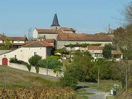
Courlac
| Courlac | |
|---|---|
 | |
 Courlac | |
|
Location within Nouvelle-Aquitaine region  Courlac | |
| Coordinates: 45°18′06″N 0°05′35″E / 45.3017°N 0.0931°ECoordinates: 45°18′06″N 0°05′35″E / 45.3017°N 0.0931°E | |
| Country | France |
| Region | Nouvelle-Aquitaine |
| Department | Charente |
| Arrondissement | Angoulême |
| Canton | Chalais |
| Intercommunality | Pays de Chalais |
| Government | |
| • Mayor (2008–2014) | Thierry Crochet |
| Area1 | 6.58 km2 (2.54 sq mi) |
| Population (2008)2 | 66 |
| • Density | 10/km2 (26/sq mi) |
| Time zone | CET (UTC+1) |
| • Summer (DST) | CEST (UTC+2) |
| INSEE/Postal code | 16112 / 16210 |
| Elevation |
48–139 m (157–456 ft) (avg. 122 m or 400 ft) |
|
1 French Land Register data, which excludes lakes, ponds, glaciers > 1 km² (0.386 sq mi or 247 acres) and river estuaries. 2 Population without double counting: residents of multiple communes (e.g., students and military personnel) only counted once. | |
Courlac is a commune in the Charente department in southwestern France.
Population
| Historical population | ||
|---|---|---|
| Year | Pop. | ±% |
| 1793 | 252 | — |
| 1800 | 242 | −4.0% |
| 1806 | 299 | +23.6% |
| 1821 | 308 | +3.0% |
| 1831 | 334 | +8.4% |
| 1841 | 307 | −8.1% |
| 1846 | 335 | +9.1% |
| 1851 | 309 | −7.8% |
| 1856 | 315 | +1.9% |
| 1861 | 312 | −1.0% |
| 1866 | 294 | −5.8% |
| 1872 | 290 | −1.4% |
| 1876 | 270 | −6.9% |
| 1881 | 265 | −1.9% |
| 1886 | 264 | −0.4% |
| 1891 | 233 | −11.7% |
| 1896 | 261 | +12.0% |
| 1901 | 264 | +1.1% |
| 1906 | 260 | −1.5% |
| 1911 | 248 | −4.6% |
| 1921 | 199 | −19.8% |
| 1926 | 171 | −14.1% |
| 1931 | 169 | −1.2% |
| 1936 | 186 | +10.1% |
| 1946 | 152 | −18.3% |
| 1954 | 131 | −13.8% |
| 1962 | 132 | +0.8% |
| 1968 | 92 | −30.3% |
| 1975 | 84 | −8.7% |
| 1982 | 80 | −4.8% |
| 1990 | 64 | −20.0% |
| 1999 | 59 | −7.8% |
| 2008 | 66 | +11.9% |
See also
References
| Wikimedia Commons has media related to Courlac. |
This article is issued from Wikipedia - version of the 2/22/2013. The text is available under the Creative Commons Attribution/Share Alike but additional terms may apply for the media files.