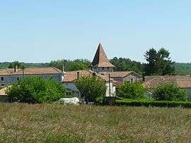
Roussines, Charente
| Roussines | |
|---|---|
 | |
 Roussines | |
|
Location within Nouvelle-Aquitaine region  Roussines | |
| Coordinates: 45°43′26″N 0°37′16″E / 45.7239°N 0.6211°ECoordinates: 45°43′26″N 0°37′16″E / 45.7239°N 0.6211°E | |
| Country | France |
| Region | Nouvelle-Aquitaine |
| Department | Charente |
| Arrondissement | Confolens |
| Canton | Montembœuf |
| Government | |
| • Mayor (2008–2014) | Roland Boiraud |
| Area1 | 16.08 km2 (6.21 sq mi) |
| Population (2008)2 | 310 |
| • Density | 19/km2 (50/sq mi) |
| Time zone | CET (UTC+1) |
| • Summer (DST) | CEST (UTC+2) |
| INSEE/Postal code | 16289 / 16310 |
| Elevation |
147–281 m (482–922 ft) (avg. 236 m or 774 ft) |
|
1 French Land Register data, which excludes lakes, ponds, glaciers > 1 km² (0.386 sq mi or 247 acres) and river estuaries. 2 Population without double counting: residents of multiple communes (e.g., students and military personnel) only counted once. | |
Roussines is a commune in the Charente department in southwestern France.
Population
| Historical population | ||
|---|---|---|
| Year | Pop. | ±% |
| 1793 | 1,050 | — |
| 1800 | 969 | −7.7% |
| 1806 | 911 | −6.0% |
| 1821 | 953 | +4.6% |
| 1831 | 1,164 | +22.1% |
| 1841 | 1,201 | +3.2% |
| 1846 | 1,126 | −6.2% |
| 1851 | 1,160 | +3.0% |
| 1856 | 1,233 | +6.3% |
| 1861 | 1,069 | −13.3% |
| 1866 | 1,102 | +3.1% |
| 1872 | 1,103 | +0.1% |
| 1876 | 1,127 | +2.2% |
| 1881 | 1,167 | +3.5% |
| 1886 | 1,138 | −2.5% |
| 1891 | 1,139 | +0.1% |
| 1896 | 1,126 | −1.1% |
| 1901 | 1,065 | −5.4% |
| 1906 | 1,054 | −1.0% |
| 1911 | 1,036 | −1.7% |
| 1921 | 939 | −9.4% |
| 1926 | 898 | −4.4% |
| 1931 | 772 | −14.0% |
| 1936 | 708 | −8.3% |
| 1946 | 712 | +0.6% |
| 1954 | 624 | −12.4% |
| 1962 | 577 | −7.5% |
| 1968 | 504 | −12.7% |
| 1975 | 442 | −12.3% |
| 1982 | 396 | −10.4% |
| 1990 | 374 | −5.6% |
| 1999 | 300 | −19.8% |
| 2008 | 310 | +3.3% |
See also
References
| Wikimedia Commons has media related to Roussines (Charente). |
This article is issued from Wikipedia - version of the 3/15/2016. The text is available under the Creative Commons Attribution/Share Alike but additional terms may apply for the media files.