Aunac
| Aunac | |
|---|---|
|
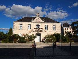
Town hall | |
 Aunac | |
|
Location within Nouvelle-Aquitaine region  Aunac | |
| Coordinates: 45°55′07″N 0°14′31″E / 45.9186°N 0.2419°ECoordinates: 45°55′07″N 0°14′31″E / 45.9186°N 0.2419°E | |
| Country | France |
| Region | Nouvelle-Aquitaine |
| Department | Charente |
| Arrondissement | Confolens |
| Canton | Mansle |
| Intercommunality | Pays Manslois |
| Government | |
| • Mayor (2008–2014) | Anne-Marie Cheminade |
| Area1 | 4.77 km2 (1.84 sq mi) |
| Population (2008)2 | 346 |
| • Density | 73/km2 (190/sq mi) |
| Time zone | CET (UTC+1) |
| • Summer (DST) | CEST (UTC+2) |
| INSEE/Postal code | 16023 / 16460 |
| Elevation |
64–104 m (210–341 ft) (avg. 94 m or 308 ft) |
|
1 French Land Register data, which excludes lakes, ponds, glaciers > 1 km² (0.386 sq mi or 247 acres) and river estuaries. 2 Population without double counting: residents of multiple communes (e.g., students and military personnel) only counted once. | |
Aunac is a commune in the Charente department in southwestern France.
Population
| Historical population | ||
|---|---|---|
| Year | Pop. | ±% |
| 1793 | 348 | — |
| 1800 | 381 | +9.5% |
| 1806 | 332 | −12.9% |
| 1821 | 313 | −5.7% |
| 1831 | 446 | +42.5% |
| 1841 | 441 | −1.1% |
| 1846 | 506 | +14.7% |
| 1851 | 527 | +4.2% |
| 1856 | 537 | +1.9% |
| 1861 | 504 | −6.1% |
| 1866 | 464 | −7.9% |
| 1872 | 502 | +8.2% |
| 1876 | 503 | +0.2% |
| 1881 | 505 | +0.4% |
| 1886 | 519 | +2.8% |
| 1891 | 530 | +2.1% |
| 1896 | 452 | −14.7% |
| 1901 | 431 | −4.6% |
| 1906 | 439 | +1.9% |
| 1911 | 409 | −6.8% |
| 1921 | 348 | −14.9% |
| 1926 | 352 | +1.1% |
| 1931 | 354 | +0.6% |
| 1936 | 388 | +9.6% |
| 1946 | 337 | −13.1% |
| 1954 | 317 | −5.9% |
| 1962 | 340 | +7.3% |
| 1968 | 318 | −6.5% |
| 1975 | 317 | −0.3% |
| 1982 | 327 | +3.2% |
| 1990 | 292 | −10.7% |
| 1999 | 298 | +2.1% |
| 2008 | 346 | +16.1% |
See also
References
| Wikimedia Commons has media related to Aunac. |
This article is issued from Wikipedia - version of the 2/12/2016. The text is available under the Creative Commons Attribution/Share Alike but additional terms may apply for the media files.