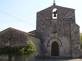
Saint-Amant-de-Nouère
| Saint-Amant-de-Nouère | |
|---|---|
 | |
 Saint-Amant-de-Nouère | |
|
Location within Nouvelle-Aquitaine region  Saint-Amant-de-Nouère | |
| Coordinates: 45°44′48″N 0°00′09″E / 45.7467°N 0.0025°ECoordinates: 45°44′48″N 0°00′09″E / 45.7467°N 0.0025°E | |
| Country | France |
| Region | Nouvelle-Aquitaine |
| Department | Charente |
| Arrondissement | Angoulême |
| Canton | Hiersac |
| Intercommunality | Rouillacais |
| Government | |
| • Mayor (2008–2014) | Marie-Madeleine Potuaud |
| Area1 | 11.15 km2 (4.31 sq mi) |
| Population (2008)2 | 395 |
| • Density | 35/km2 (92/sq mi) |
| Time zone | CET (UTC+1) |
| • Summer (DST) | CEST (UTC+2) |
| INSEE/Postal code | 16298 / 16170 |
| Elevation |
62–130 m (203–427 ft) (avg. 100 m or 330 ft) |
|
1 French Land Register data, which excludes lakes, ponds, glaciers > 1 km² (0.386 sq mi or 247 acres) and river estuaries. 2 Population without double counting: residents of multiple communes (e.g., students and military personnel) only counted once. | |
Saint-Amant-de-Nouère is a commune in the Charente department in southwestern France.
Population
| Historical population | ||
|---|---|---|
| Year | Pop. | ±% |
| 1793 | 524 | — |
| 1800 | 584 | +11.5% |
| 1806 | 718 | +22.9% |
| 1821 | 741 | +3.2% |
| 1831 | 751 | +1.3% |
| 1841 | 718 | −4.4% |
| 1846 | 703 | −2.1% |
| 1851 | 687 | −2.3% |
| 1856 | 634 | −7.7% |
| 1861 | 630 | −0.6% |
| 1866 | 635 | +0.8% |
| 1872 | 616 | −3.0% |
| 1876 | 607 | −1.5% |
| 1881 | 586 | −3.5% |
| 1886 | 526 | −10.2% |
| 1891 | 473 | −10.1% |
| 1896 | 400 | −15.4% |
| 1901 | 411 | +2.8% |
| 1906 | 431 | +4.9% |
| 1911 | 432 | +0.2% |
| 1921 | 411 | −4.9% |
| 1926 | 385 | −6.3% |
| 1931 | 383 | −0.5% |
| 1936 | 396 | +3.4% |
| 1946 | 374 | −5.6% |
| 1954 | 374 | +0.0% |
| 1962 | 359 | −4.0% |
| 1968 | 352 | −1.9% |
| 1975 | 331 | −6.0% |
| 1982 | 350 | +5.7% |
| 1990 | 372 | +6.3% |
| 1999 | 382 | +2.7% |
| 2008 | 395 | +3.4% |
See also
References
| Wikimedia Commons has media related to Saint-Amant-de-Nouère. |
This article is issued from Wikipedia - version of the 2/22/2013. The text is available under the Creative Commons Attribution/Share Alike but additional terms may apply for the media files.