Pillac
| Pillac | |
|---|---|
|
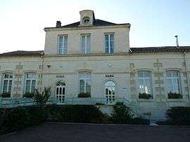
Town hall | |
 Pillac | |
|
Location within Nouvelle-Aquitaine region  Pillac | |
| Coordinates: 45°19′31″N 0°11′32″E / 45.3253°N 0.1922°ECoordinates: 45°19′31″N 0°11′32″E / 45.3253°N 0.1922°E | |
| Country | France |
| Region | Nouvelle-Aquitaine |
| Department | Charente |
| Arrondissement | Angoulême |
| Canton | Aubeterre-sur-Dronne |
| Intercommunality | Pays d'Aubeterre |
| Government | |
| • Mayor (2008–2014) | Gérard Galluret |
| Area1 | 19.64 km2 (7.58 sq mi) |
| Population (2008)2 | 254 |
| • Density | 13/km2 (33/sq mi) |
| Time zone | CET (UTC+1) |
| • Summer (DST) | CEST (UTC+2) |
| INSEE/Postal code | 16260 / 16390 |
| Elevation |
53–165 m (174–541 ft) (avg. 82 m or 269 ft) |
|
1 French Land Register data, which excludes lakes, ponds, glaciers > 1 km² (0.386 sq mi or 247 acres) and river estuaries. 2 Population without double counting: residents of multiple communes (e.g., students and military personnel) only counted once. | |
Pillac is a commune in the Charente department in southwestern France.
Population
| Historical population | ||
|---|---|---|
| Year | Pop. | ±% |
| 1793 | 1,027 | — |
| 1800 | 1,298 | +26.4% |
| 1806 | 975 | −24.9% |
| 1821 | 1,011 | +3.7% |
| 1831 | 1,021 | +1.0% |
| 1841 | 1,048 | +2.6% |
| 1846 | 1,032 | −1.5% |
| 1851 | 968 | −6.2% |
| 1856 | 962 | −0.6% |
| 1861 | 961 | −0.1% |
| 1866 | 900 | −6.3% |
| 1872 | 816 | −9.3% |
| 1876 | 837 | +2.6% |
| 1881 | 853 | +1.9% |
| 1886 | 793 | −7.0% |
| 1891 | 630 | −20.6% |
| 1896 | 598 | −5.1% |
| 1901 | 569 | −4.8% |
| 1906 | 565 | −0.7% |
| 1911 | 583 | +3.2% |
| 1921 | 504 | −13.6% |
| 1926 | 500 | −0.8% |
| 1931 | 445 | −11.0% |
| 1936 | 433 | −2.7% |
| 1946 | 407 | −6.0% |
| 1954 | 404 | −0.7% |
| 1962 | 357 | −11.6% |
| 1968 | 356 | −0.3% |
| 1975 | 307 | −13.8% |
| 1982 | 267 | −13.0% |
| 1990 | 260 | −2.6% |
| 1999 | 270 | +3.8% |
| 2008 | 254 | −5.9% |
See also
References
| Wikimedia Commons has media related to Pillac. |
This article is issued from Wikipedia - version of the 2/22/2013. The text is available under the Creative Commons Attribution/Share Alike but additional terms may apply for the media files.