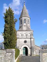
Rancogne
| Rancogne | |
|---|---|
 | |
 Rancogne | |
|
Location within Nouvelle-Aquitaine region  Rancogne | |
| Coordinates: 45°41′51″N 0°24′15″E / 45.6975°N 0.4042°ECoordinates: 45°41′51″N 0°24′15″E / 45.6975°N 0.4042°E | |
| Country | France |
| Region | Nouvelle-Aquitaine |
| Department | Charente |
| Arrondissement | Angoulême |
| Canton | La Rochefoucauld |
| Intercommunality | Val de Tardoire |
| Government | |
| • Mayor (2008–2014) | Joseph Vinet |
| Area1 | 12.52 km2 (4.83 sq mi) |
| Population (2008)2 | 375 |
| • Density | 30/km2 (78/sq mi) |
| Time zone | CET (UTC+1) |
| • Summer (DST) | CEST (UTC+2) |
| INSEE/Postal code | 16274 / 16110 |
| Elevation | 81–136 m (266–446 ft) |
|
1 French Land Register data, which excludes lakes, ponds, glaciers > 1 km² (0.386 sq mi or 247 acres) and river estuaries. 2 Population without double counting: residents of multiple communes (e.g., students and military personnel) only counted once. | |
Rancogne is a commune in the Charente department in southwestern France.
Population
| Historical population | ||
|---|---|---|
| Year | Pop. | ±% |
| 1793 | 401 | — |
| 1800 | 355 | −11.5% |
| 1806 | 439 | +23.7% |
| 1821 | 458 | +4.3% |
| 1831 | 468 | +2.2% |
| 1841 | 487 | +4.1% |
| 1846 | 514 | +5.5% |
| 1851 | 482 | −6.2% |
| 1856 | 437 | −9.3% |
| 1861 | 410 | −6.2% |
| 1866 | 415 | +1.2% |
| 1872 | 391 | −5.8% |
| 1876 | 421 | +7.7% |
| 1881 | 449 | +6.7% |
| 1886 | 431 | −4.0% |
| 1891 | 448 | +3.9% |
| 1896 | 412 | −8.0% |
| 1901 | 380 | −7.8% |
| 1906 | 355 | −6.6% |
| 1911 | 367 | +3.4% |
| 1921 | 330 | −10.1% |
| 1926 | 322 | −2.4% |
| 1931 | 293 | −9.0% |
| 1936 | 297 | +1.4% |
| 1946 | 270 | −9.1% |
| 1954 | 280 | +3.7% |
| 1962 | 259 | −7.5% |
| 1968 | 252 | −2.7% |
| 1975 | 239 | −5.2% |
| 1982 | 264 | +10.5% |
| 1990 | 315 | +19.3% |
| 1999 | 330 | +4.8% |
| 2008 | 375 | +13.6% |
See also
References
| Wikimedia Commons has media related to Rancogne. |
This article is issued from Wikipedia - version of the 6/21/2015. The text is available under the Creative Commons Attribution/Share Alike but additional terms may apply for the media files.