Saint-Michel, Charente
| Saint-Michel | |
|---|---|
|
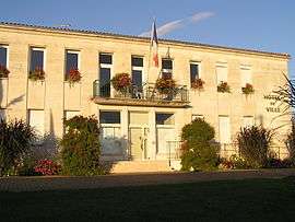
Town hall | |
 Saint-Michel | |
|
Location within Nouvelle-Aquitaine region  Saint-Michel | |
| Coordinates: 45°38′34″N 0°06′26″E / 45.6428°N 0.1072°ECoordinates: 45°38′34″N 0°06′26″E / 45.6428°N 0.1072°E | |
| Country | France |
| Region | Nouvelle-Aquitaine |
| Department | Charente |
| Arrondissement | Angoulême |
| Canton | La Couronne |
| Intercommunality | Grand Angoulême |
| Government | |
| • Mayor (2008–2014) | Fabienne Godichaud |
| Area1 | 2.46 km2 (0.95 sq mi) |
| Population (2008)2 | 3,106 |
| • Density | 1,300/km2 (3,300/sq mi) |
| Time zone | CET (UTC+1) |
| • Summer (DST) | CEST (UTC+2) |
| INSEE/Postal code | 16341 / 16470 |
| Elevation |
25–62 m (82–203 ft) (avg. 33 m or 108 ft) |
|
1 French Land Register data, which excludes lakes, ponds, glaciers > 1 km² (0.386 sq mi or 247 acres) and river estuaries. 2 Population without double counting: residents of multiple communes (e.g., students and military personnel) only counted once. | |
Saint-Michel is a commune in the Charente department in southwestern France.
Population
| Historical population | ||
|---|---|---|
| Year | Pop. | ±% |
| 1793 | 391 | — |
| 1800 | 501 | +28.1% |
| 1806 | 346 | −30.9% |
| 1821 | 491 | +41.9% |
| 1831 | 491 | +0.0% |
| 1841 | 591 | +20.4% |
| 1846 | 569 | −3.7% |
| 1851 | 519 | −8.8% |
| 1856 | 553 | +6.6% |
| 1861 | 676 | +22.2% |
| 1866 | 782 | +15.7% |
| 1872 | 773 | −1.2% |
| 1876 | 882 | +14.1% |
| 1881 | 985 | +11.7% |
| 1886 | 1,068 | +8.4% |
| 1891 | 1,302 | +21.9% |
| 1896 | 1,311 | +0.7% |
| 1901 | 1,246 | −5.0% |
| 1906 | 1,209 | −3.0% |
| 1911 | 1,262 | +4.4% |
| 1921 | 1,296 | +2.7% |
| 1926 | 1,368 | +5.6% |
| 1931 | 1,534 | +12.1% |
| 1936 | 1,769 | +15.3% |
| 1946 | 1,960 | +10.8% |
| 1954 | 1,849 | −5.7% |
| 1962 | 2,305 | +24.7% |
| 1968 | 2,702 | +17.2% |
| 1975 | 2,846 | +5.3% |
| 1982 | 3,238 | +13.8% |
| 1990 | 3,125 | −3.5% |
| 1999 | 2,964 | −5.2% |
| 2008 | 3,106 | +4.8% |
See also
References
| Wikimedia Commons has media related to Saint-Michel (Charente). |
This article is issued from Wikipedia - version of the 2/22/2013. The text is available under the Creative Commons Attribution/Share Alike but additional terms may apply for the media files.