Les Essards, Charente
| Les Essards | |
|---|---|
|
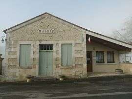
Town hall | |
 Les Essards | |
|
Location within Nouvelle-Aquitaine region  Les Essards | |
| Coordinates: 45°14′27″N 0°07′03″E / 45.2408°N 0.1175°ECoordinates: 45°14′27″N 0°07′03″E / 45.2408°N 0.1175°E | |
| Country | France |
| Region | Nouvelle-Aquitaine |
| Department | Charente |
| Arrondissement | Angoulême |
| Canton | Aubeterre-sur-Dronne |
| Intercommunality | Pays d'Aubeterre |
| Government | |
| • Mayor (2008–2014) | Jean-Michel Droillard |
| Area1 | 8.98 km2 (3.47 sq mi) |
| Population (2008)2 | 211 |
| • Density | 23/km2 (61/sq mi) |
| Time zone | CET (UTC+1) |
| • Summer (DST) | CEST (UTC+2) |
| INSEE/Postal code | 16130 / 16210 |
| Elevation |
30–145 m (98–476 ft) (avg. 124 m or 407 ft) |
|
1 French Land Register data, which excludes lakes, ponds, glaciers > 1 km² (0.386 sq mi or 247 acres) and river estuaries. 2 Population without double counting: residents of multiple communes (e.g., students and military personnel) only counted once. | |
Les Essards is a commune in the Charente department in southwestern France.
Population
| Historical population | ||
|---|---|---|
| Year | Pop. | ±% |
| 1793 | 849 | — |
| 1800 | 795 | −6.4% |
| 1806 | 707 | −11.1% |
| 1821 | 761 | +7.6% |
| 1831 | 792 | +4.1% |
| 1841 | 774 | −2.3% |
| 1846 | 770 | −0.5% |
| 1851 | 728 | −5.5% |
| 1856 | 707 | −2.9% |
| 1861 | 658 | −6.9% |
| 1866 | 622 | −5.5% |
| 1872 | 585 | −5.9% |
| 1876 | 592 | +1.2% |
| 1881 | 565 | −4.6% |
| 1886 | 550 | −2.7% |
| 1891 | 508 | −7.6% |
| 1896 | 478 | −5.9% |
| 1901 | 452 | −5.4% |
| 1906 | 452 | +0.0% |
| 1911 | 405 | −10.4% |
| 1921 | 354 | −12.6% |
| 1926 | 329 | −7.1% |
| 1931 | 335 | +1.8% |
| 1936 | 319 | −4.8% |
| 1946 | 314 | −1.6% |
| 1954 | 304 | −3.2% |
| 1962 | 277 | −8.9% |
| 1968 | 241 | −13.0% |
| 1975 | 233 | −3.3% |
| 1982 | 203 | −12.9% |
| 1990 | 193 | −4.9% |
| 1999 | 196 | +1.6% |
| 2008 | 211 | +7.7% |
See also
References
| Wikimedia Commons has media related to Les Essards (Charente). |
This article is issued from Wikipedia - version of the 7/20/2016. The text is available under the Creative Commons Attribution/Share Alike but additional terms may apply for the media files.