Vars, Charente
| Vars | ||
|---|---|---|
|
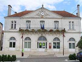
Town hall | ||
| ||
 Vars | ||
|
Location within Nouvelle-Aquitaine region  Vars | ||
| Coordinates: 45°45′47″N 0°07′29″E / 45.7631°N 0.1247°ECoordinates: 45°45′47″N 0°07′29″E / 45.7631°N 0.1247°E | ||
| Country | France | |
| Region | Nouvelle-Aquitaine | |
| Department | Charente | |
| Arrondissement | Angoulême | |
| Canton | Saint-Amant-de-Boixe | |
| Intercommunality | Boixe | |
| Government | ||
| • Mayor (2008–2014) | Jean-Marc de Lustrac | |
| Area1 | 27.46 km2 (10.60 sq mi) | |
| Population (2008)2 | 1,937 | |
| • Density | 71/km2 (180/sq mi) | |
| Time zone | CET (UTC+1) | |
| • Summer (DST) | CEST (UTC+2) | |
| INSEE/Postal code | 16393 / 16330 | |
| Elevation |
35–153 m (115–502 ft) (avg. 42 m or 138 ft) | |
|
1 French Land Register data, which excludes lakes, ponds, glaciers > 1 km² (0.386 sq mi or 247 acres) and river estuaries. 2 Population without double counting: residents of multiple communes (e.g., students and military personnel) only counted once. | ||
.svg.png)
Vars is a commune in the Charente department in southwestern France.
Population
| Historical population | ||
|---|---|---|
| Year | Pop. | ±% |
| 1793 | 1,689 | — |
| 1800 | 1,858 | +10.0% |
| 1806 | 1,796 | −3.3% |
| 1821 | 1,978 | +10.1% |
| 1831 | 1,987 | +0.5% |
| 1841 | 2,035 | +2.4% |
| 1846 | 1,941 | −4.6% |
| 1851 | 2,076 | +7.0% |
| 1856 | 1,869 | −10.0% |
| 1861 | 1,903 | +1.8% |
| 1866 | 2,011 | +5.7% |
| 1872 | 1,948 | −3.1% |
| 1876 | 1,948 | +0.0% |
| 1881 | 1,934 | −0.7% |
| 1886 | 1,713 | −11.4% |
| 1891 | 1,561 | −8.9% |
| 1896 | 1,551 | −0.6% |
| 1901 | 1,570 | +1.2% |
| 1906 | 1,557 | −0.8% |
| 1911 | 1,408 | −9.6% |
| 1921 | 1,157 | −17.8% |
| 1926 | 1,225 | +5.9% |
| 1931 | 1,166 | −4.8% |
| 1936 | 1,202 | +3.1% |
| 1946 | 1,178 | −2.0% |
| 1954 | 1,092 | −7.3% |
| 1962 | 1,089 | −0.3% |
| 1968 | 1,306 | +19.9% |
| 1975 | 1,340 | +2.6% |
| 1982 | 1,551 | +15.7% |
| 1990 | 1,511 | −2.6% |
| 1999 | 1,569 | +3.8% |
| 2008 | 1,937 | +23.5% |
See also
References
| Wikimedia Commons has media related to Vars (Charente). |
This article is issued from Wikipedia - version of the 3/15/2016. The text is available under the Creative Commons Attribution/Share Alike but additional terms may apply for the media files.