Bazac
| Bazac | |
|---|---|
|
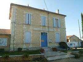
Town hall | |
 Bazac | |
|
Location within Nouvelle-Aquitaine region  Bazac | |
| Coordinates: 45°13′55″N 0°03′01″E / 45.2319°N 0.0503°ECoordinates: 45°13′55″N 0°03′01″E / 45.2319°N 0.0503°E | |
| Country | France |
| Region | Nouvelle-Aquitaine |
| Department | Charente |
| Arrondissement | Angoulême |
| Canton | Chalais |
| Intercommunality | Pays de Chalais |
| Government | |
| • Mayor (2008–2014) | Catherine Constanty |
| Area1 | 4.92 km2 (1.90 sq mi) |
| Population (2008)2 | 171 |
| • Density | 35/km2 (90/sq mi) |
| Time zone | CET (UTC+1) |
| • Summer (DST) | CEST (UTC+2) |
| INSEE/Postal code | 16034 / 16210 |
| Elevation |
25–121 m (82–397 ft) (avg. 75 m or 246 ft) |
|
1 French Land Register data, which excludes lakes, ponds, glaciers > 1 km² (0.386 sq mi or 247 acres) and river estuaries. 2 Population without double counting: residents of multiple communes (e.g., students and military personnel) only counted once. | |
Bazac is a commune in the Charente department in southwestern France.
Population
| Historical population | ||
|---|---|---|
| Year | Pop. | ±% |
| 1793 | 381 | — |
| 1800 | 364 | −4.5% |
| 1806 | 369 | +1.4% |
| 1821 | 376 | +1.9% |
| 1831 | 395 | +5.1% |
| 1841 | 400 | +1.3% |
| 1846 | 433 | +8.3% |
| 1851 | 433 | +0.0% |
| 1856 | 427 | −1.4% |
| 1861 | 449 | +5.2% |
| 1866 | 452 | +0.7% |
| 1872 | 457 | +1.1% |
| 1876 | 452 | −1.1% |
| 1881 | 440 | −2.7% |
| 1886 | 448 | +1.8% |
| 1891 | 396 | −11.6% |
| 1896 | 418 | +5.6% |
| 1901 | 406 | −2.9% |
| 1906 | 461 | +13.5% |
| 1911 | 439 | −4.8% |
| 1921 | 367 | −16.4% |
| 1926 | 355 | −3.3% |
| 1931 | 333 | −6.2% |
| 1936 | 350 | +5.1% |
| 1946 | 341 | −2.6% |
| 1954 | 283 | −17.0% |
| 1962 | 283 | +0.0% |
| 1968 | 260 | −8.1% |
| 1975 | 233 | −10.4% |
| 1982 | 158 | −32.2% |
| 1990 | 159 | +0.6% |
| 1999 | 153 | −3.8% |
| 2008 | 171 | +11.8% |
See also
References
| Wikimedia Commons has media related to Bazac. |
This article is issued from Wikipedia - version of the 3/15/2016. The text is available under the Creative Commons Attribution/Share Alike but additional terms may apply for the media files.