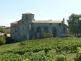
Berneuil, Charente
| Berneuil | |
|---|---|
 | |
 Berneuil | |
|
Location within Nouvelle-Aquitaine region  Berneuil | |
| Coordinates: 45°23′38″N 0°04′17″W / 45.3939°N 0.0714°WCoordinates: 45°23′38″N 0°04′17″W / 45.3939°N 0.0714°W | |
| Country | France |
| Region | Nouvelle-Aquitaine |
| Department | Charente |
| Arrondissement | Cognac |
| Canton | Barbezieux-Saint-Hilaire |
| Intercommunality | 3B - Sud-Charente |
| Government | |
| • Mayor (2008–2014) | Raymond Poitou |
| Area1 | 16.55 km2 (6.39 sq mi) |
| Population (2008)2 | 342 |
| • Density | 21/km2 (54/sq mi) |
| Time zone | CET (UTC+1) |
| • Summer (DST) | CEST (UTC+2) |
| INSEE/Postal code | 16040 / 16480 |
| Elevation |
74–166 m (243–545 ft) (avg. 146 m or 479 ft) |
|
1 French Land Register data, which excludes lakes, ponds, glaciers > 1 km² (0.386 sq mi or 247 acres) and river estuaries. 2 Population without double counting: residents of multiple communes (e.g., students and military personnel) only counted once. | |
Berneuil is a commune in the Charente department in southwestern France.
Population
| Historical population | ||
|---|---|---|
| Year | Pop. | ±% |
| 1793 | 922 | — |
| 1800 | 857 | −7.0% |
| 1806 | 797 | −7.0% |
| 1821 | 1,010 | +26.7% |
| 1831 | 1,045 | +3.5% |
| 1841 | 1,008 | −3.5% |
| 1846 | 1,010 | +0.2% |
| 1851 | 994 | −1.6% |
| 1856 | 961 | −3.3% |
| 1861 | 914 | −4.9% |
| 1866 | 841 | −8.0% |
| 1872 | 809 | −3.8% |
| 1876 | 775 | −4.2% |
| 1881 | 788 | +1.7% |
| 1886 | 748 | −5.1% |
| 1891 | 688 | −8.0% |
| 1896 | 653 | −5.1% |
| 1901 | 634 | −2.9% |
| 1906 | 640 | +0.9% |
| 1911 | 628 | −1.9% |
| 1921 | 545 | −13.2% |
| 1926 | 541 | −0.7% |
| 1931 | 529 | −2.2% |
| 1936 | 520 | −1.7% |
| 1946 | 509 | −2.1% |
| 1954 | 450 | −11.6% |
| 1962 | 464 | +3.1% |
| 1968 | 386 | −16.8% |
| 1975 | 354 | −8.3% |
| 1982 | 340 | −4.0% |
| 1990 | 326 | −4.1% |
| 1999 | 315 | −3.4% |
| 2008 | 342 | +8.6% |
See also
References
| Wikimedia Commons has media related to Berneuil (Charente). |
This article is issued from Wikipedia - version of the 2/11/2016. The text is available under the Creative Commons Attribution/Share Alike but additional terms may apply for the media files.