Barro, Charente
| Barro | |
|---|---|
|
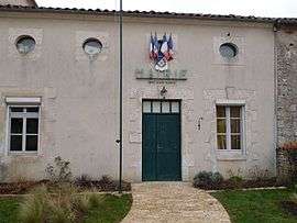
Town hall | |
 Barro | |
|
Location within Nouvelle-Aquitaine region  Barro | |
| Coordinates: 46°00′05″N 0°13′39″E / 46.0014°N 0.2275°ECoordinates: 46°00′05″N 0°13′39″E / 46.0014°N 0.2275°E | |
| Country | France |
| Region | Nouvelle-Aquitaine |
| Department | Charente |
| Arrondissement | Confolens |
| Canton | Charente-Nord |
| Intercommunality | Ruffec |
| Government | |
| • Mayor (2008–2014) | Paul Gaildraud |
| Area1 | 10.65 km2 (4.11 sq mi) |
| Population (2008)2 | 354 |
| • Density | 33/km2 (86/sq mi) |
| Time zone | CET (UTC+1) |
| • Summer (DST) | CEST (UTC+2) |
| INSEE/Postal code | 16031 / 16700 |
| Elevation |
77–164 m (253–538 ft) (avg. 85 m or 279 ft) |
|
1 French Land Register data, which excludes lakes, ponds, glaciers > 1 km² (0.386 sq mi or 247 acres) and river estuaries. 2 Population without double counting: residents of multiple communes (e.g., students and military personnel) only counted once. | |
Barro is a commune in the Charente department in southwestern France.
Population
| Historical population | ||
|---|---|---|
| Year | Pop. | ±% |
| 1793 | 461 | — |
| 1800 | 451 | −2.2% |
| 1806 | 537 | +19.1% |
| 1821 | 425 | −20.9% |
| 1831 | 523 | +23.1% |
| 1841 | 548 | +4.8% |
| 1846 | 534 | −2.6% |
| 1851 | 533 | −0.2% |
| 1856 | 535 | +0.4% |
| 1861 | 502 | −6.2% |
| 1866 | 453 | −9.8% |
| 1872 | 443 | −2.2% |
| 1876 | 439 | −0.9% |
| 1881 | 441 | +0.5% |
| 1886 | 454 | +2.9% |
| 1891 | 419 | −7.7% |
| 1896 | 373 | −11.0% |
| 1901 | 368 | −1.3% |
| 1906 | 332 | −9.8% |
| 1911 | 336 | +1.2% |
| 1921 | 327 | −2.7% |
| 1926 | 317 | −3.1% |
| 1931 | 305 | −3.8% |
| 1936 | 287 | −5.9% |
| 1946 | 282 | −1.7% |
| 1954 | 310 | +9.9% |
| 1962 | 254 | −18.1% |
| 1968 | 223 | −12.2% |
| 1975 | 206 | −7.6% |
| 1982 | 231 | +12.1% |
| 1990 | 258 | +11.7% |
| 1999 | 265 | +2.7% |
| 2008 | 354 | +33.6% |
See also
References
| Wikimedia Commons has media related to Barro (France). |
This article is issued from Wikipedia - version of the 4/24/2016. The text is available under the Creative Commons Attribution/Share Alike but additional terms may apply for the media files.