Saint-Cybardeaux
| Saint-Cybardeaux | ||
|---|---|---|
|
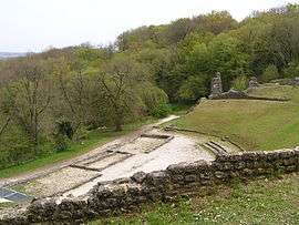
Roman amphitheater | ||
| ||
 Saint-Cybardeaux | ||
|
Location within Nouvelle-Aquitaine region  Saint-Cybardeaux | ||
| Coordinates: 45°46′10″N 0°01′40″W / 45.7694°N 0.0278°WCoordinates: 45°46′10″N 0°01′40″W / 45.7694°N 0.0278°W | ||
| Country | France | |
| Region | Nouvelle-Aquitaine | |
| Department | Charente | |
| Arrondissement | Cognac | |
| Canton | Rouillac | |
| Intercommunality | Rouillacais | |
| Government | ||
| • Mayor (2008–2014) | Francis Roy | |
| Area1 | 21 km2 (8 sq mi) | |
| Population (2008)2 | 787 | |
| • Density | 37/km2 (97/sq mi) | |
| Time zone | CET (UTC+1) | |
| • Summer (DST) | CEST (UTC+2) | |
| INSEE/Postal code | 16312 / 16170 | |
| Elevation | 74–163 m (243–535 ft) | |
|
1 French Land Register data, which excludes lakes, ponds, glaciers > 1 km² (0.386 sq mi or 247 acres) and river estuaries. 2 Population without double counting: residents of multiple communes (e.g., students and military personnel) only counted once. | ||

Saint-Cybardeaux is a commune in the Charente department in southwestern France.
Population
| Historical population | ||||||||||||||||||||||||||||||||||||||||||||||||||||||||||||||||||||||||||||||||||||||||||||||||||||||||||
|---|---|---|---|---|---|---|---|---|---|---|---|---|---|---|---|---|---|---|---|---|---|---|---|---|---|---|---|---|---|---|---|---|---|---|---|---|---|---|---|---|---|---|---|---|---|---|---|---|---|---|---|---|---|---|---|---|---|---|---|---|---|---|---|---|---|---|---|---|---|---|---|---|---|---|---|---|---|---|---|---|---|---|---|---|---|---|---|---|---|---|---|---|---|---|---|---|---|---|---|---|---|---|---|---|---|---|
|
| |||||||||||||||||||||||||||||||||||||||||||||||||||||||||||||||||||||||||||||||||||||||||||||||||||||||||
See also
References
| Wikimedia Commons has media related to Saint-Cybardeaux. |
This article is issued from Wikipedia - version of the 1/24/2016. The text is available under the Creative Commons Attribution/Share Alike but additional terms may apply for the media files.