Orgedeuil
| Orgedeuil | |
|---|---|
 | |
 Orgedeuil | |
|
Location within Nouvelle-Aquitaine region  Orgedeuil | |
| Coordinates: 45°41′29″N 0°29′37″E / 45.6914°N 0.4936°ECoordinates: 45°41′29″N 0°29′37″E / 45.6914°N 0.4936°E | |
| Country | France |
| Region | Nouvelle-Aquitaine |
| Department | Charente |
| Arrondissement | Angoulême |
| Canton | Montbron |
| Intercommunality | Val de Tardoire |
| Government | |
| • Mayor (2008–2014) | Guy Bernard |
| Area1 | 10.39 km2 (4.01 sq mi) |
| Population (2008)2 | 222 |
| • Density | 21/km2 (55/sq mi) |
| Time zone | CET (UTC+1) |
| • Summer (DST) | CEST (UTC+2) |
| INSEE/Postal code | 16250 / 16220 |
| Elevation |
113–322 m (371–1,056 ft) (avg. 160 m or 520 ft) |
|
1 French Land Register data, which excludes lakes, ponds, glaciers > 1 km² (0.386 sq mi or 247 acres) and river estuaries. 2 Population without double counting: residents of multiple communes (e.g., students and military personnel) only counted once. | |
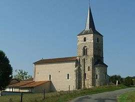
Orgedeuil is a commune in the Charente department in southwestern France.
Population
| Historical population | ||
|---|---|---|
| Year | Pop. | ±% |
| 1793 | 425 | — |
| 1800 | 421 | −0.9% |
| 1806 | 441 | +4.8% |
| 1821 | 523 | +18.6% |
| 1831 | 505 | −3.4% |
| 1841 | 564 | +11.7% |
| 1846 | 532 | −5.7% |
| 1851 | 553 | +3.9% |
| 1856 | 520 | −6.0% |
| 1861 | 502 | −3.5% |
| 1866 | 503 | +0.2% |
| 1872 | 494 | −1.8% |
| 1876 | 513 | +3.8% |
| 1881 | 475 | −7.4% |
| 1886 | 504 | +6.1% |
| 1891 | 446 | −11.5% |
| 1896 | 433 | −2.9% |
| 1901 | 416 | −3.9% |
| 1906 | 392 | −5.8% |
| 1911 | 374 | −4.6% |
| 1921 | 326 | −12.8% |
| 1926 | 275 | −15.6% |
| 1931 | 255 | −7.3% |
| 1936 | 253 | −0.8% |
| 1946 | 261 | +3.2% |
| 1954 | 230 | −11.9% |
| 1962 | 284 | +23.5% |
| 1968 | 244 | −14.1% |
| 1975 | 213 | −12.7% |
| 1982 | 207 | −2.8% |
| 1990 | 245 | +18.4% |
| 1999 | 207 | −15.5% |
| 2008 | 222 | +7.2% |
See also
References
| Wikimedia Commons has media related to Orgedeuil. |
This article is issued from Wikipedia - version of the 7/2/2016. The text is available under the Creative Commons Attribution/Share Alike but additional terms may apply for the media files.