Verrières, Charente
| Verrières | |
|---|---|
|
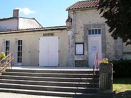
Town hall | |
 Verrières | |
|
Location within Nouvelle-Aquitaine region  Verrières | |
| Coordinates: 45°34′19″N 0°15′55″W / 45.5719°N 0.2653°WCoordinates: 45°34′19″N 0°15′55″W / 45.5719°N 0.2653°W | |
| Country | France |
| Region | Nouvelle-Aquitaine |
| Department | Charente |
| Arrondissement | Cognac |
| Canton | Segonzac |
| Intercommunality | Grande Champagne |
| Government | |
| • Mayor (2008–2014) | Michel Desafit |
| Area1 | 13.37 km2 (5.16 sq mi) |
| Population (2008)2 | 367 |
| • Density | 27/km2 (71/sq mi) |
| Time zone | CET (UTC+1) |
| • Summer (DST) | CEST (UTC+2) |
| INSEE/Postal code | 16399 / 16130 |
| Elevation |
21–98 m (69–322 ft) (avg. 75 m or 246 ft) |
|
1 French Land Register data, which excludes lakes, ponds, glaciers > 1 km² (0.386 sq mi or 247 acres) and river estuaries. 2 Population without double counting: residents of multiple communes (e.g., students and military personnel) only counted once. | |
Verrières is a commune in the Charente department in southwestern France.
Population
| Historical population | ||
|---|---|---|
| Year | Pop. | ±% |
| 1793 | 698 | — |
| 1800 | 851 | +21.9% |
| 1806 | 741 | −12.9% |
| 1821 | 758 | +2.3% |
| 1831 | 853 | +12.5% |
| 1841 | 867 | +1.6% |
| 1846 | 872 | +0.6% |
| 1851 | 876 | +0.5% |
| 1856 | 881 | +0.6% |
| 1861 | 867 | −1.6% |
| 1866 | 857 | −1.2% |
| 1872 | 804 | −6.2% |
| 1876 | 807 | +0.4% |
| 1881 | 712 | −11.8% |
| 1886 | 614 | −13.8% |
| 1891 | 584 | −4.9% |
| 1896 | 555 | −5.0% |
| 1901 | 532 | −4.1% |
| 1906 | 605 | +13.7% |
| 1911 | 603 | −0.3% |
| 1921 | 537 | −10.9% |
| 1926 | 544 | +1.3% |
| 1931 | 550 | +1.1% |
| 1936 | 503 | −8.5% |
| 1946 | 518 | +3.0% |
| 1954 | 535 | +3.3% |
| 1962 | 526 | −1.7% |
| 1968 | 537 | +2.1% |
| 1975 | 474 | −11.7% |
| 1982 | 409 | −13.7% |
| 1990 | 406 | −0.7% |
| 1999 | 401 | −1.2% |
| 2008 | 367 | −8.5% |
See also
References
| Wikimedia Commons has media related to Verrières (Charente). |
This article is issued from Wikipedia - version of the 7/20/2016. The text is available under the Creative Commons Attribution/Share Alike but additional terms may apply for the media files.