Échallat
| Échallat | |
|---|---|
|
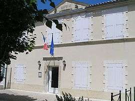
Town hall | |
 Échallat | |
|
Location within Nouvelle-Aquitaine region  Échallat | |
| Coordinates: 45°43′26″N 0°02′21″W / 45.7239°N 0.0392°WCoordinates: 45°43′26″N 0°02′21″W / 45.7239°N 0.0392°W | |
| Country | France |
| Region | Nouvelle-Aquitaine |
| Department | Charente |
| Arrondissement | Angoulême |
| Canton | Hiersac |
| Intercommunality | Rouillacais |
| Government | |
| • Mayor (2008–2014) | Alain Laidet |
| Area1 | 15.14 km2 (5.85 sq mi) |
| Population (2008)2 | 460 |
| • Density | 30/km2 (79/sq mi) |
| Time zone | CET (UTC+1) |
| • Summer (DST) | CEST (UTC+2) |
| INSEE/Postal code | 16123 / 16170 |
| Elevation |
50–149 m (164–489 ft) (avg. 89 m or 292 ft) |
|
1 French Land Register data, which excludes lakes, ponds, glaciers > 1 km² (0.386 sq mi or 247 acres) and river estuaries. 2 Population without double counting: residents of multiple communes (e.g., students and military personnel) only counted once. | |
Échallat is a commune in the Charente department in southwestern France.
Population
| Historical population | ||
|---|---|---|
| Year | Pop. | ±% |
| 1793 | 1,036 | — |
| 1800 | 1,046 | +1.0% |
| 1806 | 1,043 | −0.3% |
| 1821 | 1,059 | +1.5% |
| 1831 | 816 | −22.9% |
| 1841 | 843 | +3.3% |
| 1846 | 899 | +6.6% |
| 1851 | 855 | −4.9% |
| 1856 | 850 | −0.6% |
| 1861 | 865 | +1.8% |
| 1866 | 895 | +3.5% |
| 1872 | 872 | −2.6% |
| 1876 | 822 | −5.7% |
| 1881 | 768 | −6.6% |
| 1886 | 679 | −11.6% |
| 1891 | 637 | −6.2% |
| 1896 | 611 | −4.1% |
| 1901 | 600 | −1.8% |
| 1906 | 575 | −4.2% |
| 1911 | 567 | −1.4% |
| 1921 | 535 | −5.6% |
| 1926 | 520 | −2.8% |
| 1931 | 516 | −0.8% |
| 1936 | 499 | −3.3% |
| 1946 | 502 | +0.6% |
| 1954 | 517 | +3.0% |
| 1962 | 454 | −12.2% |
| 1968 | 402 | −11.5% |
| 1975 | 400 | −0.5% |
| 1982 | 407 | +1.8% |
| 1990 | 426 | +4.7% |
| 1999 | 421 | −1.2% |
| 2008 | 460 | +9.3% |
See also
References
| Wikimedia Commons has media related to Échallat. |
This article is issued from Wikipedia - version of the 2/22/2013. The text is available under the Creative Commons Attribution/Share Alike but additional terms may apply for the media files.