Guimps
| Guimps | |
|---|---|
|
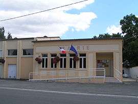
Town hall | |
 Guimps | |
|
Location within Nouvelle-Aquitaine region  Guimps | |
| Coordinates: 45°27′51″N 0°14′45″W / 45.4642°N 0.2458°WCoordinates: 45°27′51″N 0°14′45″W / 45.4642°N 0.2458°W | |
| Country | France |
| Region | Nouvelle-Aquitaine |
| Department | Charente |
| Arrondissement | Cognac |
| Canton | Barbezieux-Saint-Hilaire |
| Intercommunality | 3B - Sud-Charente |
| Government | |
| • Mayor (2008–2014) | Albert Barussaud |
| Area1 | 12.60 km2 (4.86 sq mi) |
| Population (2008)2 | 489 |
| • Density | 39/km2 (100/sq mi) |
| Time zone | CET (UTC+1) |
| • Summer (DST) | CEST (UTC+2) |
| INSEE/Postal code | 16160 / 16300 |
| Elevation |
49–108 m (161–354 ft) (avg. 76 m or 249 ft) |
|
1 French Land Register data, which excludes lakes, ponds, glaciers > 1 km² (0.386 sq mi or 247 acres) and river estuaries. 2 Population without double counting: residents of multiple communes (e.g., students and military personnel) only counted once. | |
Guimps is a commune in the Charente department in southwestern France.
Population
| Historical population | ||
|---|---|---|
| Year | Pop. | ±% |
| 1793 | 1,153 | — |
| 1800 | 1,135 | −1.6% |
| 1806 | 1,143 | +0.7% |
| 1821 | 1,099 | −3.8% |
| 1831 | 1,143 | +4.0% |
| 1841 | 897 | −21.5% |
| 1846 | 1,098 | +22.4% |
| 1851 | 1,079 | −1.7% |
| 1856 | 1,060 | −1.8% |
| 1861 | 670 | −36.8% |
| 1866 | 1,007 | +50.3% |
| 1872 | 963 | −4.4% |
| 1876 | 946 | −1.8% |
| 1881 | 926 | −2.1% |
| 1886 | 815 | −12.0% |
| 1891 | 768 | −5.8% |
| 1896 | 728 | −5.2% |
| 1901 | 710 | −2.5% |
| 1906 | 714 | +0.6% |
| 1911 | 736 | +3.1% |
| 1921 | 693 | −5.8% |
| 1926 | 683 | −1.4% |
| 1931 | 643 | −5.9% |
| 1936 | 645 | +0.3% |
| 1946 | 603 | −6.5% |
| 1954 | 603 | +0.0% |
| 1962 | 580 | −3.8% |
| 1968 | 603 | +4.0% |
| 1975 | 546 | −9.5% |
| 1982 | 478 | −12.5% |
| 1990 | 508 | +6.3% |
| 1999 | 493 | −3.0% |
| 2008 | 489 | −0.8% |
See also
References
| Wikimedia Commons has media related to Guimps. |
This article is issued from Wikipedia - version of the 3/15/2016. The text is available under the Creative Commons Attribution/Share Alike but additional terms may apply for the media files.