Bessé
| Bessé | |
|---|---|
|
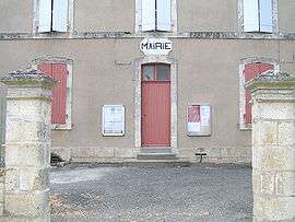
Town hall | |
 Bessé | |
|
Location within Nouvelle-Aquitaine region  Bessé | |
| Coordinates: 45°57′22″N 0°04′28″E / 45.9561°N 0.0744°ECoordinates: 45°57′22″N 0°04′28″E / 45.9561°N 0.0744°E | |
| Country | France |
| Region | Nouvelle-Aquitaine |
| Department | Charente |
| Arrondissement | Confolens |
| Canton | Aigre |
| Intercommunality | Pays d'Aigre |
| Government | |
| • Mayor (2008–2014) | Noël Lizot |
| Area1 | 7.67 km2 (2.96 sq mi) |
| Population (2008)2 | 149 |
| • Density | 19/km2 (50/sq mi) |
| Time zone | CET (UTC+1) |
| • Summer (DST) | CEST (UTC+2) |
| INSEE/Postal code | 16042 / 16140 |
| Elevation |
84–131 m (276–430 ft) (avg. 111 m or 364 ft) |
|
1 French Land Register data, which excludes lakes, ponds, glaciers > 1 km² (0.386 sq mi or 247 acres) and river estuaries. 2 Population without double counting: residents of multiple communes (e.g., students and military personnel) only counted once. | |
Bessé is a commune in the Charente department in southwestern France.
Population
| Historical population | ||
|---|---|---|
| Year | Pop. | ±% |
| 1793 | 250 | — |
| 1800 | 382 | +52.8% |
| 1806 | 386 | +1.0% |
| 1821 | 418 | +8.3% |
| 1831 | 420 | +0.5% |
| 1841 | 403 | −4.0% |
| 1846 | 413 | +2.5% |
| 1851 | 414 | +0.2% |
| 1856 | 413 | −0.2% |
| 1861 | 440 | +6.5% |
| 1866 | 405 | −8.0% |
| 1872 | 410 | +1.2% |
| 1876 | 429 | +4.6% |
| 1881 | 377 | −12.1% |
| 1886 | 380 | +0.8% |
| 1891 | 344 | −9.5% |
| 1896 | 334 | −2.9% |
| 1901 | 334 | +0.0% |
| 1906 | 325 | −2.7% |
| 1911 | 330 | +1.5% |
| 1921 | 277 | −16.1% |
| 1926 | 263 | −5.1% |
| 1931 | 261 | −0.8% |
| 1936 | 265 | +1.5% |
| 1946 | 237 | −10.6% |
| 1954 | 222 | −6.3% |
| 1962 | 216 | −2.7% |
| 1968 | 169 | −21.8% |
| 1975 | 137 | −18.9% |
| 1982 | 116 | −15.3% |
| 1990 | 132 | +13.8% |
| 1999 | 152 | +15.2% |
| 2008 | 149 | −2.0% |
The inhabitants of Bessé-sur-Braye are called Besséens.
See also
References
| Wikimedia Commons has media related to Bessé. |
This article is issued from Wikipedia - version of the 2/22/2013. The text is available under the Creative Commons Attribution/Share Alike but additional terms may apply for the media files.