Réparsac
| Réparsac | |
|---|---|
|
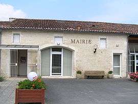
Town hall | |
 Réparsac | |
|
Location within Nouvelle-Aquitaine region  Réparsac | |
| Coordinates: 45°43′52″N 0°14′06″W / 45.7311°N 0.235°WCoordinates: 45°43′52″N 0°14′06″W / 45.7311°N 0.235°W | |
| Country | France |
| Region | Nouvelle-Aquitaine |
| Department | Charente |
| Arrondissement | Cognac |
| Canton | Jarnac |
| Intercommunality | Jarnac |
| Government | |
| • Mayor (2008–2014) | Sylvie Gadiou-Charbonnier |
| Area1 | 11.06 km2 (4.27 sq mi) |
| Population (2008)2 | 588 |
| • Density | 53/km2 (140/sq mi) |
| Time zone | CET (UTC+1) |
| • Summer (DST) | CEST (UTC+2) |
| INSEE/Postal code | 16277 / 16200 |
| Elevation |
10–38 m (33–125 ft) (avg. 28 m or 92 ft) |
|
1 French Land Register data, which excludes lakes, ponds, glaciers > 1 km² (0.386 sq mi or 247 acres) and river estuaries. 2 Population without double counting: residents of multiple communes (e.g., students and military personnel) only counted once. | |
Réparsac is a commune in the Charente department in southwestern France.
Population
| Historical population | ||
|---|---|---|
| Year | Pop. | ±% |
| 1793 | 327 | — |
| 1800 | 400 | +22.3% |
| 1806 | 364 | −9.0% |
| 1821 | 449 | +23.4% |
| 1831 | 457 | +1.8% |
| 1841 | 482 | +5.5% |
| 1846 | 506 | +5.0% |
| 1851 | 523 | +3.4% |
| 1856 | 550 | +5.2% |
| 1861 | 560 | +1.8% |
| 1866 | 527 | −5.9% |
| 1872 | 520 | −1.3% |
| 1876 | 501 | −3.7% |
| 1881 | 512 | +2.2% |
| 1886 | 476 | −7.0% |
| 1891 | 487 | +2.3% |
| 1896 | 466 | −4.3% |
| 1901 | 478 | +2.6% |
| 1906 | 452 | −5.4% |
| 1911 | 419 | −7.3% |
| 1921 | 396 | −5.5% |
| 1926 | 405 | +2.3% |
| 1931 | 420 | +3.7% |
| 1936 | 410 | −2.4% |
| 1946 | 355 | −13.4% |
| 1954 | 422 | +18.9% |
| 1962 | 425 | +0.7% |
| 1968 | 451 | +6.1% |
| 1975 | 458 | +1.6% |
| 1982 | 490 | +7.0% |
| 1990 | 531 | +8.4% |
| 1999 | 506 | −4.7% |
| 2008 | 588 | +16.2% |
See also
References
| Wikimedia Commons has media related to Réparsac. |
This article is issued from Wikipedia - version of the 2/22/2013. The text is available under the Creative Commons Attribution/Share Alike but additional terms may apply for the media files.