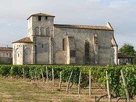
Challignac
| Challignac | |
|---|---|
 | |
 Challignac | |
|
Location within Nouvelle-Aquitaine region  Challignac | |
| Coordinates: 45°24′57″N 0°04′51″W / 45.4158°N 0.0808°WCoordinates: 45°24′57″N 0°04′51″W / 45.4158°N 0.0808°W | |
| Country | France |
| Region | Nouvelle-Aquitaine |
| Department | Charente |
| Arrondissement | Cognac |
| Canton | Barbezieux-Saint-Hilaire |
| Intercommunality | 3B - Sud-Charente |
| Government | |
| • Mayor (2008–2014) | Guy Waye |
| Area1 | 13.21 km2 (5.10 sq mi) |
| Population (2008)2 | 299 |
| • Density | 23/km2 (59/sq mi) |
| Time zone | CET (UTC+1) |
| • Summer (DST) | CEST (UTC+2) |
| INSEE/Postal code | 16074 / 16300 |
| Elevation |
57–133 m (187–436 ft) (avg. 102 m or 335 ft) |
|
1 French Land Register data, which excludes lakes, ponds, glaciers > 1 km² (0.386 sq mi or 247 acres) and river estuaries. 2 Population without double counting: residents of multiple communes (e.g., students and military personnel) only counted once. | |
Challignac is a commune in the Charente department in southwestern France.
Population
| Historical population | ||
|---|---|---|
| Year | Pop. | ±% |
| 1793 | 796 | — |
| 1800 | 680 | −14.6% |
| 1806 | 709 | +4.3% |
| 1821 | 760 | +7.2% |
| 1831 | 741 | −2.5% |
| 1841 | 755 | +1.9% |
| 1846 | 754 | −0.1% |
| 1851 | 712 | −5.6% |
| 1856 | 726 | +2.0% |
| 1861 | 713 | −1.8% |
| 1866 | 617 | −13.5% |
| 1872 | 613 | −0.6% |
| 1876 | 584 | −4.7% |
| 1881 | 602 | +3.1% |
| 1886 | 592 | −1.7% |
| 1891 | 519 | −12.3% |
| 1896 | 503 | −3.1% |
| 1901 | 482 | −4.2% |
| 1906 | 480 | −0.4% |
| 1911 | 468 | −2.5% |
| 1921 | 441 | −5.8% |
| 1926 | 417 | −5.4% |
| 1931 | 420 | +0.7% |
| 1936 | 390 | −7.1% |
| 1946 | 377 | −3.3% |
| 1954 | 384 | +1.9% |
| 1962 | 367 | −4.4% |
| 1968 | 344 | −6.3% |
| 1975 | 257 | −25.3% |
| 1982 | 288 | +12.1% |
| 1990 | 327 | +13.5% |
| 1999 | 313 | −4.3% |
| 2008 | 299 | −4.5% |
See also
References
| Wikimedia Commons has media related to Challignac. |
This article is issued from Wikipedia - version of the 2/11/2016. The text is available under the Creative Commons Attribution/Share Alike but additional terms may apply for the media files.