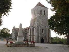
Saint-Front, Charente
| Saint-Front | |
|---|---|
 | |
 Saint-Front | |
|
Location within Nouvelle-Aquitaine region  Saint-Front | |
| Coordinates: 45°53′41″N 0°17′24″E / 45.8947°N 0.29°ECoordinates: 45°53′41″N 0°17′24″E / 45.8947°N 0.29°E | |
| Country | France |
| Region | Nouvelle-Aquitaine |
| Department | Charente |
| Arrondissement | Confolens |
| Canton | Mansle |
| Intercommunality | Pays Manslois |
| Government | |
| • Mayor (2014–) | Sébastien Charriaud |
| Area1 | 13.35 km2 (5.15 sq mi) |
| Population (2012)2 | 353 |
| • Density | 26/km2 (68/sq mi) |
| Time zone | CET (UTC+1) |
| • Summer (DST) | CEST (UTC+2) |
| INSEE/Postal code | 16318 / 16460 |
| Elevation |
66–119 m (217–390 ft) (avg. 65 m or 213 ft) |
|
1 French Land Register data, which excludes lakes, ponds, glaciers > 1 km² (0.386 sq mi or 247 acres) and river estuaries. 2 Population without double counting: residents of multiple communes (e.g., students and military personnel) only counted once. | |
Saint-Front is a commune in the Charente department in southwestern France.
Population
| Historical population | ||
|---|---|---|
| Year | Pop. | ±% |
| 1793 | 558 | — |
| 1800 | 658 | +17.9% |
| 1806 | 708 | +7.6% |
| 1821 | 708 | +0.0% |
| 1831 | 791 | +11.7% |
| 1841 | 859 | +8.6% |
| 1846 | 869 | +1.2% |
| 1851 | 857 | −1.4% |
| 1856 | 808 | −5.7% |
| 1861 | 719 | −11.0% |
| 1866 | 739 | +2.8% |
| 1872 | 736 | −0.4% |
| 1876 | 760 | +3.3% |
| 1881 | 762 | +0.3% |
| 1886 | 701 | −8.0% |
| 1891 | 661 | −5.7% |
| 1896 | 623 | −5.7% |
| 1901 | 587 | −5.8% |
| 1906 | 589 | +0.3% |
| 1911 | 588 | −0.2% |
| 1921 | 548 | −6.8% |
| 1926 | 549 | +0.2% |
| 1931 | 544 | −0.9% |
| 1936 | 475 | −12.7% |
| 1946 | 460 | −3.2% |
| 1954 | 447 | −2.8% |
| 1962 | 390 | −12.8% |
| 1968 | 408 | +4.6% |
| 1975 | 378 | −7.4% |
| 1982 | 372 | −1.6% |
| 1990 | 301 | −19.1% |
| 1999 | 315 | +4.7% |
| 2008 | 332 | +5.4% |
See also
References
| Wikimedia Commons has media related to Saint-Front (Charente). |
This article is issued from Wikipedia - version of the 12/17/2015. The text is available under the Creative Commons Attribution/Share Alike but additional terms may apply for the media files.