Blanzac-Porcheresse
| Blanzac-Porcheresse | ||
|---|---|---|
|
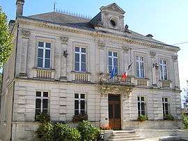
Town hall | ||
| ||
 Blanzac-Porcheresse | ||
|
Location within Nouvelle-Aquitaine region  Blanzac-Porcheresse | ||
| Coordinates: 45°28′38″N 0°01′57″E / 45.4772°N 0.0325°ECoordinates: 45°28′38″N 0°01′57″E / 45.4772°N 0.0325°E | ||
| Country | France | |
| Region | Nouvelle-Aquitaine | |
| Department | Charente | |
| Arrondissement | Angoulême | |
| Canton | Blanzac-Porcheresse | |
| Intercommunality | Blanzacais | |
| Government | ||
| • Mayor (2008–2014) | Jean-Philippe Sallée | |
| Area1 | 10.84 km2 (4.19 sq mi) | |
| Population (2008)2 | 833 | |
| • Density | 77/km2 (200/sq mi) | |
| Time zone | CET (UTC+1) | |
| • Summer (DST) | CEST (UTC+2) | |
| INSEE/Postal code | 16046 / 16250 | |
| Elevation |
62–160 m (203–525 ft) (avg. 80 m or 260 ft) | |
|
1 French Land Register data, which excludes lakes, ponds, glaciers > 1 km² (0.386 sq mi or 247 acres) and river estuaries. 2 Population without double counting: residents of multiple communes (e.g., students and military personnel) only counted once. | ||
.svg.png)
Blanzac-Porcheresse is a commune in the Charente department in southwestern France.
Population
| Historical population | ||
|---|---|---|
| Year | Pop. | ±% |
| 1793 | 649 | — |
| 1800 | 546 | −15.9% |
| 1806 | 627 | +14.8% |
| 1821 | 607 | −3.2% |
| 1831 | 643 | +5.9% |
| 1841 | 682 | +6.1% |
| 1846 | 719 | +5.4% |
| 1851 | 817 | +13.6% |
| 1856 | 842 | +3.1% |
| 1861 | 893 | +6.1% |
| 1866 | 918 | +2.8% |
| 1872 | 830 | −9.6% |
| 1876 | 893 | +7.6% |
| 1881 | 773 | −13.4% |
| 1886 | 873 | +12.9% |
| 1891 | 871 | −0.2% |
| 1896 | 950 | +9.1% |
| 1901 | 900 | −5.3% |
| 1906 | 976 | +8.4% |
| 1911 | 910 | −6.8% |
| 1921 | 738 | −18.9% |
| 1926 | 752 | +1.9% |
| 1931 | 763 | +1.5% |
| 1936 | 728 | −4.6% |
| 1946 | 751 | +3.2% |
| 1954 | 739 | −1.6% |
| 1962 | 817 | +10.6% |
| 1968 | 852 | +4.3% |
| 1975 | 1,004 | +17.8% |
| 1982 | 874 | −12.9% |
| 1990 | 819 | −6.3% |
| 1999 | 836 | +2.1% |
| 2008 | 833 | −0.4% |
See also
References
| Wikimedia Commons has media related to Blanzac-Porcheresse. |
This article is issued from Wikipedia - version of the 9/17/2015. The text is available under the Creative Commons Attribution/Share Alike but additional terms may apply for the media files.