Beaulieu-sur-Sonnette
For other uses, see Beaulieu.
| Beaulieu-sur-Sonnette | ||
|---|---|---|
|
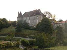
Chateau of Sansac | ||
| ||
 Beaulieu-sur-Sonnette | ||
|
Location within Nouvelle-Aquitaine region  Beaulieu-sur-Sonnette | ||
| Coordinates: 45°55′31″N 0°23′04″E / 45.9253°N 0.3844°ECoordinates: 45°55′31″N 0°23′04″E / 45.9253°N 0.3844°E | ||
| Country | France | |
| Region | Nouvelle-Aquitaine | |
| Department | Charente | |
| Arrondissement | Confolens | |
| Canton | Saint-Claud | |
| Intercommunality | Haute-Charente | |
| Government | ||
| • Mayor (2008–2014) | Daniel Rousseau | |
| Area1 | 10.29 km2 (3.97 sq mi) | |
| Population (2008)2 | 282 | |
| • Density | 27/km2 (71/sq mi) | |
| Time zone | CET (UTC+1) | |
| • Summer (DST) | CEST (UTC+2) | |
| INSEE/Postal code | 16035 / 16450 | |
| Elevation |
86–163 m (282–535 ft) (avg. 102 m or 335 ft) | |
|
1 French Land Register data, which excludes lakes, ponds, glaciers > 1 km² (0.386 sq mi or 247 acres) and river estuaries. 2 Population without double counting: residents of multiple communes (e.g., students and military personnel) only counted once. | ||
.svg.png)
Beaulieu-sur-Sonnette is a commune in the Charente department in southwestern France.
Population
| Historical population | ||
|---|---|---|
| Year | Pop. | ±% |
| 1793 | 671 | — |
| 1800 | 691 | +3.0% |
| 1806 | 691 | +0.0% |
| 1821 | 717 | +3.8% |
| 1831 | 800 | +11.6% |
| 1841 | 840 | +5.0% |
| 1846 | 813 | −3.2% |
| 1851 | 797 | −2.0% |
| 1856 | 763 | −4.3% |
| 1861 | 740 | −3.0% |
| 1866 | 685 | −7.4% |
| 1872 | 718 | +4.8% |
| 1876 | 774 | +7.8% |
| 1881 | 774 | +0.0% |
| 1886 | 740 | −4.4% |
| 1891 | 706 | −4.6% |
| 1896 | 637 | −9.8% |
| 1901 | 607 | −4.7% |
| 1906 | 659 | +8.6% |
| 1911 | 677 | +2.7% |
| 1921 | 554 | −18.2% |
| 1926 | 524 | −5.4% |
| 1931 | 553 | +5.5% |
| 1936 | 524 | −5.2% |
| 1946 | 523 | −0.2% |
| 1954 | 511 | −2.3% |
| 1962 | 483 | −5.5% |
| 1968 | 448 | −7.2% |
| 1975 | 336 | −25.0% |
| 1982 | 326 | −3.0% |
| 1990 | 300 | −8.0% |
| 1999 | 269 | −10.3% |
| 2008 | 282 | +4.8% |
See also
References
| Wikimedia Commons has media related to Beaulieu-sur-Sonnette. |
This article is issued from Wikipedia - version of the 9/17/2015. The text is available under the Creative Commons Attribution/Share Alike but additional terms may apply for the media files.