La Faye
| La Faye | |
|---|---|
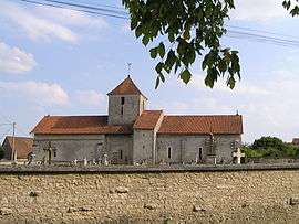 | |
 La Faye | |
|
Location within Nouvelle-Aquitaine region  La Faye | |
| Coordinates: 46°01′16″N 0°08′51″E / 46.0211°N 0.1475°ECoordinates: 46°01′16″N 0°08′51″E / 46.0211°N 0.1475°E | |
| Country | France |
| Region | Nouvelle-Aquitaine |
| Department | Charente |
| Arrondissement | Confolens |
| Canton | Villefagnan |
| Intercommunality | Ruffec |
| Government | |
| • Mayor (2008—2014) | Albert Saint-Louis |
| Area1 | 13.44 km2 (5.19 sq mi) |
| Population (2008)2 | 604 |
| • Density | 45/km2 (120/sq mi) |
| Time zone | CET (UTC+1) |
| • Summer (DST) | CEST (UTC+2) |
| INSEE/Postal code | 16136 / 16700 |
| Elevation |
104–149 m (341–489 ft) (avg. 134 m or 440 ft) |
|
1 French Land Register data, which excludes lakes, ponds, glaciers > 1 km² (0.386 sq mi or 247 acres) and river estuaries. 2 Population without double counting: residents of multiple communes (e.g., students and military personnel) only counted once. | |
La Faye is a commune in the Charente department in southwestern France.
Population
| Historical population | ||
|---|---|---|
| Year | Pop. | ±% |
| 1793 | 824 | — |
| 1800 | 890 | +8.0% |
| 1806 | 770 | −13.5% |
| 1821 | 916 | +19.0% |
| 1831 | 921 | +0.5% |
| 1841 | 993 | +7.8% |
| 1846 | 864 | −13.0% |
| 1851 | 815 | −5.7% |
| 1856 | 797 | −2.2% |
| 1861 | 739 | −7.3% |
| 1866 | 749 | +1.4% |
| 1872 | 736 | −1.7% |
| 1876 | 794 | +7.9% |
| 1881 | 815 | +2.6% |
| 1886 | 771 | −5.4% |
| 1891 | 705 | −8.6% |
| 1896 | 649 | −7.9% |
| 1901 | 649 | +0.0% |
| 1906 | 645 | −0.6% |
| 1911 | 662 | +2.6% |
| 1921 | 623 | −5.9% |
| 1926 | 635 | +1.9% |
| 1931 | 616 | −3.0% |
| 1936 | 583 | −5.4% |
| 1946 | 518 | −11.1% |
| 1954 | 581 | +12.2% |
| 1962 | 582 | +0.2% |
| 1968 | 490 | −15.8% |
| 1975 | 547 | +11.6% |
| 1982 | 519 | −5.1% |
| 1990 | 539 | +3.9% |
| 1999 | 572 | +6.1% |
| 2008 | 604 | +5.6% |
See also
References
| Wikimedia Commons has media related to La Faye. |
This article is issued from Wikipedia - version of the 2/22/2013. The text is available under the Creative Commons Attribution/Share Alike but additional terms may apply for the media files.