Saint-Genis-d'Hiersac
| Saint-Genis-d'Hiersac | |
|---|---|
|
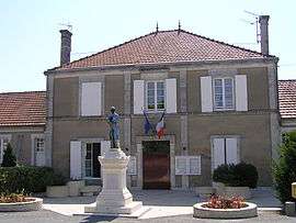
Town hall | |
 Saint-Genis-d'Hiersac | |
|
Location within Nouvelle-Aquitaine region  Saint-Genis-d'Hiersac | |
| Coordinates: 45°45′03″N 0°01′46″E / 45.7508°N 0.0294°ECoordinates: 45°45′03″N 0°01′46″E / 45.7508°N 0.0294°E | |
| Country | France |
| Region | Nouvelle-Aquitaine |
| Department | Charente |
| Arrondissement | Angoulême |
| Canton | Hiersac |
| Intercommunality | Rouillacais |
| Government | |
| • Mayor (2008–2014) | Michèle Gaillard |
| Area1 | 19.08 km2 (7.37 sq mi) |
| Population (2008)2 | 862 |
| • Density | 45/km2 (120/sq mi) |
| Time zone | CET (UTC+1) |
| • Summer (DST) | CEST (UTC+2) |
| INSEE/Postal code | 16320 / 16570 |
| Elevation |
41–147 m (135–482 ft) (avg. 250 m or 820 ft) |
|
1 French Land Register data, which excludes lakes, ponds, glaciers > 1 km² (0.386 sq mi or 247 acres) and river estuaries. 2 Population without double counting: residents of multiple communes (e.g., students and military personnel) only counted once. | |
Saint-Genis-d'Hiersac is a commune in the Charente department in southwestern France.
Population
| Historical population | ||
|---|---|---|
| Year | Pop. | ±% |
| 1793 | 1,318 | — |
| 1800 | 1,316 | −0.2% |
| 1806 | 1,300 | −1.2% |
| 1821 | 1,291 | −0.7% |
| 1831 | 1,410 | +9.2% |
| 1841 | 1,331 | −5.6% |
| 1846 | 1,442 | +8.3% |
| 1851 | 1,444 | +0.1% |
| 1856 | 1,350 | −6.5% |
| 1861 | 1,410 | +4.4% |
| 1866 | 1,465 | +3.9% |
| 1872 | 1,366 | −6.8% |
| 1876 | 1,344 | −1.6% |
| 1881 | 1,208 | −10.1% |
| 1886 | 1,098 | −9.1% |
| 1891 | 1,012 | −7.8% |
| 1896 | 931 | −8.0% |
| 1901 | 938 | +0.8% |
| 1906 | 922 | −1.7% |
| 1911 | 880 | −4.6% |
| 1921 | 767 | −12.8% |
| 1926 | 746 | −2.7% |
| 1931 | 759 | +1.7% |
| 1936 | 743 | −2.1% |
| 1946 | 722 | −2.8% |
| 1954 | 725 | +0.4% |
| 1962 | 727 | +0.3% |
| 1968 | 706 | −2.9% |
| 1975 | 694 | −1.7% |
| 1982 | 724 | +4.3% |
| 1990 | 836 | +15.5% |
| 1999 | 806 | −3.6% |
| 2008 | 862 | +6.9% |
See also
References
| Wikimedia Commons has media related to Saint-Genis-d'Hiersac. |
This article is issued from Wikipedia - version of the 2/23/2013. The text is available under the Creative Commons Attribution/Share Alike but additional terms may apply for the media files.