San Joaquin County, California
| San Joaquin County, California | |||||||
|---|---|---|---|---|---|---|---|
| County | |||||||
| San Joaquin County | |||||||
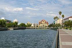
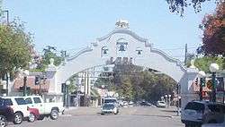
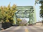
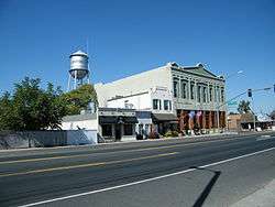
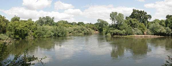
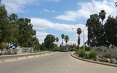
Images, from top down, left to right: Downtown Stockton waterfront, Lodi Arch, San Joaquin River Bridge at Mossdale Crossing, Lockeford, Stanislaus River at Caswell Memorial State Park | |||||||
| |||||||
.svg.png) Location of San Joaquin County in California | |||||||
 California's location in the United States | |||||||
| Country |
| ||||||
| State |
| ||||||
| Region | San Joaquin Valley | ||||||
| Incorporated | February 18, 1850[1] | ||||||
| County seat | Stockton | ||||||
| Largest city | Stockton | ||||||
| Government | |||||||
| • County Administrator | Monica Nino[2] | ||||||
| Area | |||||||
| • Total | 1,426 sq mi (3,690 km2) | ||||||
| • Land | 1,391 sq mi (3,600 km2) | ||||||
| • Water | 35 sq mi (90 km2) | ||||||
| Highest elevation[3] | 3,629 ft (1,106 m) | ||||||
| Population (April 1, 2010)[4] | |||||||
| • Total | 704,379 | ||||||
| • Estimate (2015)[4] | 726,106 | ||||||
| • Density | 490/sq mi (190/km2) | ||||||
| Time zone | Pacific Standard Time (UTC-8) | ||||||
| • Summer (DST) | Pacific Daylight Time (UTC-7) | ||||||
| FIPS code | 06-077 | ||||||
| GNIS feature ID | 277303 | ||||||
| Website |
www | ||||||

San Joaquin County /ˈsæn wɑːˈkiːn/ is a county in the U.S. state of California. As of the 2010 census, the population was 685,306.[4] The county seat is Stockton.[5]
San Joaquin County comprises the Stockton-Lodi, CA Metropolitan Statistical Area, which is also included in the more inclusive San Jose-San Francisco-Oakland, CA Combined Statistical Area. The county is located in Northern Californias Central Valley, just east of the less extensive nine-county San Francisco Bay Area region.
The City of San Joaquin, despite sharing its name with the county, is located in Fresno County.
History
San Joaquin County was one of the original United States counties of California, created in 1850 at the time of statehood.
The county was named for the San Joaquin River which runs through it. In the early 19th century Lieutenant Gabriel Moraga, commanding an expedition in the lower great California Central Valley, gave the name of San Joaquin (meaning Joachim) to the San Joaquin River, which springs from the southern Sierra Nevada. San Joaquin County is the site of the San Joaquin Valley's first permanent residence.
Between 1843 and 1846, during the era when California was a province of independent Mexico, five Mexican land grants were made in what became San Joaquin County: Campo de los Franceses, Pescadero (Grimes), Pescadero (Pico), Sanjon de los Moquelumnes and Thompson.
It was developed for ranching and agriculture. It attracted more miners and settlers at the time of the California Gold Rush.
Tracy tire fire
On August 7, 1998, a tire fire ignited at S.F. Royster's Tire Disposal just south of Tracy on South MacArthur Drive, near Linne Rd. The tire dump held over 7 million illegally stored tires and was allowed to burn for more than two years before it was extinguished. Allowing the fire to burn was considered to be a better way to avoid groundwater contamination than putting it out.[6] The cleanup cost $16.2 million and wound up contaminating local groundwater anyway.[7]
Geography
According to the U.S. Census Bureau, the county has a total area of 1,426 square miles (3,690 km2), of which 1,391 square miles (3,600 km2) is land and 35 square miles (91 km2) (2.5%) is water.[8]
The center of San Joaquin County is near Stockton at about 37°54'N 121°12'W (37.9,-121.2).
National protected area
Demographics
2011
| Population, race, and income | |||||
|---|---|---|---|---|---|
| Total population[9] | 680,277 | ||||
| White[9] | 403,225 | 59.3% | |||
| Black or African American[9] | 50,400 | 7.4% | |||
| American Indian or Alaska Native[9] | 6,782 | 1.0% | |||
| Asian[9] | 97,902 | 14.4% | |||
| Native Hawaiian or other Pacific Islander[9] | 3,427 | 0.5% | |||
| Some other race[9] | 78,817 | 11.6% | |||
| Two or more races[9] | 39,724 | 5.8% | |||
| Hispanic or Latino (of any race)[10] | 260,636 | 38.3% | |||
| Per capita income[11] | $22,857 | ||||
| Median household income[12] | $53,764 | ||||
| Median family income[13] | $60,725 | ||||
Places by population, race, and income
| Places by population and race | ||||||||
|---|---|---|---|---|---|---|---|---|
| Place | Type[14] | Population[9] | White[9] | Other[9] [note 1] |
Asian[9] | Black or African American[9] |
Native American[9] [note 2] |
Hispanic or Latino (of any race)[10] |
| Acampo | CDP | 387 | 100.0% | 0.0% | 0.0% | 0.0% | 0.0% | 92.2% |
| August | CDP | 8,017 | 63.3% | 27.1% | 4.2% | 2.2% | 3.2% | 70.6% |
| Collierville | CDP | 1,891 | 81.8% | 17.1% | 0.0% | 1.2% | 0.0% | 23.1% |
| Country Club | CDP | 9,311 | 67.0% | 20.7% | 4.7% | 6.4% | 1.1% | 36.4% |
| Dogtown | CDP | 2,407 | 91.4% | 7.1% | 1.5% | 0.0% | 0.0% | 32.4% |
| Escalon | City | 7,106 | 90.8% | 5.0% | 1.6% | 0.8% | 1.8% | 21.4% |
| Farmington | CDP | 299 | 75.9% | 14.0% | 0.0% | 10.0% | 0.0% | 0.0% |
| French Camp | CDP | 4,702 | 70.8% | 15.8% | 2.2% | 10.1% | 1.1% | 55.4% |
| Garden Acres | CDP | 10,516 | 60.5% | 32.6% | 2.4% | 2.3% | 2.1% | 68.0% |
| Kennedy | CDP | 3,756 | 61.1% | 28.8% | 0.8% | 9.2% | 0.1% | 81.2% |
| Lathrop | City | 17,488 | 51.4% | 16.2% | 24.4% | 5.8% | 2.1% | 44.7% |
| Lincoln Village | CDP | 4,363 | 64.6% | 23.2% | 8.2% | 3.3% | 0.7% | 30.5% |
| Linden | CDP | 1,874 | 94.1% | 4.7% | 0.0% | 1.2% | 0.0% | 17.6% |
| Lockeford | CDP | 3,241 | 94.0% | 5.9% | 0.1% | 0.0% | 0.0% | 31.1% |
| Lodi | City | 62,354 | 79.1% | 11.7% | 6.5% | 1.7% | 1.0% | 33.8% |
| Manteca | City | 66,081 | 75.5% | 13.2% | 6.5% | 3.5% | 1.4% | 37.4% |
| Morada | CDP | 4,481 | 66.3% | 18.4% | 12.2% | 2.3% | 0.8% | 16.1% |
| Mountain House | CDP | 8,895 | 37.2% | 13.0% | 32.3% | 13.6% | 3.8% | 17.8% |
| Peters | CDP | 697 | 83.8% | 16.2% | 0.0% | 0.0% | 0.0% | 39.3% |
| Ripon | City | 14,021 | 86.7% | 5.4% | 5.4% | 1.6% | 1.0% | 20.7% |
| Stockton | City | 289,926 | 45.6% | 19.1% | 21.8% | 12.0% | 1.6% | 40.0% |
| Taft Mosswood | CDP | 1,406 | 30.4% | 30.4% | 16.1% | 21.4% | 1.6% | 65.0% |
| Terminous | CDP | 367 | 93.7% | 6.3% | 0.0% | 0.0% | 0.0% | 0.0% |
| Thornton | CDP | 783 | 73.1% | 24.8% | 1.0% | 0.8% | 0.4% | 67.4% |
| Tracy | City | 81,115 | 53.9% | 22.5% | 16.0% | 6.3% | 1.4% | 38.0% |
| Victor | CDP | 244 | 93.4% | 6.6% | 0.0% | 0.0% | 0.0% | 21.7% |
| Waterloo | CDP | 227 | 81.5% | 18.5% | 0.0% | 0.0% | 0.0% | 33.0% |
| Woodbridge | CDP | 4,153 | 77.4% | 16.5% | 6.0% | 0.0% | 0.0% | 23.3% |
| Places by population and income | |||||
|---|---|---|---|---|---|
| Place | Type[14] | Population[15] | Per capita income[11] | Median household income[12] | Median family income[13] |
| Acampo | CDP | 387 | $25,012 | $121,455 | $121,455 |
| August | CDP | 8,017 | $12,109 | $30,231 | $32,769 |
| Collierville | CDP | 1,891 | $26,183 | $52,083 | $66,250 |
| Country Club | CDP | 9,311 | $23,248 | $49,716 | $54,493 |
| Dogtown | CDP | 2,407 | $27,074 | $67,083 | $80,750 |
| Escalon | City | 7,106 | $26,092 | $61,855 | $80,921 |
| Farmington | CDP | 299 | $25,878 | $33,833 | $44,861 |
| French Camp | CDP | 4,702 | $11,630 | $41,993 | $48,531 |
| Garden Acres | CDP | 10,516 | $13,553 | $42,043 | $46,176 |
| Kennedy | CDP | 3,756 | $11,450 | $32,917 | $38,723 |
| Lathrop | City | 17,488 | $20,506 | $64,732 | $65,256 |
| Lincoln Village | CDP | 4,363 | $26,777 | $57,359 | $62,463 |
| Linden | CDP | 1,874 | $32,553 | $79,500 | $78,125 |
| Lockeford | CDP | 3,241 | $19,916 | $40,946 | $51,968 |
| Lodi | City | 62,354 | $25,011 | $49,318 | $58,710 |
| Manteca | City | 66,081 | $23,823 | $60,963 | $66,933 |
| Morada | CDP | 4,481 | $40,146 | $68,516 | $85,351 |
| Mountain House | CDP | 8,895 | $30,915 | $95,977 | $103,271 |
| Peters | CDP | 697 | $30,941 | $71,964 | $78,261 |
| Ripon | City | 14,021 | $31,588 | $75,934 | $83,279 |
| Stockton | City | 289,926 | $20,082 | $47,365 | $51,684 |
| Taft Mosswood | CDP | 1,406 | $11,430 | $31,597 | $32,361 |
| Terminous | CDP | 367 | $44,594 | $57,500 | $51,000 |
| Thornton | CDP | 783 | $15,438 | $46,250 | $50,060 |
| Tracy | City | 81,115 | $26,846 | $76,739 | $83,073 |
| Victor | CDP | 244 | $24,507 | $36,667 | $81,667 |
| Waterloo | CDP | 227 | $29,955 | $29,926 | $91,518 |
| Woodbridge | CDP | 4,153 | $35,400 | $65,867 | $87,614 |
2010
| Historical population | |||
|---|---|---|---|
| Census | Pop. | %± | |
| 1850 | 3,647 | — | |
| 1860 | 9,435 | 158.7% | |
| 1870 | 21,050 | 123.1% | |
| 1880 | 24,349 | 15.7% | |
| 1890 | 28,629 | 17.6% | |
| 1900 | 35,452 | 23.8% | |
| 1910 | 50,731 | 43.1% | |
| 1920 | 79,905 | 57.5% | |
| 1930 | 102,940 | 28.8% | |
| 1940 | 134,207 | 30.4% | |
| 1950 | 200,750 | 49.6% | |
| 1960 | 249,989 | 24.5% | |
| 1970 | 290,208 | 16.1% | |
| 1980 | 347,342 | 19.7% | |
| 1990 | 480,628 | 38.4% | |
| 2000 | 563,598 | 17.3% | |
| 2010 | 685,306 | 21.6% | |
| Est. 2015 | 726,106 | [16] | 6.0% |
| U.S. Decennial Census[17] 1790–1960[18] 1900–1990[19] 1990–2000[20] 2010–2015[4] | |||
The 2010 United States Census reported that San Joaquin County had a population of 685,306. The racial makeup of San Joaquin County was 349,287 (51.0%) White, 51,744 (7.6%) African American, 7,196 (1.1%) Native American, 98,472 (14.4%) Asian, 3,758 (0.5%) Pacific Islander, 131,054 (19.1%) from other races, and 43,795 (6.4%) from two or more races. Hispanic or Latino of any race were 266,341 persons (38.9%).[21] The Filipino American population was 46,447, just under half (47%) of all Asian Americans in San Joaquin County,[22] and as of 1990 have been the largest population of Asian Americans in the county.[23]
| Population reported at 2010 United States Census | |||||||||
|---|---|---|---|---|---|---|---|---|---|
Population | American | American | | Islander | races | more races | or Latino (of any race) | ||
| San Joaquin County | 685,306 | 349,287 | 51,744 | 7,196 | 98,472 | 3,758 | 131,054 | 43,795 | 266,341 |
cities | Population | American | American | | Islander | races | more races | or Latino (of any race) | |
| Escalon | 7,132 | 5,823 | 30 | 80 | 96 | 22 | 823 | 258 | 1,928 |
| Lathrop | 18,023 | 7,410 | 1,300 | 231 | 3,968 | 144 | 3,735 | 1,235 | 7,674 |
| Lodi | 62,134 | 42,662 | 517 | 560 | 4,293 | 105 | 11,164 | 2,833 | 22,613 |
| Manteca | 67,096 | 41,840 | 2,869 | 735 | 4,780 | 384 | 11,648 | 4,840 | 25,317 |
| Ripon | 14,297 | 11,392 | 221 | 125 | 599 | 36 | 1,208 | 716 | 3,177 |
| Stockton | 291,707 | 108,044 | 35,548 | 3,086 | 62,716 | 1,822 | 60,332 | 20,159 | 117,590 |
| Tracy | 82,922 | 43,724 | 5,953 | 715 | 12,229 | 747 | 13,173 | 6,381 | 30,557 |
places | Population | American | American | | Islander | races | more races | or Latino (of any race) | |
| Acampo | 341 | 169 | 0 | 1 | 3 | 8 | 136 | 24 | 199 |
| August | 8,390 | 3,914 | 224 | 183 | 358 | 20 | 3,110 | 581 | 5,897 |
| Collierville | 1,934 | 1,552 | 14 | 21 | 49 | 1 | 229 | 68 | 518 |
| Country Club | 9,379 | 5,744 | 472 | 159 | 628 | 42 | 1,537 | 797 | 3,790 |
| Dogtown | 2,506 | 2,040 | 15 | 23 | 57 | 2 | 253 | 116 | 638 |
| Farmington | 207 | 164 | 7 | 1 | 6 | 0 | 18 | 11 | 42 |
| French Camp | 3,376 | 1,678 | 410 | 31 | 163 | 11 | 920 | 163 | 1,748 |
| Garden Acres | 10,648 | 5,244 | 233 | 172 | 358 | 40 | 3,908 | 693 | 7,338 |
| Kennedy | 3,254 | 517 | 200 | 23 | 258 | 4 | 2,109 | 143 | 2,513 |
| Lincoln Village | 4,381 | 2,971 | 154 | 58 | 269 | 13 | 536 | 380 | 1,422 |
| Linden | 1,784 | 1,541 | 6 | 10 | 25 | 1 | 127 | 74 | 385 |
| Lockeford | 3,233 | 2,526 | 10 | 22 | 64 | 13 | 413 | 185 | 956 |
| Morada | 3,828 | 2,848 | 47 | 28 | 412 | 30 | 263 | 200 | 676 |
| Mountain House | 9,675 | 3,467 | 903 | 45 | 3,830 | 71 | 663 | 696 | 1,637 |
| Peters | 672 | 532 | 7 | 15 | 20 | 0 | 60 | 38 | 153 |
| Taft Mosswood | 1,530 | 443 | 192 | 10 | 183 | 1 | 617 | 84 | 1,099 |
| Terminous | 381 | 338 | 2 | 6 | 7 | 0 | 13 | 15 | 40 |
| Thornton | 1,131 | 554 | 43 | 3 | 45 | 1 | 443 | 42 | 770 |
| Victor | 293 | 177 | 0 | 7 | 19 | 0 | 79 | 11 | 150 |
| Waterloo | 572 | 450 | 0 | 5 | 21 | 1 | 77 | 18 | 152 |
| Woodbridge | 3,984 | 2,997 | 15 | 46 | 201 | 7 | 582 | 136 | 1,234 |
communities | Population | American | American | | Islander | races | more races | or Latino (of any race) | |
| All others not CDPs (combined) | 70,496 | 48,526 | 2,352 | 795 | 2,815 | 232 | 12,878 | 2,898 | 26,128 |
2000
As of the census[24] of 2000, there were 563,598 people, 181,629 households, and 134,768 families residing in the county. The population density was 403 people per square mile (156/km²). There were 189,160 housing units at an average density of 135 per square mile (52/km²). The racial makeup of the county was 58.1% White, 6.7% Black or African American, 1.1% Native American, 11.4% Asian, 0.4% Pacific Islander, 16.3% from other races, and 6.1% from two or more races. 30.5% of the population were Hispanic or Latino of any race. 9.3% were of German, 5.3% Irish and 5.0% English ancestry according to Census 2000. 66.4% spoke English, 21.3% Spanish, 2.2% Tagalog, 1.8% Mon-Khmer or Cambodian, 1.1% Vietnamese and 1.1% Hmong as their first language.
There were 181,629 households out of which 40.5% had children under the age of 18 living with them, 54.3% were married couples living together, 14.0% had a female householder with no husband present, and 25.8% were non-families. 20.7% of all households were made up of individuals and 8.4% had someone living alone who was 65 years of age or older. The average household size was 3.00 and the average family size was 3.48.
In the county the population was spread out with 31.0% under the age of 18, 10.0% from 18 to 24, 28.8% from 25 to 44, 19.6% from 45 to 64, and 10.6% who were 65 years of age or older. The median age was 32 years. For every 100 females there were 99.9 males. For every 100 females age 18 and over, there were 97.2 males.
The median income for a household in the county was $41,282, and the median income for a family was $46,919. Males had a median income of $39,246 versus $27,507 for females. The per capita income for the county was $17,365. About 13.5% of families and 17.7% of the population were below the poverty line, including 23.7% of those under age 18 and 10.0% of those age 65 or over.
Metropolitan Statistical Area
The United States Office of Management and Budget has designated San Joaquin County as the Stockton-Lodi, CA Metropolitan Statistical Area.[25] The United States Census Bureau ranked the Stockton-Lodi, CA Metropolitan Statistical Area as the 76th most populous metropolitan statistical area of the United States as of July 1, 2012.[26]
The Office of Management and Budget has further designated the Stockton-Lodi, CA Metropolitan Statistical Area as a component of the more extensive San Jose-San Francisco-Oakland, CA Combined Statistical Area,[25] the 5th most populous combined statistical area and primary statistical area of the United States as of July 1, 2012.[26][27]
Government
The Government of San Joaquin County is defined and authorized under the California Constitution and California law as a general law county.[28] Much of the Government of California is in practice the responsibility of county governments, such as the Government of San Joaquin County. The County government provides countywide services such as elections and voter registration, law enforcement, jails, vital records, property records, tax collection, public health, and social services. In addition the County serves as the local government for all unincorporated areas.[29] Some chartered cities such as Stockton and Tracy provide their own municipal services such as police, public safety, libraries, parks and recreation, and zoning. Some other cities arrange to have the County provide some or all of these services on a contract basis.
The County government is composed of the elected five-member Board of Supervisors (BOS), which operates in a legislative, executive, and quasi-judicial capacity; several other elected offices including the Sheriff, District Attorney, and Assessor; and numerous county departments and entities under the supervision of the County Administrator.
As of January 2016, the supervisors are:
- Carlos Villapudua (District 1),
- Katherine Miller (District 2 and Chair),
- Moses Zapien (District 3),
- Charles Winn (District 4 and Vice Chair), and
- Bob Elliott (District 5).[30]
In addition, several entities of the government of California have jurisdiction conterminous with San Joaquin County, such as the San Joaquin County Superior Court, and the California Department of Corrections and Rehabilitation operates the Deuel Vocational Institution a state prison in unincorporated San Joaquin County near Tracy.[31][32]
Politics
Voter registration
| Population and registered voters | ||
|---|---|---|
| Total population[9] | 680,277 | |
| Registered voters[33][note 3] | 293,957 | 43.2% |
| Democratic[33] | 128,530 | 43.7% |
| Republican[33] | 107,147 | 36.4% |
| Democratic–Republican spread[33] | +21,383 | +7.3% |
| Independent[33] | 7,553 | 2.6% |
| Green[33] | 819 | 0.3% |
| Libertarian[33] | 1,300 | 0.4% |
| Peace and Freedom[33] | 686 | 0.2% |
| Americans Elect[33] | 12 | 0.0% |
| Other[33] | 1,410 | 0.5% |
| No party preference[33] | 46,500 | 15.8% |
Cities by population and voter registration
| Cities by population and voter registration | |||||||
|---|---|---|---|---|---|---|---|
| City | Population[9] | Registered voters[33] [note 3] |
Democratic[33] | Republican[33] | D–R spread[33] | Other[33] | No party preference[33] |
| Escalon | 7,106 | 51.3% | 31.0% | 47.1% | -16.1% | 9.0% | 16.5% |
| Lathrop | 17,488 | 40.1% | 49.3% | 25.9% | +23.4% | 6.9% | 20.5% |
| Lodi | 62,354 | 45.5% | 30.7% | 50.2% | -19.5% | 7.0% | 14.9% |
| Manteca | 66,081 | 46.0% | 39.0% | 37.3% | +1.7% | 8.9% | 18.3% |
| Ripon | 14,021 | 56.0% | 24.4% | 54.9% | -30.5% | 8.0% | 16.1% |
| Stockton | 289,926 | 41.7% | 52.7% | 30.0% | +22.7% | 5.3% | 14.0% |
| Tracy | 81,115 | 41.7% | 44.3% | 30.2% | +14.1% | 7.4% | 21.1% |
Overview
| Year | GOP | DEM | Others |
|---|---|---|---|
| 2016 | 40.3% 82,477 | 53.1% 108,559 | 6.6% 13,559 |
| 2012 | 41.9% 86,071 | 55.6% 114,121 | 2.5% 5,172 |
| 2008 | 43.6% 91,607 | 54.2% 113,974 | 2.2% 4,727 |
| 2004 | 53.2% 100,978 | 45.8% 87,012 | 1.0% 1,874 |
| 2000 | 48.9% 81,773 | 47.7% 79,776 | 3.4% 5,680 |
| 1996 | 44.9% 65,131 | 46.3% 67,253 | 8.8% 12,756 |
| 1992 | 37.8% 58,355 | 41.3% 63,655 | 20.9% 32,200 |
| 1988 | 54.4% 75,309 | 44.6% 61,699 | 1.0% 1,445 |
| 1984 | 59.6% 81,795 | 39.2% 53,846 | 1.2% 1,572 |
| 1980 | 55.4% 64,718 | 35.6% 41,551 | 9.1% 10,594 |
| 1976 | 49.6% 50,277 | 48.1% 48,733 | 2.3% 2,351 |
| 1972 | 55.3% 61,646 | 39.5% 44,062 | 5.2% 5,761 |
| 1968 | 48.0% 47,293 | 42.7% 42,073 | 9.4% 9,223 |
| 1964 | 38.1% 36,546 | 61.8% 59,210 | 0.1% 83 |
| 1960 | 52.9% 48,441 | 46.8% 42,855 | 0.4% 361 |
| 1956 | 54.5% 44,491 | 45.3% 36,941 | 0.2% 168 |
| 1952 | 55.8% 45,512 | 43.5% 35,432 | 0.7% 587 |
| 1948 | 49.1% 29,135 | 47.0% 27,908 | 3.9% 2,318 |
| 1944 | 47.2% 24,357 | 52.5% 27,074 | 0.3% 157 |
| 1940 | 46.3% 23,403 | 52.6% 26,536 | 1.1% 559 |
| 1936 | 25.6% 10,172 | 73.2% 29,078 | 1.2% 473 |
| 1932 | 32.2% 11,145 | 63.3% 21,929 | 4.5% 1,552 |
| 1928 | 61.1% 16,695 | 37.9% 10,343 | 1.1% 288 |
| 1924 | 48.9% 11,056 | 10.6% 2,397 | 40.5% 9,154 |
| 1920 | 60.9% 12,003 | 32.9% 6,487 | 6.1% 1,208 |
San Joaquin was historically a Republican-leaning county in Presidential and Congressional elections, and is trending Democratic. Until recently, the last Democrat to win a majority in the county before 2008 was Lyndon Johnson in 1964, although Bill Clinton won pluralities in the county in 1992 and 1996. However, in 2008, Democrat Barack Obama won 54.5% of the county's vote. In 2012, Obama even increased his share of his vote to 55.6% of the vote.
In the United States House of Representatives, San Joaquin County is split between California's 9th and 10th congressional districts,[35] represented by Jerry McNerney (D–Stockton) and Jeff Denham (R–Atwater), respectively.[36]
In the California State Assembly, San Joaquin County is split between 3 legislative districts:[37]
- the 9th Assembly District, represented by Democrat Jim Cooper,
- the 12th Assembly District, represented by Republican Heath Flora, and
- the 13th Assembly District, represented by Democrat Susan Eggman.
In the California State Senate, San Joaquin County is in the 5th Senate District, represented by Democrat Cathleen Galgiani.[38]
On November 4, 2008, San Joaquin County voted 65.5% for Proposition 8 which amended the California Constitution to ban same-sex marriages.[39]
Crime
The following table includes the number of incidents reported and the rate per 1,000 persons for each type of offense.
| Population and crime rates | ||
|---|---|---|
| Population[9] | 680,277 | |
| Violent crime[40] | 5,531 | 8.13 |
| Homicide[40] | 51 | 0.07 |
| Forcible rape[40] | 148 | 0.22 |
| Robbery[40] | 1,759 | 2.59 |
| Aggravated assault[40] | 3,573 | 5.25 |
| Property crime[40] | 16,971 | 24.95 |
| Burglary[40] | 7,521 | 11.06 |
| Larceny-theft[40][note 4] | 17,218 | 25.31 |
| Motor vehicle theft[40] | 3,991 | 5.87 |
| Arson[40] | 121 | 0.18 |
Cities by population and crime rates
| Cities by population and crime rates | ||||||||
|---|---|---|---|---|---|---|---|---|
| City | Population[41] | Violent crimes[41] | Violent crime rate per 1,000 persons |
Property crimes[41] | Property crime rate per 1,000 persons | |||
| Escalon | 7,314 | 24 | 3.28 | 227 | 31.04 | |||
| Lodi | 63,718 | 280 | 4.39 | 2,599 | 40.79 | |||
| Manteca | 68,887 | 265 | 3.85 | 2,681 | 38.92 | |||
| Ripon | 14,662 | 6 | 0.41 | 297 | 20.26 | |||
| Stockton | 299,105 | 4,630 | 15.48 | 15,258 | 51.01 | |||
| Tracy | 85,047 | 145 | 1.70 | 2,158 | 25.37 | |||
Economy
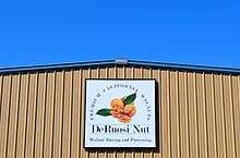
San Joaquin County is home to one of the most reputable and largest walnut processing faculties in the world, DeRuosi Nut. Another large company; Pacific State Bancorp (PSBC) was based here but was closed by the California Department of Financial Institutions on August 20, 2010.[42]
Education
San Joaquin County is home to 14 public school districts and numerous private schools.
| District Name | Enrollment | Lang Arts Performance | Math Performance |
|---|---|---|---|
| Escalon Unified | 3,140 | 49.4% | 46.0% |
| Lincoln Unified | 8,712 | 50.9% | 51.3% |
| Linden Unified | 2,758 | 44.4% | 45.9% |
| Lodi Unified | 31,266 | 38.0% | 43.1% |
| Manteca Unified | 23,643 | 42.7% | 42.4% |
| Ripon Unified | 3,014 | 58.3% | 60.3% |
| Stockton Unified | 38,617 | 29.1% | 38.2% |
| Tracy Unified | 17,375 | 44.3% | 41.2% |
| Averages for all Districts[43] | 45.5% | 48.5% |
On June 8, 2010 Lammersville Unified School District was approved in the new town of * Mountain House.[44]
The San Joaquin Delta Community College District is composed of San Joaquin Delta College located in Stockton and covers San Joaquin County as well as Rio Vista in Solano County, Galt in Sacramento County, and a large portion of Calaveras County.
Media
The Record and The Lodi News-Sentinel are daily newspapers. Bilingual Weekly News publishes a weekly newspaper in both Spanish and English. Tracy Press also publishes a weekly newspaper.
Big Monkey Group publishes four Stockton magazines: Weston Ranch Monthly, Brookside Monthly, Spanos Park Monthly and On the Mile. Caravan is a local community arts and events monthly tabloid. The Central Valley Business Journal is a monthly business tabloid. San Joaquin Magazine is a regional lifestyle magazine covering Stockton, Lodi, Tracy, and Manteca. The Downtowner is a free monthly guide to downtown Stockton's events, commerce, real estate, and other cultural and community happenings.
Poets' Espresso Review is a periodical that has been based in Stockton, mostly distributed by mail, since summer of 2005. Artifact is a San Joaquin Delta College periodical based in Stockton since December 2006, featuring writing in all genres, photography, and visual media by students, staff and faculty as well as community members. The Pacifican, University of the Pacific's newspaper since 1908 features News, Opinion, Lifestyles, and Sports pertinent to the Pacific campus and surrounding Stockton community.
The FX show Sons of Anarchy is set in Charming, California, a fictional town in San Joaquin County.
Transportation
Major highways
-
.svg.png) Interstate 5
Interstate 5 -
.svg.png) Interstate 205
Interstate 205 -
.svg.png) Interstate 580
Interstate 580 -
 State Route 4 (Crosstown Freeway/California Delta Highway)
 -
 State Route 12
 -
 State Route 26
 -
 State Route 88
 -
 State Route 99
 -
 State Route 120
 -
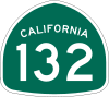 State Route 132
Public transportation
San Joaquin Regional Transit District provides city bus service within Stockton. RTD also runs intercity routes throughout the county, and subscription commuter routes to Livermore, Pleasanton, Sacramento, and Santa Clara County.
The cities of Lodi, Escalon, Manteca, Tracy and Ripon operate their own bus systems.
Train and bus service
Greyhound buses and Amtrak trains both stop in Stockton. Amtrak's San Joaquins Oakland-Bakersfield train stops at the San Joaquin Street Station. Amtrak's San Joaquins Sacramento-Bakersfield trains stop at the Robert J. Cabral Station which is also used by Altamont Commuter Express trains which originate in Stockton. RTD Hopper is a public bus service connecting Ripon, Manteca, Tracy, Lodi and Lathrop to Stockton.
Airports
Stockton Metropolitan Airport features passenger service to Las Vegas along with cargo service and general aviation. Other general aviation airports in the county include Lodi Airport and Tracy Municipal Airport.
Port
Port of Stockton is a major inland deepwater port in Stockton, California located on the San Joaquin River before it joins the Sacramento River to empty into Suisun Bay, eighty miles inland. The port sits on about 4,200 acres (17 km2), and occupies an island in the Sacramento–San Joaquin River Delta.
Communities
Cities
Census-designated places
Unincorporated communities
Population ranking
The population ranking of the following table is based on the 2010 census of San Joaquin County.[45]
† county seat
| Rank | City/Town/etc. | Municipal type | Population (2010 Census)
|
|---|---|---|---|
| 1 | † Stockton | City | 291,707 |
| 2 | Tracy | City | 82,922 |
| 3 | Manteca | City | 67,096 |
| 4 | Lodi | City | 62,134 |
| 5 | Lathrop | City | 18,023 |
| 6 | Ripon | City | 14,297 |
| 7 | Garden Acres | CDP | 10,468 |
| 8 | Mountain House | CDP | 9,675 |
| 9 | Country Club | CDP | 9,379 |
| 10 | August | CDP | 8,390 |
| 11 | Escalon | City | 7,132 |
| 12 | Lincoln Village | CDP | 4,381 |
| 13 | Woodbridge | CDP | 3,984 |
| 14 | Morada | CDP | 3,828 |
| 15 | French Camp | CDP | 3,376 |
| 16 | Kennedy | CDP | 3,254 |
| 17 | Lockeford | CDP | 3,233 |
| 18 | Dogtown | CDP | 2,506 |
| 19 | Collierviile | CDP | 1,934 |
| 20 | Linden | CDP | 1,784 |
| 21 | Taft Mosswood | CDP | 1,530 |
| 22 | Thornton | CDP | 1,131 |
| 23 | Peters | CDP | 672 |
| 24 | Waterloo | CDP | 572 |
| 25 | Terminous | CDP | 381 |
| 26 | Acampo | CDP | 341 |
| 27 | Victor | CDP | 293 |
| 28 | Farmington | CDP | 207 |
See also
- Conergy
- Irrigation district
- List of museums in the San Joaquin Valley
- List of school districts in San Joaquin County, California
- National Register of Historic Places listings in San Joaquin County, California
- San Joaquin County Historical Society and Museum
Notes
- ↑ Other = Some other race + Two or more races
- ↑ Native American = Native Hawaiian or other Pacific Islander + American Indian or Alaska Native
- 1 2 Percentage of registered voters with respect to total population. Percentages of party members with respect to registered voters follow.
- ↑ Only larceny-theft cases involving property over $400 in value are reported as property crimes.
References
- ↑ "Chronology". California State Association of Counties. Retrieved February 6, 2015.
- ↑ "County Administrator Office". San Joaquin County. Retrieved January 9, 2015.
- ↑ "Boardman North". Peakbagger.com. Retrieved April 19, 2015.
- 1 2 3 4 "State & County QuickFacts". United States Census Bureau. Retrieved April 6, 2016.
- ↑ "Find a County". National Association of Counties. Retrieved 2011-06-07.
- ↑ Rubber Threat: Tracy tire fire highlights old problem. Lodi News-Sentinel. 18 August 1998.
- ↑ Breitler, Alex. Byproducts from 1998 tire fire found in water, Record. 20 Dec. 2005.
- ↑ "2010 Census Gazetteer Files". United States Census Bureau. August 22, 2012. Retrieved October 4, 2015.
- 1 2 3 4 5 6 7 8 9 10 11 12 13 14 15 16 17 U.S. Census Bureau. American Community Survey, 2011 American Community Survey 5-Year Estimates, Table B02001. American FactFinder. Retrieved 2013-10-26.
- 1 2 U.S. Census Bureau. American Community Survey, 2011 American Community Survey 5-Year Estimates, Table B03003. American FactFinder. Retrieved 2013-10-26.
- 1 2 U.S. Census Bureau. American Community Survey, 2011 American Community Survey 5-Year Estimates, Table B19301. American FactFinder. Retrieved 2013-10-21.
- 1 2 U.S. Census Bureau. American Community Survey, 2011 American Community Survey 5-Year Estimates, Table B19013. American FactFinder. Retrieved 2013-10-21.
- 1 2 U.S. Census Bureau. American Community Survey, 2011 American Community Survey 5-Year Estimates, Table B19113. American FactFinder. Retrieved 2013-10-21.
- 1 2 U.S. Census Bureau. American Community Survey, 2011 American Community Survey 5-Year Estimates. American FactFinder. Retrieved 2013-10-21.
- ↑ U.S. Census Bureau. American Community Survey, 2011 American Community Survey 5-Year Estimates, Table B01003. American FactFinder. Retrieved 2013-10-21.
- ↑ "County Totals Dataset: Population, Population Change and Estimated Components of Population Change: April 1, 2010 to July 1, 2015". Retrieved July 2, 2016.
- ↑ "U.S. Decennial Census". United States Census Bureau. Retrieved October 4, 2015.
- ↑ "Historical Census Browser". University of Virginia Library. Retrieved October 4, 2015.
- ↑ Forstall, Richard L., ed. (March 27, 1995). "Population of Counties by Decennial Census: 1900 to 1990". United States Census Bureau. Retrieved October 4, 2015.
- ↑ "Census 2000 PHC-T-4. Ranking Tables for Counties: 1990 and 2000" (PDF). United States Census Bureau. April 2, 2001. Retrieved October 4, 2015.
- ↑ "2010 Census P.L. 94-171 Summary File Data". United States Census Bureau.
- ↑ "Profile of General Population and Housing Characteristics: 2010". 2010 Census Summary File 2. United States Census Bureau. 2010. Retrieved January 2, 2014.
- ↑ Dawn B. Mabalon, Ph.D.; Rico Reyes; Filipino American National Historical Society (2008). Filipinos in Stockton. Arcadia Publishing. p. 8. ISBN 978-0-7385-5624-6.
- ↑ "American FactFinder". United States Census Bureau. Retrieved 2011-05-14.
- 1 2 "OMB Bulletin No. 13-01: Revised Delineations of Metropolitan Statistical Areas, Micropolitan Statistical Areas, and Combined Statistical Areas, and Guidance on Uses of the Delineations of These Areas" (PDF). United States Office of Management and Budget. February 28, 2013. Retrieved March 20, 2013.
- 1 2 "Table 1. Annual Estimates of the Population of Metropolitan and Micropolitan Statistical Areas: April 1, 2010 to July 1, 2012" (CSV). 2012 Population Estimates. United States Census Bureau, Population Division. March 2013. Retrieved March 20, 2013.
- ↑ "Table 2. Annual Estimates of the Population of Combined Statistical Areas: April 1, 2010 to July 1, 2012" (CSV). 2012 Population Estimates. United States Census Bureau, Population Division. March 2013. Retrieved March 20, 2013.
- ↑ "Counties of California". San Joaquin County website. Retrieved December 29, 2012.
- ↑ "About County Government". Guide to Government. League of Women Voters of California. Retrieved December 28, 2012.
- ↑ "Board of Supervisors". San Joaquin County. Retrieved January 9, 2015.
- ↑ "Deuel Vocational Institution." California Department of Corrections and Rehabilitation. Retrieved on June 6, 2011. "23500 Kasson Road Tracy, CA 95376"
- ↑ "Tracy city, California." U.S. Census Bureau. Retrieved on June 6, 2011.
- 1 2 3 4 5 6 7 8 9 10 11 12 13 14 15 16 17 California Secretary of State. February 10, 2013 - Report of Registration. Retrieved 2013-10-31.
- ↑ http://uselectionatlas.org/RESULTS/
- ↑ "Counties by County and by District". California Citizens Redistricting Commission. Retrieved September 24, 2014.
- ↑ "California's 9th Congressional District - Representatives & District Map". Civic Impulse, LLC. Retrieved March 9, 2013.
- ↑ "Communities of Interest - Counties". California Citizens Redistricting Commission. Retrieved September 24, 2014.
- ↑ "Communities of Interest - Counties". California Citizens Redistricting Commission. Retrieved September 24, 2014.
- ↑ County Results - Election Center 2008 - Elections & Politics from CNN.com
- 1 2 3 4 5 6 7 8 9 10 Office of the Attorney General, Department of Justice, State of California. Table 11: Crimes – 2009. Retrieved 2013-11-14.
- 1 2 3 United States Department of Justice, Federal Bureau of Investigation. Crime in the United States, 2012, Table 8 (California). Retrieved 2013-11-14.
- ↑ Pacific Bank
- ↑ A statewide average for this value is not computed by the California Department of Education.
- ↑ "Voters approve Lammersville school unification". Tracy press. Jun 8, 2010. Retrieved Jun 8, 2010.
- ↑ http://www.census.gov/2010census/
External links
| Wikimedia Commons has media related to San Joaquin County, California. |
- Official website
- San Joaquin County Office of Emergency Services (OES)
- San Joaquin County Office of Education
- San Joaquin County Superior Court
- South San Joaquin Irrigation District
 |
Sacramento County | Amador County | | |
| Contra Costa County and Alameda County | |
Calaveras County | ||
| ||||
| | ||||
| Santa Clara County | Stanislaus County | Stanislaus County |
Municipalities and communities of San Joaquin County, California, United States | ||
|---|---|---|
| Cities | 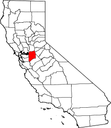 | |
| CDPs | ||
| Unincorporated communities | ||
| Ghost towns |
| |
