Escalon, California
| City of Escalon | |
|---|---|
| City | |
|
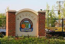
Escalon, Land of Peaches and Cream, welcome sign | |
 City of Escalon Location in the United States | |
| Coordinates: 37°47.5′N 120°59.5′W / 37.7917°N 120.9917°WCoordinates: 37°47.5′N 120°59.5′W / 37.7917°N 120.9917°W | |
| Country |
|
| State |
|
| County | San Joaquin |
| Incorporated | March 12, 1957[1] |
| Government | |
| • Mayor | Gary Haskin |
| • Senate | Tom Berryhill (R) |
| • Assembly | Greg Aghazarian (R) |
| • U. S. Congress | Jeff Denham (R)[2] |
| Area[3] | |
| • Total | 2.368 sq mi (6.134 km2) |
| • Land | 2.301 sq mi (5.959 km2) |
| • Water | 0.067 sq mi (0.175 km2) 2.85% |
| Elevation | 118 ft (36 m) |
| Population (2012) | |
| • Total | 7,266 |
| • Density | 3,100/sq mi (1,200/km2) |
| Time zone | PST (UTC-8) |
| • Summer (DST) | PDT (UTC-7) |
| ZIP code | 95320 |
| Area code(s) | 209 |
| FIPS code | 06-22790 |
| GNIS feature ID | 1656002 |
| Website |
www |
Escalon is a city in San Joaquin County, California, United States. The population was 7,132 at the 2010 census, up from 5,963 at the 2000 census. Its name derives from the Spanish word for "step" or "stepping stone".
Geography
Escalon is located at 37°47.5'N 120°59.5'W (37.7984,-120.9969), where State Highway 120 crosses the BNSF railroad. According to the United States Census Bureau, the city has a total area of 2.4 square miles (6.2 km2). 2.3 square miles (6.0 km2) of it is land and 2.85% is water.
Economy
Industry
Escalon has a large agricultural industry which is based on the fertile farmland surrounding the city. DeRuosi Nut, one of the most reputable and largest walnut processing plants in the world lies in the heart of Escalon accounting for its great deal of agricultural urban living. Escalon is always growing its agriculture in new ways.

Principal employers
Major manufacturing employers in the city include:
| # | Employer | # of Employees |
|---|---|---|
| 1 | DeRuosi Nut | 124 |
Demographics
| Historical population | |||
|---|---|---|---|
| Census | Pop. | %± | |
| 1960 | 1,763 | — | |
| 1970 | 2,366 | 34.2% | |
| 1980 | 3,127 | 32.2% | |
| 1990 | 4,437 | 41.9% | |
| 2000 | 5,963 | 34.4% | |
| 2010 | 7,132 | 19.6% | |
| Est. 2015 | 7,523 | [4] | 5.5% |
2010
The 2010 United States Census[6] reported that Escalon had a population of 7,132. The population density was 3,011.5 people per square mile (1,162.8/km²). The racial makeup of Escalon was 5,823 (81.6%) White, 30 (0.4%) African American, 80 (1.1%) Native American, 96 (1.3%) Asian, 22 (0.3%) Pacific Islander, 823 (11.5%) from other races, and 258 (3.6%) from two or more races. Hispanic or Latino of any race were 1,928 persons (27.0%).
The Census reported that 7,117 people (99.8% of the population) lived in households, 15 (0.2%) lived in non-institutionalized group quarters, and 0 (0%) were institutionalized.
There were 2,476 households, out of which 975 (39.4%) had children under the age of 18 living in them, 1,484 (59.9%) were married couples living together, 291 (11.8%) had a female householder with no husband present, 143 (5.8%) had a male householder with no wife present. There were 130 (5.3%) unmarried. 469 households (18.9%) were made up of individuals and 241 (9.7%) had someone living alone who was 65 years of age or older. The average household size was 2.87. There were 1,918 families (77.5% of all households); the average family size was 3.28.
The population was spread out with 1,933 people (27.1%) under the age of 18, 675 people (9.5%) aged 18 to 24, 1,736 people (24.3%) aged 25 to 44, 1,898 people (26.6%) aged 45 to 64, and 890 people (12.5%) who were 65 years of age or older. The median age was 36.0 years. For every 100 females there were 96.0 males. For every 100 females age 18 and over, there were 95.2 males.
There were 2,610 housing units at an average density of 1,102.1 per square mile (425.5/km²), of which 1,792 (72.4%) were owner-occupied, and 684 (27.6%) were occupied by renters. The homeowner vacancy rate was 2.5%; the rental vacancy rate was 5.9%. 5,082 people (71.3% of the population) lived in owner-occupied housing units and 2,035 people (28.5%) lived in rental housing units.
2000
As of the census[7] of 2000, there were 5,963 people, 2,056 households, and 1,597 families residing in the city. The population density was 2,930.0 people per square mile (1,128.6/km²). There were 2,132 housing units at an average density of 1,047.6 per square mile (403.5/km²). It was estimated that the population would grow to 7,257 people as of July 2006. This is a 21.7% change. The racial makeup of the city was 85.23% White, 0.57% African American, 0.96% Native American, 1.09% Asian, 0.18% Pacific Islander, 8.72% from other races, and 3.25% from two or more races. Hispanic or Latino of any race were 18.87% of the population. There were 2,056 households out of which 41.3% had children under the age of 18 living with them, 61.2% were married couples living together, 11.6% had a female householder with no husband present, and 22.3% were non-families. 19.6% of all households were made up of individuals and 10.5% had someone living alone who was 65 years of age or older. The average household size was 2.89 and the average family size was 3.31. In the city the population was spread out with 30.9% under the age of 18, 8.4% from 18 to 24, 27.3% from 25 to 44, 20.7% from 45 to 64, and 12.7% who were 65 years of age or older. The median age was 36 years. For every 100 females there were 97.1 males. For every 100 females age 18 and over, there were 92.4 males. The median income for a household in the city was $49,797, and the median income for a family was $55,488. Males had a median income of $46,554 versus $27,059 for females. The per capita income for the city was $19,016. About 6.9% of families and 8.6% of the population were below the poverty line, including 13.3% of those under age 18 and 2.5% of those age 65 or over.
References
- ↑ "California Cities by Incorporation Date" (Word). California Association of Local Agency Formation Commissions. Retrieved August 25, 2014.
- ↑ "California's 10th Congressional District - Representatives & District Map". Civic Impulse, LLC. Retrieved March 11, 2013.
- ↑ U.S. Census
- ↑ "Annual Estimates of the Resident Population for Incorporated Places: April 1, 2010 to July 1, 2015". Retrieved July 2, 2016.
- ↑ "Census of Population and Housing". Census.gov. Retrieved June 4, 2015.
- ↑ "2010 Census Interactive Population Search: CA - Escalon city". U.S. Census Bureau. Retrieved July 12, 2014.
- ↑ "American FactFinder". United States Census Bureau. Retrieved 2008-01-31.
External links
Municipalities and communities of San Joaquin County, California, United States | ||
|---|---|---|
| Cities | 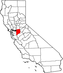 | |
| CDPs | ||
| Unincorporated communities | ||
| Ghost towns |
| |