Indianapolis metropolitan area
| Indianapolis metropolitan area Indianapolis–Carmel–Anderson | |
|---|---|
| Metropolitan area | |
|
Indianapolis | |
 Carmel | |
 Anderson | |
| Country |
|
| States |
|
| Principal cities |
Indianapolis Carmel Anderson |
| Area | |
| • Metropolitan area | 15,614.6 km2 (6,028.83 sq mi) |
| • Land | 15,386.4 km2 (5,940.73 sq mi) |
| • Water | 228.2 km2 (88.10 sq mi) 1.46% |
| • MSA | 12,398.5 km2 (4,787.09 sq mi) |
| • CSA | 15,614.6 km2 (6,028.83 sq mi) |
| Population (2012) | |
| • Urban | 1,487,483 (33rd) |
| • Urban density | 812.557/km2 (2,104.514/sq mi) |
| • MSA | 2,001,452 (32nd) |
| • MSA density | 171.725/km2 (444.767/sq mi) |
| • CSA | 2,414,369 (23rd) |
| • CSA density | 155.365/km2 (402.394/sq mi) |
| Time zone | ET (UTC-5) |
| • Summer (DST) | EDT (UTC-4) |
| ZIP Codes | 460xx, 461xx, 462xx, 466xx, 469xx |
| Area code(s) | 317, 463, 765, 812, 930 |
.jpg)
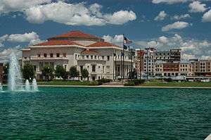
Indianapolis–Carmel–Anderson or Indianapolis metropolitan area is an 11-county metropolitan area in the U.S. state of Indiana, as defined by the Office of Management and Budget.[1] The metropolitan area is situated in Central Indiana, within the American Midwest.
The metropolitan area is centered on the capital and most populous city of Indiana, Indianapolis. Indianapolis–Carmel–Anderson is the 33rd most populous metropolitan area in the United States, and largest in the state of Indiana. As of 2014, the population was 1,971,274.[2] Indianapolis also anchors the larger Indianapolis–Carmel–Muncie combined statistical area (CSA), the 26th most populated, with 2,336,237.
The Indianapolis metropolitan area is part of the Great Lakes Megalopolis, which contains an estimated 59 million people.
Geography
Metropolitan area
Anchor city
Municipalities with 50,000 to 100,000 inhabitants
Municipalities with 10,000 to 50,000 residents
|
Municipalities with 1,000 to 10,000 inhabitants
Municipalities with fewer than 1,000 inhabitants
| ||
Counties
| County | 2015 Estimate | 2010 Census | Change |
|---|---|---|---|
| Marion County | 939,020 | 903,389 | +3.94% |
| Hamilton County | 309,697 | 274,569 | +12.79% |
| Hendricks County | 158,192 | 145,412 | +8.79% |
| Johnson County | 149,633 | 139,867 | +6.98% |
| Madison County | 129,723 | 131,636 | −1.45% |
| Hancock County | 72,520 | 70,045 | +3.53% |
| Morgan County | 69,648 | 68,939 | +1.03% |
| Boone County | 63,344 | 56,638 | +11.84% |
| Shelby County | 44,478 | 44,393 | +0.19% |
| Putnam County | 37,585 | 37,952 | −0.97% |
| Brown County | 14,977 | 15,242 | −1.74% |
| Total | 1,988,817 | 1,887,722 | +5.36% |
Combined Statistical Area

The larger Indianapolis-Carmel-Muncie Combined Statistical Area (CSA) includes the Columbus, IN Metropolitan Statistical Area, Crawfordsville, IN Micropolitan Statistical Area, Greensburg, IN Micropolitan Statistical Area, Indianapolis-Carmel-Anderson, IN Metropolitan Statistical Area, Muncie, IN Metropolitan Statistical Area, New Castle, IN Micropolitan Statistical Area, North Vernon, IN Micropolitan Statistical Area, and the Seymour, IN Micropolitan Statistical Area.[3] The Indianapolis-Carmel-Muncie CSA had a population of 2,166,632 in 2014.[4]
Area codes
The 317 area code covered all of northern and central Indiana until 1948, when the 219 area code was created. Central Indiana remained under the 317 banner until 1997, when growth in and around Indianapolis prompted the creation of 765 area code.
The 317 area code covers the Indianapolis metropolitan area. The counties covered by 317 are Boone County, Hancock County, Hamilton County, Hendricks County, Johnson County, Madison County, Morgan County, and Shelby County.
According to the Indiana Office of Utility Consumer Counselor, the 317 area code is expected to run out of numbers in 2017.[5] Overlay area code 463 will be implemented in late 2016, thereby requiring 10-digit dialing.[6]
Transportation
Highways
Indiana's "Crossroads of America" moniker is largely attributed to the historical function of the Indianapolis metropolitan area has played as a center for logistics and transportation.
Interstates
The Indianapolis area is a major point on the United States Interstate Highway System, as it is a confluence of four major interstate highways:
-
 I-65 – Runs to Gary, Indiana to the north and Louisville, Kentucky, Nashville, Tennessee, and Birmingham, Alabama to the south.
 -
 I-69 – Runs to Fort Wayne, Indiana, to the north and is expected to run to Evansville, Indiana to the south (currently under construction)
 -
 I-70 – Runs to Columbus, Ohio, to the east and St. Louis, Missouri, Kansas City and Denver, Colorado to the west.
 -
 I-74 – Runs to Cincinnati, Ohio to the east and Peoria, Illinois, to the west.
Other interstates that cross through the Indianapolis area include:
-
 I-465 – Also known as the USS Indianapolis Memorial Highway, I-465 is a beltway circling suburban Indianapolis.
 -
 I-865 – It is an east–west connector northwest of Indianapolis in Boone County.
US Highways
Indiana state highways
Other notable roads
Other notable roads in the area are:
- Indiana Avenue (Indianapolis) – One of four diagonal streets included in Alexander Ralston's 1821 Plat of Indianapolis, the street became a center for the local African American community and now anchors a cultural district of the same name.
- Meridian Street (Indianapolis) – A primary north-south route through Marion and Hamilton counties, the street serves as the axis separating east addresses from west addresses.
- Michigan Road – Indiana's first "highway," built in the 1830s and 1840s, running north to Michigan City, Indiana and south to Madison, Indiana.
- Sam Jones Expressway (Indianapolis) – Expressway between I-465 and I-70, connecting south-central Indianapolis with the former terminal of the Indianapolis International Airport.
- Washington Street (Indianapolis) – A primary east–west street through Marion County, the street follows the route of the National Road for almost all of its length in the city of Indianapolis.
Air
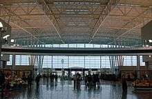
The Indianapolis metropolitan area is served by several airports, most under ownership and operation of the Indianapolis Airport Authority, including Eagle Creek Airpark (EYE), Indianapolis Metropolitan Airport (UMP), Indianapolis Regional Airport (MQJ), Hendricks County Airport (2R2), Indianapolis Downtown Heliport (8A4), and the busiest airport in the state, Indianapolis International Airport (IND). In 2014, Indianapolis International served 7.4 million passengers and handled nearly 1 million metric tonnes of cargo.
Other airports within the region include:
- Anderson Municipal Airport
- Elwood Airport
- Franklin Flying Field
- Greenwood Municipal Airport
- Indianapolis Executive Airport
- Noblesville Airport
- Pam's Place Airport
- Pope Field
- Putnam County Airport
- Shelbyville Municipal Airport
- Sheridan Airport
- Westfield Airport
Rail
Indianapolis Union Station serves as a hub for Amtrak, which maintains service to the Cardinal and is the eastern terminus of the Hoosier State.
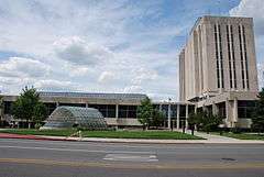
Higher education
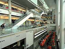
The Indianapolis metropolitan area is home to a number of higher education institutions, including:
- Anderson University
- Ball State University College of Architecture and Planning‡
- Butler University
- Christian Theological Seminary
- Crossroads Bible College
- DePauw University
- Franklin College
- Indiana Bible College
- Indiana Institute of Technology‡
- Indiana University – Purdue University Indianapolis
- Indiana Wesleyan University‡
- Ivy Tech Community College of Indiana
- Marian University
- Martin University
- Oakland City University‡
- Trine University‡
- University of Indianapolis
- Vincennes University‡
The ‡ symbol denotes university branches whose main campuses are located outside the Indianapolis metropolitan area.
Sports
Professional teams
| Club | Sport | Founded | League | Venue |
|---|---|---|---|---|
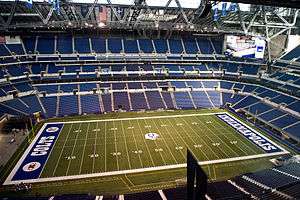
| Indianapolis Colts | American Football | 1984 | NFL | Lucas Oil Stadium |
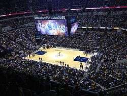
| Indiana Pacers | Basketball | 1967 | NBA | Bankers Life Fieldhouse |
| Indiana Fever | Basketball | 2000 | WNBA | Bankers Life Fieldhouse |
| Indy Eleven | Soccer | 2013 | NASL | Michael Carroll Stadium |
| Indy Fuel | Ice hockey | 2014 | ECHL | Indiana Farmers Coliseum |
| Indianapolis Indians | Baseball | 1902 | IL (Triple-A) | Victory Field |
Semi-professional teams
| Club | Sport | Founded | League | Venue |
|---|---|---|---|---|
| Indy Eleven NPSL | Soccer | 2007 | NPSL | Grand Park |
| F.C. Indiana | Women's Soccer | 2003 | WPSL | Newton Park |
| Indy Crash | Women's Football | 2011 | WFA | Marian University |
| Indianapolis AlleyCats | Ultimate | 2012 | AUDL | Kuntz Stadium |
College sports (Division I)
Headquartered in Indianapolis, the National Collegiate Athletic Association (NCAA) is the preeminent collegiate athletic governing body in the U.S. and Canada, regulating athletes of 1,281 institutions; conferences; organizations; and individuals. The NCAA also organizes the athletic programs of many colleges and universities and helps more than 450,000 college student-athletes who compete annually in college sports.
| School | Founded | Nickname | Conference |
|---|---|---|---|
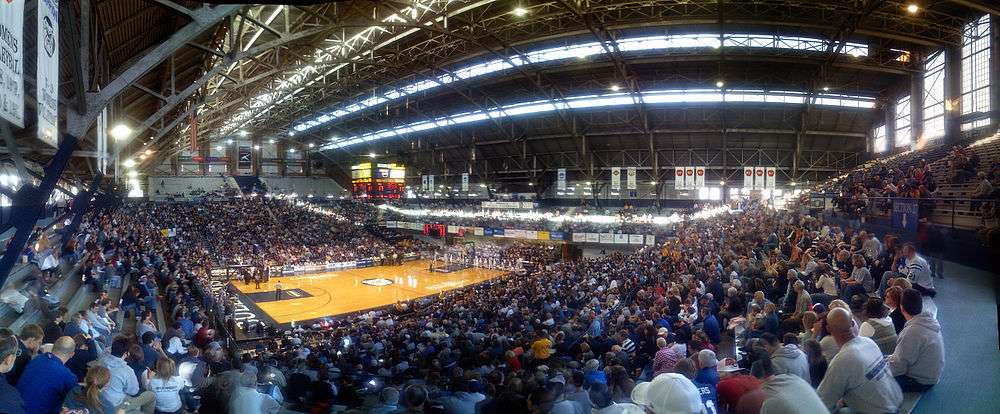
| Indiana University – Purdue University Indianapolis | 1972 | IUPUI Jaguars | The Summit League |
| Butler University | 1932 | Butler Bulldogs | Big East Conference |
Events
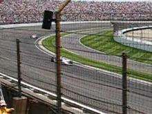
The Indianapolis metropolitan area hosts several notable sporting events annually, including the Brickyard 400, Grand Prix of Indianapolis, NHRA U.S. Nationals, NFL Scouting Combine, Big Ten Football Championship Game, the largest half marathon in the U.S.,[7] and the largest single-day sporting event in the world, the Indianapolis 500. The cars competing in the latter race are known as IndyCars as a reference to the event. Indianapolis has also been a frequent host of the NCAA Division I Men's and Women's basketball tournaments. Other major sporting events hosted include Pan American Games X in 1987, Super Bowl XLVI in 2012,[8] and the 2013 International Champions Cup between Chelsea F.C. and Inter Milan.[9]
High school sports are highly competitive in Greater Indianapolis. In 2013, MaxPreps ranked Indianapolis No. 3 in its Top 10 Metro Areas for High School Football.[10]
Notable natives
- Steve Alford
- Philip Warren Anderson
- John Andretti
- Melvin E. Biddle
- Tim Bogar
- Roger D. Branigin
- James Brewer
- Maria Cantwell
- Rodney Carney
- Ed Carpenter
- Lauren Cheney
- Roosevelt Colvin
- Mike Conley, Jr.
- James Dean
- Chris Doleman
- Tandon Doss
- Katie Douglas
- Colonel Eli Lilly
- Steve Ells
- Anthony W. England
- Mike Epps
- Carl Erskine
- Michael L. Eskew
- Carl G. Fisher
- Jared Fogle
- Jake Fox
- Vivica A. Fox
- Brendan Fraser
- Katie Gearlds
- Jeff George
- Eric Gordon
- Jeff Gordon
- John Green (author)
- William Grose
- Nick Hardwick
- Del Harris
- Gordon Hayward
- Alan Henderson
- George Hill
- Tommy Hunter
- JaJuan Johnson
- Mathias Kiwanuka
- Ron Klain
- Adam Lambert
- Courtney Lee
- David Letterman
- Richard Lugar
- Lance Lynn
- George McGinnis
- Steve McQueen
- Josh McRoberts
- Brandon Miller
- Rick Mount
- Ryan Murphy (writer)
- Greg Oden
- Jane Pauley
- Madelyn Pugh
- Dan Quayle
- Oscar Robertson
- Courtney Roby
- Walter Bedell Smith
- Brad Stevens
- Tony Stewart
- Drew Storen
- Marc Summers
- Jeff Teague
- Jeremy Trueblood
- Kurt Vonnegut
- Herman B Wells
- Jason Whitlock
- David Wolf
- John Wooden
- Mike Woodson
- Lew Wallace
References
- ↑ https://www.whitehouse.gov/sites/default/files/omb/bulletins/2013/b-13-01.pdf
- ↑ "Archived copy". Archived from the original on April 16, 2016. Retrieved January 23, 2016.
- ↑ https://www.whitehouse.gov/sites/default/files/omb/bulletins/2013/b-13-01.pdf
- ↑ http://www.stats.indiana.edu/profiles/profiles.asp?scope_choice=b&county_changer2=Rcomb:294
- ↑ "NANPA : Number Resources - NPA (Area) Codes". Nanpa.com. Retrieved 21 December 2014.
- ↑ Russell, John. "New area code, mandatory 10-digit dialing, come to Central Indiana". Indianapolis Star. Retrieved July 4, 2016.
- ↑ "OneAmerica 500 Festival Mini Marathon & 5K". halfmarathons.net. Retrieved 2015-05-26.
- ↑ "Indianapolis beats out Houston, Arizona to host first Super Bowl". NFL.com. Retrieved 21 December 2014.
- ↑ "Indianapolis Sports - Indianapolis Star - indystar.com". Indianapolis Star. Retrieved 21 December 2014.
- ↑ "Top 10 Metro Areas for high school football in 2013". MaxPreps.com. Retrieved 21 December 2014.
External links
- Indianapolis, IN Combined Statistical Area (2003) map
- U.S. Census Bureau State & County QuickFacts
- U.S. Census Bureau population estimates
- Metropolitan and Micropolitan Statistical Areas
- Historical Metropolitan Area Definitions
