Rosedale, California
| Rosedale | |
|---|---|
| census-designated place | |
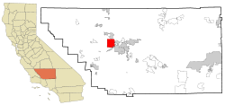 Location in Kern County and the state of California | |
 Rosedale Location in the United States | |
| Coordinates: 35°23′01″N 119°08′43″W / 35.38361°N 119.14528°WCoordinates: 35°23′01″N 119°08′43″W / 35.38361°N 119.14528°W | |
| Country |
|
| State |
|
| County | Kern |
| Government | |
| • Senate | Roy Ashburn (R) |
| • Assembly | Jean Fuller (R) |
| • U. S. Congress | Kevin McCarthy (R) |
| Area[1] | |
| • Total | 33.964 sq mi (87.966 km2) |
| • Land | 33.964 sq mi (87.966 km2) |
| • Water | 0 sq mi (0 km2) 0% |
| Elevation[2] | 364 ft (111 m) |
| Population (2010) | |
| • Total | 14,058 |
| • Density | 410/sq mi (160/km2) |
| Time zone | PST (UTC-8) |
| • Summer (DST) | PDT (UTC-7) |
| ZIP code | 93312 |
| Area code(s) | 661 |
| FIPS code | 06-62854 |
| GNIS feature ID | 1652784 |
Rosedale is a Census-designated place (CDP) in Kern County, California, United States. The population was 14,058 at the 2010 census, up from 8,445 at the 2000 census. Formerly a country town 10 miles (16 km) west of Bakersfield, it is now surrounded by suburban housing and now has the highest household income in Kern County, according to Census estimates.
Geography
Rosedale is located at 35°23′01″N 119°08′43″W / 35.38361°N 119.14528°W.[2]
According to the United States Census Bureau, the CDP has a total area of 34.0 square miles (88 km2), all of it land.
History
Rosedale was founded in 1891 as a colony of English farmers.[3] A post office operated at Rosedale from 1891 to 1913.[3]
Demographics
2010
The 2010 United States Census[4] reported that Rosedale had a population of 14,058. The population density was 413.9 people per square mile (159.8/km²). The racial makeup of Rosedale was 11,695 (83.2%) White, 208 (1.5%) African American, 159 (1.1%) Native American, 389 (2.8%) Asian, 24 (0.2%) Pacific Islander, 997 (7.1%) from other races, and 586 (4.2%) from two or more races. Hispanic or Latino of any race were 2,495 persons (17.7%).
The Census reported that 14,049 people (99.9% of the population) lived in households, 9 (0.1%) lived in non-institutionalized group quarters, and 0 (0%) were institutionalized.
There were 4,565 households, out of which 1,941 (42.5%) had children under the age of 18 living in them, 3,386 (74.2%) were opposite-sex married couples living together, 290 (6.4%) had a female householder with no husband present, 208 (4.6%) had a male householder with no wife present. There were 171 (3.7%) unmarried opposite-sex partnerships, and 35 (0.8%) same-sex married couples or partnerships. 522 households (11.4%) were made up of individuals and 161 (3.5%) had someone living alone who was 65 years of age or older. The average household size was 3.08. There were 3,884 families (85.1% of all households); the average family size was 3.32.
The population was spread out with 3,811 people (27.1%) under the age of 18, 1,223 people (8.7%) aged 18 to 24, 3,124 people (22.2%) aged 25 to 44, 4,642 people (33.0%) aged 45 to 64, and 1,258 people (8.9%) who were 65 years of age or older. The median age was 40.1 years. For every 100 females there were 99.0 males. For every 100 females age 18 and over, there were 97.4 males.
There were 4,799 housing units at an average density of 141.3 per square mile (54.6/km²), of which 4,106 (89.9%) were owner-occupied, and 459 (10.1%) were occupied by renters. The homeowner vacancy rate was 1.6%; the rental vacancy rate was 9.4%. 12,647 people (90.0% of the population) lived in owner-occupied housing units and 1,402 people (10.0%) lived in rental housing units.
2000
As of the census[5] of 2000, there were 8,445 people, 2,566 households, and 2,304 families residing in the CDP. The population density was 223.1 people per square mile (86.1/km²). There were 2,776 housing units at an average density of 73.3 per square mile (28.3/km²). The racial makeup of the CDP was 88.98% White, 1.22% Black or African American, 1.22% Native American, 1.36% Asian, 0.04% Pacific Islander, 4.30% from other races, and 2.89% from two or more races. 11.00% of the population were Hispanic or Latino of any race.
There were 2,566 households out of which 49.6% had children under the age of 18 living with them, 80.4% were married couples living together, 5.8% had a female householder with no husband present, and 10.2% were non-families. 7.8% of all households were made up of individuals and 2.6% had someone living alone who was 65 years of age or older. The average household size was 3.28 and the average family size was 3.45.
In the CDP the population was spread out with 33.3% under the age of 18, 6.4% from 18 to 24, 28.7% from 25 to 44, 25.6% from 45 to 64, and 6.0% who were 65 years of age or older. The median age was 37 years. For every 100 females there were 98.0 males. For every 100 females age 18 and over, there were 96.7 males.
The median income for a household in the CDP was $76,277, and the median income for a family was $83,704. Males had a median income of $61,379 versus $33,750 for females. The per capita income for the CDP was $25,414. About 4.5% of families and 6.3% of the population were below the poverty line, including 7.4% of those under age 18 and 2.8% of those age 65 or over.
References
- ↑ U.S. Census
- 1 2 U.S. Geological Survey Geographic Names Information System: Rosedale, California
- 1 2 Durham, David L. (1998). California's Geographic Names: A Gazetteer of Historic and Modern Names of the State. Clovis, Calif.: Word Dancer Press. p. 1098. ISBN 1-884995-14-4.
- ↑ "2010 Census Interactive Population Search: CA - Rosedale CDP". U.S. Census Bureau. Retrieved July 12, 2014.
- ↑ "American FactFinder". United States Census Bureau. Retrieved 2008-01-31.
