Worcester, Massachusetts
| Worcester, Massachusetts | |||||||||||
|---|---|---|---|---|---|---|---|---|---|---|---|
| City | |||||||||||
| City of Worcester | |||||||||||
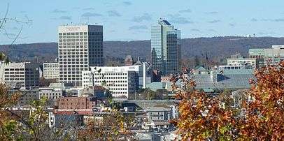
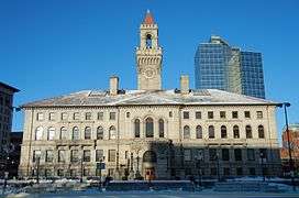
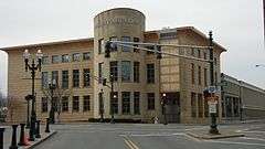
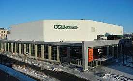
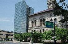
Downtown Skyline City Hall, Union Station Worcester Public Library, DCU Center American Antiquarian Society, Clark University Paul Revere Road, Catharine Street | |||||||||||
| |||||||||||
| Nickname(s): The City of the Seven Hills, The Heart of the Commonwealth, Wormtown, Woo-town, The Woo | |||||||||||
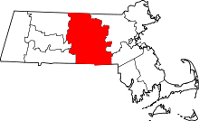
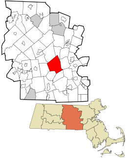 Location in Worcester County and the state of Massachusetts | |||||||||||
 Worcester, Massachusetts Location in the United States | |||||||||||
| Coordinates: 42°16′N 71°48′W / 42.267°N 71.800°WCoordinates: 42°16′N 71°48′W / 42.267°N 71.800°W | |||||||||||
| Country | United States | ||||||||||
| State | Massachusetts | ||||||||||
| County | Worcester | ||||||||||
| Settled | 1673 | ||||||||||
| Incorporated as a town | June 14, 1722 | ||||||||||
| Incorporated as a city | February 29, 1848 | ||||||||||
| Government | |||||||||||
| • Type | Council-manager | ||||||||||
| • City Manager | Edward M. Augustus, Jr. | ||||||||||
| • Mayor | Joseph Petty | ||||||||||
| Area | |||||||||||
| • City | 38.6 sq mi (99.9 km2) | ||||||||||
| • Land | 37.6 sq mi (97.3 km2) | ||||||||||
| • Water | 1.0 sq mi (2.6 km2) | ||||||||||
| Elevation | 480 ft (146 m) | ||||||||||
| Population (2014 est.) | |||||||||||
| • City | 183,016 | ||||||||||
| • Density | 4,678.1/sq mi (1,807.8/km2) | ||||||||||
| • Metro | 923,672 | ||||||||||
| Time zone | Eastern (UTC-5) | ||||||||||
| • Summer (DST) | Eastern (UTC-4) | ||||||||||
| ZIP code | 01601–01610, 01612–01615, 01653–01655 | ||||||||||
| Area code(s) | 508 / 774 | ||||||||||
| FIPS code 0 | 25-82000 | ||||||||||
| GNIS feature ID | 0617867 | ||||||||||
| Website |
www | ||||||||||

Worcester (/ˈwʊstər/ WUUSS-tər, locally also ![]() i/ˈwᵻstə/ WISS-tə)[1] is a city and the historic county seat of Worcester County, Massachusetts, United States until most of Massachusetts disbanded county government in 1998. Named after Worcester, England, as of the 2010 Census the city's population was 181,045,[2] making it the second most populous city in New England after Boston.[3] Worcester is located approximately 40 miles (64 km) west of Boston, 50 miles (80 km) east of Springfield and 40 miles (64 km) north of Providence. Due to its location in Central Massachusetts, amidst Massachusetts' major metropolitan regions, Worcester is known as the "Heart of the Commonwealth", thus, a heart is the official symbol of the city. However, the heart symbol may also have its provenance in lore that Valentine's Day cards were invented in the city.[4]
i/ˈwᵻstə/ WISS-tə)[1] is a city and the historic county seat of Worcester County, Massachusetts, United States until most of Massachusetts disbanded county government in 1998. Named after Worcester, England, as of the 2010 Census the city's population was 181,045,[2] making it the second most populous city in New England after Boston.[3] Worcester is located approximately 40 miles (64 km) west of Boston, 50 miles (80 km) east of Springfield and 40 miles (64 km) north of Providence. Due to its location in Central Massachusetts, amidst Massachusetts' major metropolitan regions, Worcester is known as the "Heart of the Commonwealth", thus, a heart is the official symbol of the city. However, the heart symbol may also have its provenance in lore that Valentine's Day cards were invented in the city.[4]
Worcester was considered its own region for centuries; however, with the encroachment of Boston's suburbs in the 1970s after the construction of Interstate 495 and Interstate 290, it now marks the western periphery of the Boston-Worcester-Providence (MA-RI-NH) U.S. Census Combined Statistical Area (CSA), or Greater Boston. The city features many examples of Victorian-era mill architecture.
History
The area was first inhabited by members of the Nipmuc tribe. The native people called the region Quinsigamond and built a settlement on Pakachoag Hill in Auburn.[5] In 1673 English settlers John Eliot and Daniel Gookin led an expedition to Quinsigamond to establish a new Christian Indian "praying town" and identify a new location for an English settlement. On July 13, 1674, Gookin obtained a deed to eight square miles of land in Quinsigamond from the Nipmuc people and English traders and settlers began to inhabit the region.[6]
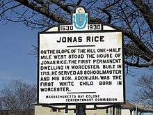
In 1675, King Philip's War broke out throughout New England with the Nipmuc Indians coming to the aid of Indian leader King Philip. The English settlers completely abandoned the Quinsigamond area and the empty buildings were burned by the Indian forces. The town was again abandoned during Queen Anne's War in 1702.[6] Finally in 1713, Worcester was permanently resettled for a third time by Jonas Rice.[7] Named after the city of Worcester, England, the town was incorporated on June 14, 1722.[8] On April 2, 1731, Worcester was chosen as the county seat of the newly founded Worcester County government. Between 1755 and 1758, future U.S. president John Adams worked as a schoolteacher and studied law in Worcester.
In the 1770s, Worcester became a center of American revolutionary activity. British General Thomas Gage was given information of patriot ammunition stockpiled in Worcester in 1775. Also in 1775, Massachusetts Spy publisher Isaiah Thomas moved his radical newspaper out of British occupied Boston to Worcester. Thomas would continuously publish his paper throughout the American Revolutionary War. On July 14, 1776, Thomas performed the first public reading in Massachusetts of the Declaration of Independence in front of the Worcester town hall. He would later go on to form the American Antiquarian Society in Worcester in 1812.[10]

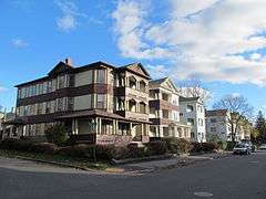
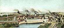
During the turn of the 19th century Worcester's economy moved into manufacturing. Factories producing textiles, shoes and clothing opened along the nearby Blackstone River. However, the manufacturing industry in Worcester would not begin to thrive until the opening of the Blackstone Canal in 1828 and the opening of the Worcester and Boston Railroad in 1835. The city transformed into a transportation hub and the manufacturing industry flourished.[11] Worcester was officially chartered as a city on February 29, 1848.[8] The city's industries soon attracted immigrants of primarily Irish, French, and Swedish descent in the mid-19th century and later many immigrants of Lithuanian, Polish, Italian, Greek, Turkish and Armenian descent.[12] Immigrants moved into new triple-decker houses which lined hundreds of Worcester's expanding streets and neighborhoods.[13]
In 1831 Ichabod Washburn opened the Washburn & Moen Company. The company would become the largest wire manufacturing in the country and Washburn became one of the leading industrial and philanthropic figures in the city.[12][14]
Worcester would become a center of machinery, wire products and power looms and boasted large manufacturers, Washburn & Moen, Wyman-Gordon Company, American Steel & Wire, Morgan Construction and the Norton Company. In 1908 the Royal Worcester Corset Factory was the largest employer of women in the United States.[15]
Worcester would also claim many inventions and firsts. New England Candlepin bowling was invented in Worcester by Justin White in 1879. Esther Howland began the first line of Valentine's Day cards from her Worcester home in 1847. Loring Coes invented the first monkey wrench and Russell Hawes created the first envelope folding machine.[16] On June 12, 1880, Lee Richmond pitched the first perfect game in Major league baseball history for the Worcester Ruby Legs at the Worcester Agricultural Fairgrounds.[16]
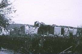
On June 9, 1953 a F4 tornado touched down in Petersham, Massachusetts northwest of Worcester. The tornado tore through 48 miles of Worcester County including a large area of the city of Worcester. The tornado left massive destruction and killed 94 people. The Worcester Tornado would be the most deadly tornado to ever hit Massachusetts.[17] Debris from the tornado landed as far away as Dedham, Massachusetts.[18]
After World War II, Worcester began to fall into decline as the city lost its manufacturing base to cheaper alternatives across the country and overseas. Worcester felt the national trends of movement away from historic urban centers. The city's population would drop over 20% from 1950 to 1980. In the mid-20th century large urban renewal projects were undertaken to try and reverse the city's decline. A huge area of downtown Worcester was demolished for new office towers and the 1,000,000 sq. ft. Worcester Center Galleria shopping mall.[19] After only 30 years the Galleria would lose most of its major tenants and lose its appeal to more suburban shopping malls around Worcester County. In the 1960s, Interstate 290 was built right through the center of Worcester, permanently dividing the city. In 1963, Worcester native Harvey Ball introduced the iconic yellow smiley face to American culture.[20][21]
In the late 20th century Worcester's economy began to recover as the city expanded into biotechnology and healthcare fields.[22] The UMass Medical School has become a leader in biomedical research and the Massachusetts Biotechnology Research Park has become a center of medical research and development.[22] Worcester hospitals Saint Vincent Hospital and UMass Memorial Health Care have become two of the largest employers in the city. Worcester's many colleges, including the College of the Holy Cross, Worcester Polytechnic Institute, Clark University, UMass Medical School, Assumption College, MCPHS University, Becker College, and Worcester State University, attract many students to the area and help drive the new economy.

On December 3, 1999 a homeless man and his girlfriend accidentally started a five-alarm fire at the Worcester Cold Storage & Warehouse Company. The fire took the lives of six firemen and drew national attention as one of the worst firefighting tragedies in the late 20th century.[23] President Bill Clinton, Vice President Al Gore and other local and national dignitaries attended the funeral service and memorial program in Worcester.[23]
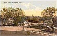
In recent decades, a renewed interest in the city's downtown has brought new investment and construction to Worcester. A Convention Center was built along the DCU Center arena in downtown Worcester in 1997.[24] In 2000, Worcester's Union Station reopened after 25 years of neglect and a $32 million renovation. Hanover Insurance helped fund a multimillion-dollar renovation to the old Franklin Square Theater into the Hanover Theatre for the Performing Arts.[25] In 2000, the Massachusetts College of Pharmacy and Health Sciences built a new campus in downtown Worcester.[26] In 2007 WPI opened the first facility in their new Gateway Park center in Lincoln Square.[27] In 2004, Berkeley Investments proposed demolishing the old Worcester Center Galleria for a new mixed-used development called City Square. The ambitious project looked to reconnect old street patterns while creating a new retail, commercial and living destination in the city.[28] After struggling to secure finances for a number of years Hanover Insurance took over the project and demolition began on September 13, 2010. Unum Insurance and the Saint Vincent Hospital leased into the project and both facilities opened in 2013. The new Front Street opened on December 31, 2012.[29]
Geography
Worcester has a total area 38.6 square miles (100 km2). 37.6 square miles (97 km2) of it is land and 1.0 square mile (2.6 km2) (roughly 2.59%) is water. Worcester is bordered by the towns of Auburn, Grafton, Holden, Leicester, Millbury, Paxton, Shrewsbury, and West Boylston.
Worcester is known as the Heart of the Commonwealth, because of its proximity to the center of Massachusetts. The city is about 45 miles (72 km) west of Boston, 40 miles (64 km) east of Springfield, and 38 miles (61 km) northwest of Providence, Rhode Island.
The Blackstone River forms in the center of Worcester by the confluence of the Middle River and Mill Brook. The river courses underground through the center of the city, and emerges at the foot of College Hill. It then flows south through Quinsigamond Village and into Millbury. Worcester is the beginning of the Blackstone Valley that frames the river. The Blackstone Canal was once an important waterway connecting Worcester to Providence and the Eastern Seaboard, but the canal fell into disuse at the end of the 19th century and was mostly covered up. In recent years, local organizations including the Canal District Business Association have proposed restoring the canal and creating a Blackstone Valley National Park.[30]
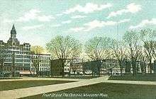
Worcester is one of many cities claimed, like Rome, to be found on seven hills: Airport Hill, Bancroft Hill, Belmont Hill (Bell Hill), Grafton Hill, Green Hill, Pakachoag Hill and Vernon Hill. However, Worcester has more than seven hills including Indian Hill, Newton Hill, Poet's Hill, and Wigwam Hill.
Worcester has many ponds and two prominent lakes: Indian Lake and Lake Quinsigamond. Lake Quinsigamond (also known as Long Pond) stretches four miles across the Worcester and Shrewsbury border and is a very popular competitive rowing and boating destination.
Climate
Worcester's humid continental climate (Köppen Dfb) is typical of New England. The weather changes rapidly owing to the confluence of warm, humid air from the southwest; cool, dry air from the north; and the moderating influence of the Atlantic Ocean to the east. Summers are typically warm and humid, while winters are cold, windy, and snowy. Snow typically falls from the second half of November into early April,[31] with occasional falls in October; May snow is much rarer. The USDA classifies the city as straddling hardiness zones 5b and 6a.[32]
The hottest month is July, with a 24-hour average of 70.2 °F (21.2 °C), while the coldest is January, at 24.1 °F (−4.4 °C). There is an average of only 3.5 days of 90 °F (32 °C)+ highs and 4.1 nights of lows at or below 0 °F (−18 °C) per year, and periods of both extremes are rarely sustained. The all-time record high temperature is 102 °F (39 °C), recorded on July 4, 1911,[33] the only 100 °F (38 °C) or greater temperature to date. The all-time record low temperature is −24 °F (−31 °C), recorded on February 16, 1943.[34]
The city averages 48.1 inches (1,220 mm) of precipitation a year, as well as an average of 64.1 inches (163 cm) of snowfall a season, receiving far more snow than coastal locations less than 40 miles (64 km) away. Massachusetts' geographic location, jutting out into the North Atlantic, makes the city very prone to Nor'easter weather systems that can dump heavy snow on the region.
While rare, the city has had its share of extreme weather. On September 21, 1938, the city was hit by the brutal New England Hurricane of 1938. Fifteen years later, Worcester was hit by a tornado that killed 94 people. The deadliest tornado in New England history, it damaged a large part of the city and surrounding towns. It struck Assumption Preparatory School, now the site of Quinsigamond Community College.
| Climate data for Worcester, Massachusetts (Worcester Regional Airport), 1981–2010 normals, extremes 1892–present | |||||||||||||
|---|---|---|---|---|---|---|---|---|---|---|---|---|---|
| Month | Jan | Feb | Mar | Apr | May | Jun | Jul | Aug | Sep | Oct | Nov | Dec | Year |
| Record high °F (°C) | 67 (19) |
67 (19) |
84 (29) |
91 (33) |
94 (34) |
98 (37) |
102 (39) |
99 (37) |
99 (37) |
91 (33) |
79 (26) |
72 (22) |
102 (39) |
| Mean maximum °F (°C) | 52.9 (11.6) |
53.8 (12.1) |
66.3 (19.1) |
78.2 (25.7) |
84.1 (28.9) |
87.5 (30.8) |
89.5 (31.9) |
88.1 (31.2) |
83.7 (28.7) |
74.7 (23.7) |
66.7 (19.3) |
56.7 (13.7) |
91.2 (32.9) |
| Average high °F (°C) | 31.3 (−0.4) |
34.6 (1.4) |
42.9 (6.1) |
55.1 (12.8) |
65.9 (18.8) |
74.1 (23.4) |
78.9 (26.1) |
77.3 (25.2) |
69.6 (20.9) |
58.3 (14.6) |
47.6 (8.7) |
36.3 (2.4) |
56.0 (13.3) |
| Average low °F (°C) | 16.8 (−8.4) |
19.4 (−7) |
26.5 (−3.1) |
37.0 (2.8) |
46.8 (8.2) |
56.0 (13.3) |
61.5 (16.4) |
60.4 (15.8) |
52.9 (11.6) |
41.7 (5.4) |
33.0 (0.6) |
22.6 (−5.2) |
39.6 (4.2) |
| Mean minimum °F (°C) | −2.3 (−19.1) |
1.5 (−16.9) |
8.1 (−13.3) |
24.4 (−4.2) |
35.6 (2) |
44.1 (6.7) |
52.3 (11.3) |
49.7 (9.8) |
39.2 (4) |
28.6 (−1.9) |
17.6 (−8) |
4.3 (−15.4) |
−4.6 (−20.3) |
| Record low °F (°C) | −19 (−28) |
−24 (−31) |
−6 (−21) |
9 (−13) |
27 (−3) |
33 (1) |
41 (5) |
38 (3) |
27 (−3) |
19 (−7) |
3 (−16) |
−17 (−27) |
−24 (−31) |
| Average precipitation inches (mm) | 3.49 (88.6) |
3.23 (82) |
4.21 (106.9) |
4.11 (104.4) |
4.19 (106.4) |
4.19 (106.4) |
4.23 (107.4) |
3.71 (94.2) |
3.93 (99.8) |
4.68 (118.9) |
4.28 (108.7) |
3.82 (97) |
48.07 (1,220.7) |
| Average snowfall inches (cm) | 17.1 (43.4) |
15.6 (39.6) |
11.4 (29) |
2.8 (7.1) |
trace | 0 (0) |
0 (0) |
0 (0) |
0 (0) |
0.2 (0.5) |
2.6 (6.6) |
14.4 (36.6) |
64.1 (162.8) |
| Average precipitation days (≥ 0.01 in) | 12.5 | 10.5 | 12.9 | 12.4 | 13.6 | 12.3 | 10.9 | 10.1 | 9.9 | 10.5 | 11.6 | 12.2 | 139.4 |
| Average snowy days (≥ 0.1 in) | 8.5 | 7.0 | 6.0 | 1.6 | 0 | 0 | 0 | 0 | 0 | 0.2 | 1.4 | 7.0 | 31.7 |
| Source: NOAA[31][35][36] | |||||||||||||
Neighborhoods
Gallery
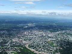 Worcester and the surrounding areas, looking north from 3700 feet (1128 m). Route 146 can be seen under construction.
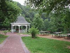 Dodge Park
 Washburn Shops, 1868
 Cristoforo Colombo Park
 Cristoforo Colombo Park
Demographics
| Historical population | |||
|---|---|---|---|
| Census | Pop. | %± | |
| 1790 | 2,095 | — | |
| 1800 | 2,411 | 15.1% | |
| 1810 | 2,577 | 6.9% | |
| 1820 | 2,962 | 14.9% | |
| 1830 | 4,173 | 40.9% | |
| 1840 | 7,497 | 79.7% | |
| 1850 | 17,049 | 127.4% | |
| 1860 | 24,960 | 46.4% | |
| 1870 | 41,105 | 64.7% | |
| 1880 | 58,291 | 41.8% | |
| 1890 | 84,655 | 45.2% | |
| 1900 | 118,421 | 39.9% | |
| 1910 | 145,986 | 23.3% | |
| 1920 | 179,754 | 23.1% | |
| 1930 | 195,311 | 8.7% | |
| 1940 | 193,694 | −0.8% | |
| 1950 | 203,486 | 5.1% | |
| 1960 | 186,587 | −8.3% | |
| 1970 | 176,572 | −5.4% | |
| 1980 | 161,799 | −8.4% | |
| 1990 | 169,759 | 4.9% | |
| 2000 | 172,648 | 1.7% | |
| 2010 | 181,045 | 4.9% | |
| Est. 2015 | 184,815 | [37] | 2.1% |
| source:[38] | |||
Successive waves of immigrants have in the past formed coherent ethnic enclaves, some of which continue to contribute to the rich ethnic texture of Worcester today. Swedes settled in Quinsigamond Village and Greendale, Italians settled along Shrewsbury Street, Irish and Poles settled around Kelley Square, Lithuanians settled on Vernon Hill, and Jews built their first synagogues on Green Island and Union Hill. The African-American community has existed since colonial times. Since the late 19th century, Grafton Hill and Vernon Hill have been points of entry for immigrants from all over the world: Irish, Italians, Lithuanians, Poles, Syrians, Lebanese, Indians, Puerto Ricans, French Canadians, and more recently, Albanians and Brazilians. Other prominent groups include Congolese, Russians, Armenians, Vietnamese, Liberians, Ghanaians and Greeks.
According to the 2010 U.S. Census, Worcester had a population of 181,045, of which 88,150 (48.7%) were male and 92,895 (51.3%) were female. In terms of age, 77.9% were over 18 years old and 11.7% were over 65 years old; the median age is 33.4 years. The median age for males is 32.1 years and 34.7 years for females.
In terms of race and ethnicity, Worcester's population was 69.4% White, 11.6% Black or African American, 0.4% American Indian and Alaska Native, 6.1% Asian (3.0% Vietnamese, 0.9% Chinese, and 0.8% Asian Indian), <0.1% Native Hawaiian and Other Pacific Islander, 8.4% from Some Other Race, and 4.0% from Two or More Races (1.2% White and Black or African American; 1.0% White and Some Other Race). Hispanics and Latinos of any race made up 20.9% of the population (12.7% Puerto Rican).[39] Non-Hispanic Whites were 59.6% of the population in 2010,[40] down from 96.8% in 1970.[41]
Income
Data is from the 2009-2013 American Community Survey 5-Year Estimates.[42][43][44]
| Rank | ZIP Code (ZCTA) | Per capita income |
Median household income |
Median family income |
Population | Number of households |
|---|---|---|---|---|---|---|
| Massachusetts | $35,763 | $66,866 | $84,900 | 6,605,058 | 2,530,147 | |
| 1 | 01606 | $32,781 | $66,912 | $86,452 | 19,495 | 8,032 |
| Worcester County | $31,537 | $65,223 | $81,519 | 802,688 | 299,663 | |
| 2 | 01602 | $31,101 | $62,832 | $77,807 | 23,707 | 9,025 |
| United States | $28,155 | $53,046 | $64,719 | 311,536,594 | 115,610,216 | |
| 3 | 01604 | $27,119 | $49,797 | $54,984 | 34,720 | 14,388 |
| Worcester | $24,330 | $45,932 | $57,704 | 181,901 | 68,850 | |
| 4 | 01607 | $24,044 | $45,152 | $56,815 | 8,957 | 3,602 |
| 5 | 01609 | $23,846 | $40,660 | $60,867 | 21,178 | 7,183 |
| 6 | 01603 | $22,315 | $48,183 | $55,000 | 19,385 | 7,243 |
| 7 | 01605 | $21,639 | $37,705 | $40,710 | 27,279 | 10,640 |
| 8 | 01610 | $14,040 | $30,532 | $35,372 | 23,964 | 7,453 |
| 9 | 01608 | $11,315 | $19,418 | $19,727 | 3,558 | 1,455 |
Government
| County-level state agency heads | |
|---|---|
| Clerk of Courts: | Dennis P. McManus (D) |
| District Attorney: | Joseph D. Early, Jr. (D) |
| Register of Deeds: | Anthony J. Vigliotti (D) |
| Register of Probate: | Stephanie K. Fattman (R) |
| County Sheriff: | Lew Evangelidis (R) |
| State government | |
| State Representative(s): | James O'Day (D)
Kate Campanale (R) |
| State Senator(s): | Michael Moore (D) Harriet L. Chandler (D) |
| Governor's Councilor(s): | Jen Caissie (R) |
| Federal government | |
| U.S. Representative(s): | James P. McGovern (D-2nd District), |
| U.S. Senators: | Elizabeth Warren (D), Ed Markey (D) |
Worcester is governed by a Council-manager government with a popularly elected mayor. A city council acts as the legislative body, and the council-appointed manager handles the traditional day-to-day chief executive functions.
City councilors can run as either a representative of a city district or as an at-large candidate. The winning at-large candidate who receives the greatest number of votes for mayor becomes the mayor (at-large councilor candidates must ask to be removed from the ballot for mayor if they do not want to be listed on the mayoral ballot). As a result, voters must vote for their mayoral candidate twice, once as an at-large councilor, and once as the mayor. The mayor has no more authority than other city councilors, but is the ceremonial head of the city and chair of the city council and school committee. Currently, there are 11 councilors: 6 at-large and 5 district.
Worcester's first charter, which went into effect in 1848, established a Mayor/Bicameral form of government. Together, the two chambers — the 11-member Board of Aldermen and the 30-member Common Council — were vested with complete legislative powers. The mayor handled all administrative departments, though appointments to those departments had to be approved by the two-chamber City Council.
Seeking to replace the 1848 charter, Worcester voters in November 1947 approved a change to Plan E municipal government. In effect from January 1949 until November 1985, this charter (as outlined in chapter 43 of the Massachusetts General Laws) established City Council/City Manager government. This type of governance, with modifications, has survived to the present day.
Initially, Plan E government in Worcester was organized as a 9-member council (all at-large), a ceremonial mayor elected from the council by the councilors, and a council-appointed city manager. The manager oversees the daily administration of the city, makes all appointments to city offices, and can be removed at any time by a majority vote of the Council. The mayor chairs the city council and the school committee, and does not have the power to veto any vote.[45]
In 1983, Worcester voters again decided to change the city charter. This "Home Rule" charter (named for the method of adoption of the charter) is similar to Plan E, the major changes being to the structure of the council and the election of the mayor. The 9-member Council became 11, 6 at-large and 1 from each city district. The mayor is chosen by popular election, but must also run and win as an at-large councilor.
Politics
Worcester's history of social progressivism includes a number of temperance and abolitionist movements. It was a leader in the women's suffrage movement: The first national convention advocating women's rights was held in Worcester, October 23–24, 1850.[46]
Two of the nation's most radical abolitionists, Abby Kelley Foster and her husband Stephen S. Foster, adopted Worcester as their home, as did Thomas Wentworth Higginson, the editor of The Atlantic Monthly and Emily Dickinson's avuncular correspondent, and Unitarian minister Rev. Edward Everett Hale.
The area was already home to Lucy Stone, Eli Thayer, and Samuel May, Jr. They were joined in their political activities by networks of related Quaker families such as the Earles and the Chases, whose organizing efforts were crucial to the anti-slavery cause in central Massachusetts and throughout New England.
Anarchist Emma Goldman and two others opened an ice cream shop in 1892. "It was spring and not yet warm," Goldman later wrote, "but the coffee I brewed, our sandwiches, and dainty dishes were beginning to be appreciated. Within a short time we were able to invest in a soda-water fountain and some lovely coloured dishes."[47]
On October 19, 1924, the largest gathering of the Ku Klux Klan (KKK) ever held in New England took place at the Agricultural Fairgrounds in Worcester. Klansmen in sheets and hoods, new Knights awaiting a mass induction ceremony, and supporters swelled the crowd to 15,000. The KKK had hired more than 400 "husky guards", but when the rally ended around midnight, a riot broke out. Klansmen's cars were stoned and burned, and their windows smashed. KKK members were pulled from their cars and beaten. Klansmen called for police protection, but the situation raged out of control for most of the night. The violence after the "Klanvocation" had the desired effect: Membership fell off, and no further public Klan meetings were held in Worcester.
Robert Stoddard, owner of The Telegram and Gazette, was one of the founders of the John Birch Society.
Sixties era radical Abbie Hoffman was born in Worcester in 1936 and spent more than half of his life there.
| Voter registration and party enrollment as of August 20, 2014 - Worcester[48] | |||||
|---|---|---|---|---|---|
| Party | Number of voters | Percentage | |||
| Democratic | 47,275 | 44% | |||
| Republican | 9,310 | 9% | |||
| Unenrolled | 50,397 | 47% | |||
| Political Designations | 0 | 0% | |||
| Total | 107,686 | 100% | |||
Public safety
For public safety needs, the City of Worcester is protected by both the Worcester Fire Department and the Worcester Police Department.
Emergency Medical Services (EMS) are provided by UMass Memorial Medical Center under contract with the city. Originally operated by Worcester City Hospital and later by the University of Massachusetts Medical School, "Worcester EMS" operates exclusively at the advanced life support (ALS) level, with two paramedics staffing each ambulance. UMass Memorial EMS maintains two community EMS stations and operates a fleet of 18 ambulances, as well as a special-operations trailer, several other support vehicles, and a bike team. The agency responds to over 32,000 calls for medical assistance annually. UMass Memorial EMS operates the EMS Communications Center, which is a secondary PSAP and provides emergency medical dispatch (EMD) services to Worcester and other communities.
Economy
By the mid-19th century Worcester was one of the largest manufacturing centers in New England. The city's large industries specialized in machinery, wire production, and power looms. And although manufacturing has largely declined, the city still maintains large manufactures, like Norton Abrasives, which was bought by Saint-Gobain in 1990, Morgan Construction and the David Clark Company. The David Clark Company pioneered aeronautical equipment including anti-gravity suits and noise attenuating headsets.
Services, particularly education and healthcare make up a large portion of the city's economy. Worcester's many colleges and universities make higher education a considerable presence in the city's economy. Hanover Insurance was founded in 1852 and retains its headquarters in Worcester. Unum Insurance and Fallon Community Health Plan have offices in the city. Polar Beverages is the largest independent soft-drink bottler in the country and is located in Worcester.
The biotechnology and technology industries have helped spur major expansions at both the University of Massachusetts Medical School and Worcester Polytechnic Institute. The Massachusetts Biotechnology Research Park hosts many innovative companies including Advanced Cell Technology and Abbott Laboratories. The Worcester Foundation for Experimental Biology located in nearby Shrewsbury developed the oral contraceptive pill in 1951.
Downtown Worcester used to boast major Boston retailers Filene's and Jordan Marsh as well Worcester's own department stores Barnard's and Denholm & McKay. Over time most retailers moved away from downtown and into the suburban Auburn Mall and Greendale Mall in North Worcester.
In 2010,[49] the median household income was $61,212. Median income for the family was $76,485. The per capita income was $29,316. About 7.7% of families and 10.8% of the population were below the poverty line, including 14.1% of those under age 18 and 7.5% of those age 65 or over. In October 2013, Worcester was found to be the number five city for investing in a rental property.[50]
Top employers
According to the City's 2010 Comprehensive Annual Financial Report,[51] the top ten employers in the city are:
| # | Employer | # of employees |
|---|---|---|
| 1 | UMass Memorial Health Care | 13,764 |
| 2 | University of Massachusetts Medical School | 5,678 |
| 3 | City of Worcester | 5,128 |
| 4 | Saint Vincent Hospital | 2,386 |
| 5 | Hanover Insurance | 1,850 |
| 6 | Saint-Gobain | 1,807 |
| 7 | Reliant Medical Group | 1,801 |
| 8 | Polar Beverages | 1,400 |
| 9 | College of the Holy Cross | 1,107 |
| 10 | Quinsigamond Community College | 900 |
Education
Primary and secondary education
Worcester's public schools educate more than 23,000 students in kindergarten through 12th grade.[52] The system consists of 33 elementary schools, 4 middle schools, 7 high schools,[53] and 13 other learning centers such as magnet schools, alternative schools, and special education schools. The city's public school system also administers an adult education component called "Night Life", and operates a Public-access television cable TV station on channel 11.
The Massachusetts Academy of Math and Science was founded in 1992 as a public secondary school located at the Worcester Polytechnic Institute.
One notable charter school in the city is Abby Kelley Foster Charter Public School, which teaches kindergarten through 12th grade. It is granted status by Massachusetts as a Level 1 school. It is the one of 834 schools in the United States to offer the International Baccalaureate Diploma Programme.
Worcester Technical High School, or Worcester Tech.'s graduating class of 2014 was honored by having president Barack Obama as the speaker at their graduation ceremony. Their principal, Sheila Harrity, was awarded the national title of Principal of the Year by NASSP.
Twenty-one private and parochial schools are also found throughout Worcester, including the city's oldest educational institution, Worcester Academy, founded in 1834, and Bancroft School, founded in 1900.
The most known public schools include North High School, South High School, Doherty High School, Abby Kelley Foster, Worcester Technical High School and Burncoat High School.
Higher education
Worcester is home to several institutes of higher education.
- Assumption College is the fourth oldest Roman Catholic college in New England and was founded in 1904. At 175 acres (0.71 km2), it has the largest campus in Worcester.
- Becker College is a private college with campuses in Worcester and Leicester, Massachusetts. It was founded in Leicester in 1784 as Leicester Academy. The Worcester campus was founded in 1887, and the two campuses merged into Becker College in 1977. Becker's video game design program has consistently been ranked in the top 10 in the U.S. and Canada.[54]
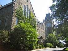
- Clark University was founded in 1887 as the first all-graduate school in the country; it now also educates undergraduates and is noted for its strengths in psychology and geography. Its first president was G. Stanley Hall, the founder of organized psychology as a science and profession, father of the child study movement, and founder of the American Psychological Association. Well-known professors include Albert A. Michelson, who won the first American Nobel Prize in 1902 for his measurement of light. Robert H. Goddard, a pioneering rocket scientist of the space age also studied and taught here, and, in his only visit to the United States, Sigmund Freud delivered his five famous "Clark Lectures" at the university. Clark offers the only program in the country leading to a Ph.D. in Holocaust History and Genocide Studies.
- The Jesuit College of the Holy Cross, was founded in 1843 and is the oldest Roman Catholic college in New England and one of the oldest in the United States. Well-known graduates include Dr. Joseph E. Murray, Nobel laureate in Physiology or Medicine, Billy Collins, former Poet Laureate of the United States, Bob Cousy, and Supreme Court Justice Clarence Thomas. In 2013, the College of the Holy Cross was ranked by U.S. News and World Report as the nation's 25th highest-rated liberal arts college.[55]
- The Massachusetts College of Pharmacy and Health Sciences Worcester Campus houses the institution's Doctor of Optometry program, accelerated programs in Nursing and Doctor of Pharmacy, Master's program New England School of Acupuncture, as well as the Master's program in Physician Assistant Studies for post-baccalaureate students.
- Quinsigamond Community College.
- The University of Massachusetts Medical School (1970) is one of the nation's top 50 medical schools. Dr. Craig Mello won the 2006 Nobel Prize for Medicine. The University of Massachusetts Medical School is ranked fourth in primary care education among America's 125 medical schools in the 2006 U.S. News & World Report annual guide "America's Best Graduate Schools".[56]
- Worcester Polytechnic Institute (1865) is an innovative leader in engineering education and partnering with local biotechnology industries. Robert Goddard, the father of modern rocketry, graduated from WPI in 1908 with a Bachelor of Science in physics.
- Worcester State University is a public, 4-year college founded in 1874 as Worcester Normal School.
An early higher education institution, the Oread Institute, closed in 1934.
Many of these institutions participate in the Colleges of Worcester Consortium. This independent, non-profit collegiate association includes academic institutions in Worcester and other communities in Worcester County, such as Anna Maria College in neighboring Paxton. It facilitates cooperation among the colleges and universities. One example of this being its inter-college shuttle bus and student cross registration.
Other programs
Worcester is the home of Dynamy, a "residential internship program" in the United States.[57] The organization was founded in 1969.
Culture
Much of Worcester culture is synonymous with Boston and New England culture. The city's name is notoriously mispronounced by people unfamiliar with the city. As with the city in England, the first syllable of "cester" (castra) is left entirely unvoiced. Combined with a predominantly non-rhotic version of a New England accent, the name can be transcribed in General American as WOOS-tah or WISS-tah; see close central unrounded vowel.[59]
Worcester has many traditionally ethnic neighborhoods, including Quinsigamond Village (Swedish), Shrewsbury Street (Italian) Kelley Square (Irish and Polish) Vernon Hill (Lithuanian) and Union Hill (Jewish).
Shrewsbury Street is Worcester's traditional "Little Italy" neighborhood and today boasts many of the city's most popular restaurants and nightlife.[60] The Canal District was once an old eastern European neighborhood, but has been redeveloped into a very popular bar, restaurant and club scene.[61] Worcester is also famously the former home of the Worcester Lunch Car Company. The company began in 1906 and built many famous lunch car diners in New England. Worcester is home to many classic lunch car diners including Boulevard Diner, Corner Lunch, Chadwick Square Diner, and Miss Worcester Diner.
There are also many dedicated community organizations and art associations located in the city. stART on the Street is an annual festival promoting local art. The Worcester Music Festival and New England Metal and Hardcore Festival are also held annually in Worcester. The Worcester County St. Patrick's Parade runs through Worcester and is one of the largest St. Patrick's Day celebrations in the state. The city also hosts the second oldest First Night celebration in the country each New Year's Eve.
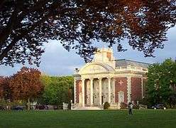
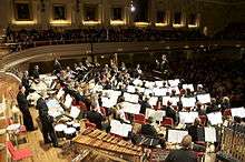
Worcester is also the state's largest center for the arts outside of Boston. Mechanics Hall, built in 1857, is one of the oldest concert halls in the country and is renowned for its pure acoustics.[62] In 2008 the old Poli Palace Theatre reopened as the Hanover Theatre for the Performing Arts.[63] The theatre brings many Broadway shows and nationally recognized performers to the city. Tuckerman Hall, designed by one of the country's earliest woman architects, Josephine Wright Chapman, is home to the Massachusetts Symphony Orchestra. The DCU Center arena and convention holds many large concerts, exhibitions and conventions in the city. The Worcester County Poetry Association sponsors readings by national and local poets in the city and the Worcester Center for Crafts provides craft education and skills to the community. Worcester is also home to the Worcester Youth Orchestras.[64] Founded in 1947 by Harry Levenson, it is the 3rd oldest youth orchestra in the country and regularly performs at Mechanics Hall.
The nickname Wormtown is synonymous with the city's once large underground rock music scene. The nickname has now become used to refer to the city itself.[65][66][67]
Sites of interest
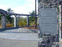
Worcester has 1,200 acres of publicly owned property. Notable parks include Elm Park, which was laid out by Frederick Law Olmsted in 1854, and the City Common laid out in 1669. Both parks are listed on the National Register of Historic Places.[68] The largest park in the city is the 549 acre Green Hill Park. The park was donated by the Green family in 1903 and includes the Green Hill Park Shelter built in 1910. In 2002, the Massachusetts Vietnam Veterans Memorial was dedicated in Green Hill Park. Other Parks, include Newton Hill, East Park, Morgan Park, Shore Park, Crompton Park, Hadwen Park, Institute Park and University Park. As a former manufacturing center, Worcester has many historic 19th century buildings and on the National Register of Historic Places, including the old facilities of the Crompton Loom Works, Ashworth and Jones Factory and Worcester Corset Company Factory.
The American Antiquarian Society has been located in Worcester since 1812. The national library and society has one of the largest collections of early American history in the world. The city's main museum is the Worcester Art Museum established in 1898. The museum is the second largest art museum in New England, behind the Museum of Fine Arts in Boston.[69] From 1931 to 2013, Worcester was home to the Higgins Armory Museum, which was the sole museum dedicated to arms and armor in the country.[70] Its collection and endowment were transferred and integrated into the Worcester Art Museum, with the collection to be shown in a new gallery slated to open in 2015. The non-profit Veterans Inc. is headquartered at the southern tip of Grove Street in the historic Massachusetts National Guard Armory building.
The Worcester Memorial Auditorium is one of the most prominent buildings in the city. Built as a World War I war memorial in 1933, the multipurpose auditorium has hosted many of the Worcester's most famous concerts and sporting events.
Sports
Worcester was home to Marshall Walter ("Major") Taylor, an African American cyclist who won the world one-mile (1.6 km) track cycling championship in 1899. Taylor's legacy is being the second black world champion in any sport. Taylor was nicknamed the Worcester Whirlwind by the local papers.
Lake Quinsigamond is home to the Eastern Sprints, a premier rowing event in the United States. Competitive rowing teams first came to Lake Quinsigamond in 1857. Finding the long, narrow lake ideal for such crew meets, avid rowers established boating clubs on the lake's shores, the first being the Quinsigamond Boating Club. More boating clubs and races followed, and soon many colleges (local, national, and international) held regattas, such as the Eastern Sprints, on the lake. Beginning in 1895, local high schools held crew races on the lake. In 1952, the lake played host to the National Olympic rowing trials.
In 2002, the Jesse Burkett Little League all-stars team went all the way to the Little League World Series. They made it to the US final before losing to Owensboro, Kentucky. Jesse Burkett covers the West Side area of Worcester, along with Ted Williams Little League.
The city will host Worcester Railers HC of the ECHL, which will begin play in October 2017. Prior to the Railers, the American Hockey League team Worcester Sharks played in Worcester from 2006 to 2015, before relocating to San Jose. The Sharks played at the DCU Center as a developmental team for the National Hockey League's San Jose Sharks. The AHL was formerly represented by the Worcester IceCats from 1994 to 2005. The IceCats were chiefly affiliated with the St. Louis Blues.
The city's former professional baseball team, the Worcester Tornadoes, started in 2005 and was a member of the Canadian-American Association of Professional Baseball League. The team played at the Hanover Insurance Park at Fitton Field on the campus of the College of the Holy Cross and was not affiliated with any major league team. The team's owner ran into financial difficulties, and the team disbanded after the 2012 season. The Worcester Bravehearts began play in 2014 as the local affiliate of the Futures Collegiate Baseball League, and won the league championship in their inaugural season. The New England Surge, a member of the Continental Indoor Football League, played their home games in the DCU Center in their two years of existence, 2007 and 2008. Candlepin bowling was invented in Worcester in 1880 by Justin White, an area bowling alley owner. The Worcester County Wildcats are part of the New England Football League, is a semi-pro football team, and play at Commerce Bank Field at Foley Stadium.
Golf's Ryder Cup's first official tournament was played at the Worcester Country Club in 1927. The course also hosted the U.S. Open in 1925, and the U.S. Women's Open in 1960.
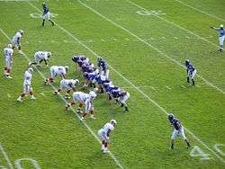
Worcester's colleges have long histories and many notable achievements in collegiate sports. The College of the Holy Cross represents NCAA Division 1 sports in Worcester. The other colleges and Universities in Worcester correspond with division II and III. The Holy Cross Crusaders won the NCAA men's basketball champions in 1947 and NIT men's basketball champions in 1954, led by future NBA hall-of-famers and Boston Celtic legends Bob Cousy and Tom Heinsohn.
Religion
The Unitarian-Universalist Church of Worcester was founded in 1841. Worcester's Greek Orthodox Cathedral, St. Spyridon, was founded in 1924.
Worcester is home to a dedicated Jewish population, who attend five synagogues, including Reform congregation Temple Emanuel Sinai, Congregation Beth Israel, a Conservative synagogue founded in 1924,[71] and Orthodox Congregation Tifereth Israel - Sons of Jacob (Chabad), home of Yeshiva Achei Tmimim Academy. Beth Israel and its rabbi were the subject of the book And They Shall be My People: An American Rabbi and His Congregation by Paul Wilkes.
The first Armenian Church in America was built in Worcester in 1890 and consecrated on January 18, 1891 as "Soorp Purgich" (Holy Saviour). The current sanctuary of the congregation, known now as Armenian Church of Our Savior was consecrated in 1952.
The first Catholics came to Worcester in 1826. They were chiefly Irish immigrants brought to America by the builders of the Blackstone canal. As time went on and the number of Catholics increased, the community petitioned Bishop Fenwick to send them a priest. In response to this appeal, the bishop appointed the Reverend James Fitton to visit the Catholics of Worcester in 1834. Catholic mass was first offered in the city in an old stone building on Front street. The foundation of Christ's Church, the first Catholic church in Worcester (now St. John's), was laid on July 6, 1834.[72]
The Roman Catholic Diocese of Worcester was canonically erected on January 14, 1950, by Pope Pius XII. Its territories were taken from the neighboring Diocese of Springfield. The current and fifth bishop is Robert Joseph McManus.[73]
Media
The Telegram & Gazette is Worcester's only daily newspaper. The paper, known locally as "the Telegram" or "the T and G", is wholly owned by GateHouse Media of Fairport, New York.[74] WCTR, channel 3, is Worcester's local news television station, and WUNI-TV, channel 27, is the only major over-the-air broadcast television station in Worcester. Radio stations based in Worcester include WCHC, WCUW, WSRS, WTAG, WWFX, WICN and WXLO. WCCA-TV Shows on channel 194 and provides Community Cable-Access Television as well as a live stream of the channel on their website WCCATV.com.[75]
Infrastructure
Transportation
Worcester is served by several interstate highways. Interstate 290 connects central Worcester to Interstate 495, I-90 in nearby Auburn, and I-395. I-190 links Worcester to MA 2 and the cities of Fitchburg and Leominster in northern Worcester County. I-90 can also be reached from a new Massachusetts Route 146 connector.
Worcester is also served by several smaller Massachusetts state highways. Route 9 links the city to its eastern and western suburbs, Shrewsbury and Leicester. Route 9 runs almost the entire length of the state, connecting Boston and Worcester with Pittsfield, near the New York state border. Route 12 was the primary route north to Leominster and Fitchburg until the completion of I-190. Route 12 also connected Worcester to Webster before I-395 was completed. It still serves as an alternate, local route. Route 146, the Worcester-Providence Turnpike, connects the city with the similar city of Providence, Rhode Island. Route 20 touches the southernmost tip of Worcester near the Massachusetts Turnpike. U.S. 20 is a coast-to-coast route connecting the Atlantic to the Pacific Ocean, and is the longest road in the United States.[76]
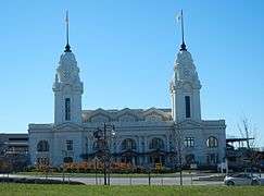
Worcester is the headquarters of the Providence and Worcester, a Class II railroad operating throughout much of southern New England. Worcester is also the western terminus of the Framingham/Worcester commuter rail line run by the Massachusetts Bay Transportation Authority. Union Station serves as the hub for commuter railway traffic. Built in 1911, the station has been restored to its original grace and splendor, reopening to full operation in 2000. It also serves as an Amtrak stop, serving the Lake Shore Limited from Boston to Chicago. In October 2008 the MBTA added 5 new trains to the Framingham/Worcester line as part of a plan to add 20 or more trains from Worcester to Boston and also to buy the track from CSX Transportation.[77] Train passengers may also connect to additional services such as the Vermonter line in Springfield.
The Worcester Regional Transit Authority, or WRTA, manages the municipal bus system. Buses operate intracity as well as connect Worcester to surrounding central Massachusetts communities. The WRTA also operates a shuttle bus between member institutions of the Colleges of Worcester Consortium. Worcester is also served by Peter Pan Bus Lines and Greyhound Bus Lines, which operate out of Union Station. MAX provides intercity bus service to Fitchburg and Brattleboro, Vermont with intermediate stops.[78]
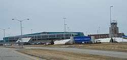
The Worcester Regional Airport, owned and operated by Massport lies at the top of Tatnuck Hill, Worcester's highest. The airport consists of one 7,000 ft (2,100 m) runway and a $15.7 million terminal. The airport held numerous airlines from the 1950s through the 1990s, but it has encountered years of spotty commercial flights. On September 4, 2008, Direct Air announced it would begin serving Worcester to Orlando, Florida, Myrtle Beach, South Carolina, and Punta Gorda, Florida, in the spring of 2009. On Tuesday March 13, 2012, Direct Air canceled its entire charter program (including service to Worcester) due to financial reasons, leaving the passenger terminal at Worcester Regional Airport empty.[79] In 2013, JetBlue announced that it would service ORH, and service began in November 2013.[80] It currently provides daily service from ORH to Fort Lauderdale, and Orlando, Florida.[81] Massport has announced plans to install a Category III landing system at ORH to combat takeoff and landing problems caused by routine fog at the airport.[82]
Healthcare
The Worcester State Insane Asylum Hospital (1833) was the first hospital in the United States established to treat mental illnesses.
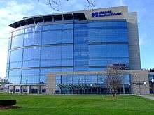
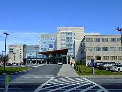
Worcester is home to the University of Massachusetts Medical School, ranked fourth in primary care education among America's 125 medical schools in the 2006 U.S. News & World Report annual guide "America's Best Graduate Schools".[56] The medical school is in the top quartile of medical schools nationally in research funding from the NIH and is home to highly respected scientists including a Nobel laureate, a Lasker Award recipient and multiple members of the National Academy of Sciences and the Howard Hughes Medical Institute. The school is closely affiliated with UMass Memorial Health Care, the clinical partner of the medical school, which has expanded its locations all over Central Massachusetts. St. Vincent Hospital at Worcester Medical Center in the downtown area rounds out Worcester's primary care facilities. Reliant Medical Group, formerly Fallon Clinic, is the largest private multi-specialty group in central Massachusetts with over 30 different specialties. It is affiliated with St. Vincent's Hospital in downtown Worcester. Reliant Medical Group was the creator of Fallon Community Health Plan, a now independent HMO based in Worcester, and one of the largest health maintenance organizations (HMOs) in the state.
Utilities and public services
Worcester has a municipally owned water supply. Sewage disposal services are provided by the Upper Blackstone Water Pollution Abatement District, which services Worcester as well as some surrounding communities. National Grid USA is the exclusive distributor of electric power to the city, though due to deregulation, customers now have a choice of electric generation companies. Natural gas is distributed by NSTAR Gas; only commercial and industrial customers may choose an alternate natural gas supplier. Verizon, successor to New England Telephone, NYNEX, and Bell Atlantic, is the primary wired telephone service provider for the area. Phone service is also available from various national wireless companies. Cable television is available from Charter Communications, with Broadband Internet access also provided, while a variety of DSL providers and resellers are able to provide broadband Internet over Verizon-owned phone lines.
Sister cities
Worcester has the following sister cities:
See also
- National Register of Historic Places listings in Worcester, Massachusetts
- List of tallest buildings in Worcester, Massachusetts
- List of mill towns in Massachusetts
- Greater Worcester Land Trust
- McCullen v. Coakley
- North High School (Worcester, Massachusetts)
- Worcester Public Library
- Worcester State Hospital
Notes
^ a: The US Census estimated that Worcester surpassed Providence in 2006 by 199 people. Though this is well within the margin of error, List of United States cities by population uses the 2008 estimates for purposes of ranking. The New England article, however, ranks by 2000 Census, which places Providence as second largest. In the 2010 Census, Worcester's roughly 181,000 residents surpassed Providence's roughly 178,000.
References
- ↑ How do you say 'Worcester?', archived from the original on May 4, 2015, retrieved August 1, 2015
- ↑ "Profile of General Population and Housing Characteristics: 2010 Demographic Profile Data (DP-1): Worcester city, Massachusetts". U.S. Census Bureau, American Factfinder. Retrieved March 6, 2013.
- ↑ The third largest city is Providence, Rhode Island, with a population of 178,042. "Geographic Identifiers: 2010 Demographic Profile Data (G001): Providence city, Rhode Island". U.S. Census Bureau, American Factfinder. Retrieved March 6, 2013.
- ↑ "Valentines weren't invented in Worcester, but they have special history here".
- ↑ Lincoln, William (1862). History of Worcester, Massachusetts, pp. 22-23. Worcester: Charles Hersey.
- 1 2 "Hassanamisco Indian Museum History". Hassanamisco Indian Museum. 2013. Retrieved December 30, 2013.
- ↑ Worcester Society of Antiquity (1903). Exercises Held at the Dedication of a Memorial to Major Jonas Rice, the First Permanent Settler of Worcester, Massachusetts, Wednesday, October 7, 1903. Charles Hamilton Press, Worcester. 72pp.
- 1 2 "Worcester, MA History | at the dawn of the American Industrial Revolution". City of Worcester, Massachusetts. 2007. Retrieved March 3, 2007.
- ↑ Coombs, Zelotes W. "Worcester & Worcester Common". City of Worcester, Massachusetts. Retrieved February 9, 2015.
- ↑ American Antiquarian Society Fact Sheet
- ↑ "Transportation". Worcester Historical Museum. 2013. Retrieved December 30, 2013.
- 1 2 Dan Ricciardi; Kathryn Mahoney (2013). "Washburn and Moen Worcester's Worldwide Wire Manufacturuer". College of the Holy Cross. Retrieved December 30, 2013.
- ↑ "Three Deckers". Worcester Historical Museum. 2013. Retrieved December 30, 2013.
- ↑ "Worcester, MA Driving Tour & Guide to Blackstone Canal Historic Markers". Retrieved July 23, 2007.
- ↑ Gaultney, Bruce (2009). Worcester Memories, pp. 21. Early 1990s.
- 1 2 Gaultney, Bruce (2009). Worcester Memories, pp. 7. 1880s.
- ↑ Gaultney, Bruce (2009). Worcester Memories, pp. 79. 1950s.
- ↑ Parr, James L. (2009). Dedham: Historic and Heroic Tales From Shiretown. The History Press. ISBN 978-1-59629-750-0.
- ↑ "City Square Slideshow". Worcester Telegram & Gazette. December 30, 2013. Retrieved December 30, 2013.
- ↑ Honan, William H. (April 14, 2001). "H. R. Ball, 79, Ad Executive Credited With happy Face". The New York Times. Retrieved August 29, 2009.
- ↑ Adams, Cecil (April 23, 1993). "Who invented the smiley face?". The Straight Dope. Retrieved April 18, 2011.
- 1 2 "Enterprise Timeline". Worcester Historical Museum. 2013. Retrieved December 30, 2013.
- 1 2 Gaultney, Bruce (2009). Worcester Memories, pp. 113. 1970s, '80s & '90s.
- ↑ "Facility Info". DCU Center. September 25, 2005.
- ↑ "Restoration". Wrcester Center for the Performing Arts. 2013. Retrieved December 30, 2013.
- ↑ Brown, Matthew (April 28, 2010). "College of Pharmacy To Buy Crowne Plaza Property". Worcester Business Journal. Retrieved December 30, 2013.
- ↑ "Gateway Park at WPI". Worcester Polytechnic Institute. 2013. Retrieved December 30, 2013.
- ↑ Kotsopoulos, Nick (March 17, 2010). "Hanover buys into CitySquare". Worcester Telegram & Gazette. Retrieved December 30, 2013.
- ↑ "Front St. connection planned by end of year in Worcester". Worcester Telegram & Gazette. December 13, 2012. Retrieved December 30, 2013.
- ↑ Jones-D'Agostino, Steven (September 3, 2013). "Worcester's Canal District Banks On National Park Designation". GoLocalWorcester. Retrieved January 2, 2014.
- 1 2 "NowData - NOAA Online Weather Data". National Oceanic and Atmospheric Administration. Retrieved 2016-04-17.
- ↑ United States Department of Agriculture. United States National Arboretum. USDA Plant Hardiness Zone Map [Retrieved February 19, 2015].
- ↑ "Daily temperature records". National Weather Service. 2007. Retrieved January 7, 2008.
- ↑ "Daily temperature records". National Weather Service. 2007. Retrieved January 7, 2008.
- ↑ "Threaded Extremes". Retrieved November 9, 2010.
- ↑ "Station Name: MA WORCESTER RGNL AP". National Oceanic and Atmospheric Administration. Retrieved February 19, 2015.
- ↑ "Annual Estimates of the Resident Population for Incorporated Places: April 1, 2010 to July 1, 2015". Retrieved July 2, 2016.
- ↑ "CENSUS OF POPULATION AND HOUSING (1790-2000)". U.S. Census Bureau. Retrieved March 9, 2012.
- ↑ American FactFinder. Factfinder2.census.gov. Retrieved on August 2, 2013.
- ↑ "Worcester (city), Massachusetts". State & County QuickFacts. U.S. Census Bureau.
- ↑ "Massachusetts - Race and Hispanic Origin for Selected Cities and Other Places: Earliest Census to 1990". U.S. Census Bureau.
- ↑ "SELECTED ECONOMIC CHARACTERISTICS 2009-2013 American Community Survey 5-Year Estimates". U.S. Census Bureau. Retrieved January 12, 2015.
- ↑ "ACS DEMOGRAPHIC AND HOUSING ESTIMATES 2009-2013 American Community Survey 5-Year Estimates". U.S. Census Bureau. Retrieved January 12, 2015.
- ↑ "HOUSEHOLDS AND FAMILIES 2009-2013 American Community Survey 5-Year Estimates". U.S. Census Bureau. Retrieved January 12, 2015.
- ↑ "Considering Worcester's Charter" (PDF). Worcester Regional Research Bureau. April 20, 1999. Archived from the original (PDF) on June 16, 2007. Retrieved June 17, 2004.
- ↑ "Worcester, MA History". City of Worcester, Massachusetts. 2007. Retrieved March 3, 2007.
- ↑ American Experience | Emma Goldman | People & Events. PBS. Retrieved on July 15, 2013.
- ↑ "The Commonwealth of Massachusetts: Enrollment Breakdown as of August 20, 2014 (pg 18)" (PDF). Massachusetts Elections Division. Retrieved November 25, 2014.
- ↑ "American FactFinder". United States Census Bureau. Retrieved April 14, 2012.
- ↑ Novinson, Michael. " Index: Central Mass. #5 in U.S. For Owning Rental Property." Worcester Business Journal. October 8, 2013.
- ↑ City of Worcester CAFR, p. 153.
- ↑ "Worcester - Enrollment/Indicators". Massachusetts Department of Education. 2007. Retrieved March 3, 2007.
- ↑ "Worcester - Directory Information". Massachusetts Department of Education. 2007. Retrieved March 3, 2007.
- ↑ "Becker Game Design Program Ranked Top 10".
- ↑ "National Liberal Arts College Rankings".
- 1 2 "America's Best Graduate Schools 2007: Top Medical Schools - Primary Care". US News & World Report. 2007. Retrieved March 3, 2007.
- ↑ Hopewell, Brian: College Gap Year website, Dynamy.
- ↑ DPW Parks, Recreation & Cemetery - Salisbury Park.
- ↑ "How do you say 'Worcester?'". College of the Holy Cross. 2013. Retrieved December 31, 2013.
- ↑ "Shrewbury Street: A Mecca for the Diverse Palate". GoLocalWorcester. 2013. Retrieved December 31, 2013.
- ↑ "History". the Canal District of Worcester. 2013. Retrieved December 31, 2013.
- ↑ "About Mechanics Hall". Mechanics Hall. 2013. Retrieved December 31, 2013.
- ↑ "Restoration". Worcester Center for the Performing Arts. 2013. Retrieved December 31, 2013.
- ↑ "The Worcester Youth Orchestras Founded in 1947 - Home". The Worcester Youth Orchestras Founded in 1947. Retrieved October 4, 2014.
- ↑ Wormtown at 20 - Timeline of events. The Worcester Phoenix, June 19–26, 1998.
- ↑ Williamson, Chet (June 3, 2010). "Wormtown at 30". Worcester Magazine.
- ↑ O'Connor, Andrew. A Wormtown Gimmick.
- ↑ "City Parks". City of Worcester, Massachusetts — Public Works and Park. 2007.
- ↑ Traditional Fine Arts Organization WAM site
- ↑ Edgers, Geoff (March 8, 2013). "Higgins Armory Museum to close". The Boston Globe. Retrieved July 31, 2013.
- ↑ About us, Synagogue website. Accessed July 17, 2008.
- ↑ F.P. Rice "The Worcester of 1898"
- ↑ Roman Catholic Diocese of Worcester
- ↑ "GateHouse parent buys T&G — and its parent chain". Media Nation. 2014. Retrieved January 14, 2015.
- ↑ http://www.wccatv.com
- ↑ "Ask the Rambler - What Is The Longest Road in the United States?". US Department of Transportation - Federal Highway Administration. January 18, 2005. Retrieved March 2, 2007.
- ↑ "MBTA board OKs beefed up train service". Telegram.com. Retrieved March 23, 2012.
- ↑ "MAX Schedule". TrueNorth Transit Group. Retrieved 1 October 2016.
- ↑ "Direct Air cancels charter program, loss of service to Worcester".
- ↑ "JetBlue's Worcester service takes off in first two years - The Boston Globe". Retrieved 2016-07-14.
- ↑ "Flights from Worcester, MA Airport brought to you by FlyORH". FlyORH. Retrieved 2016-07-14.
- ↑ "Massport - Cong. McGovern, Massport Break Ground for CAT III at Worcester Regional Airport". www.massport.com. Retrieved 2016-07-14.
Further reading
- Dubay, Debby (2014). Worcester, Massachusetts: "The Heart of the Commonwealth." Atglen, PA: Schiffer, Publishing.
- Erskine, Margaret A. (1981). Heart of the Commonwealth: Worcester. Windsor Publications, Inc. ISBN 0-89781-030-9.
- Flynn, Sean (2002). 3000 Degrees: The True Story of a Deadly Fire and the Men who Fought It. New York: Warner Books.
- Lincoln, William (1837). History of Worcester, Massachusetts, from its earliest settlement to September 1836. M. D. Phillips.
- Moynihan, Kenneth J. (2007). A History of Worcester, 1674-1848. The History Press. ISBN 978-1-59629-234-5.
- Wall & Gray. 1871 Atlas of Massachusetts.
- Worcester Directory, Worcester, Mass.: Sampson & Murdock Co., 1920
- "From Bondage to Belonging: The Worcester Slave Narratives", B. Eugene McCarthy & Thomas L. Doughton, editors.
- Map of Massachusetts. USA. New England. Counties - Berkshire, Franklin, Hampshire and Hampden, Worcester, Middlesex, Essex and Norfolk, Boston - Suffolk,Plymouth, Bristol, Barnstable and Dukes (Cape Cod). Cities - Springfield, Worcester, Lowell, Lawrence, Haverhill, Newburyport, Salem, Lynn, Taunton, Fall River. New Bedford. These 1871 maps of the Counties and Cities are useful to see the roads and rail lines.
- Beers,D.G. 1872 Atlas of Essex County Map of Massachusetts Plate 5. Click on the map for a very large image. Also see map of 1872 Essex County Plate 7.
External links
- Worcester official website
- Worcester Public Library
- Worcester Historical Museum
- Preservation Worcester
- Official Worcester visitors website
- Worcester Regional Chamber of Commerce
- Worcester Regional Research Bureau
- Worcester Public Schools official website
- Colleges of Worcester Consortium
- Worcester Business Directory
- 91.3FM WCUW - Worcester's Community Radio Station
- UMass Memorial's EMS Service for the City of Worcester
- 2011 Crash Report for Worcester, MA
Nickname(s): The City of the Seven Hills, The Heart of the Commonwealth, Wormtown, Woo-town, The Woo | ||
| Topics | | |
| Education | ||
| Government | ||
| History | ||
| Museums | ||
Boston (capital) | |
| Topics |
|
| Society | |
| Regions | |
| Counties | |
| Cities |
|
| Topics | |||||||||||
|---|---|---|---|---|---|---|---|---|---|---|---|
| States | |||||||||||
| Major cities | |||||||||||
| State capitals | |||||||||||
| Transportation |
| ||||||||||
| |||||||||||
| ||
| ||